Rānīganj elevation
Rānīganj (West Bengal, Barddhamān), India elevation is 103 meters and Rānīganj elevation in feet is 338 ft above sea level [src 1]. Rānīganj is a populated place (feature code) with elevation that is 190 meters (623 ft) smaller than average city elevation in India.
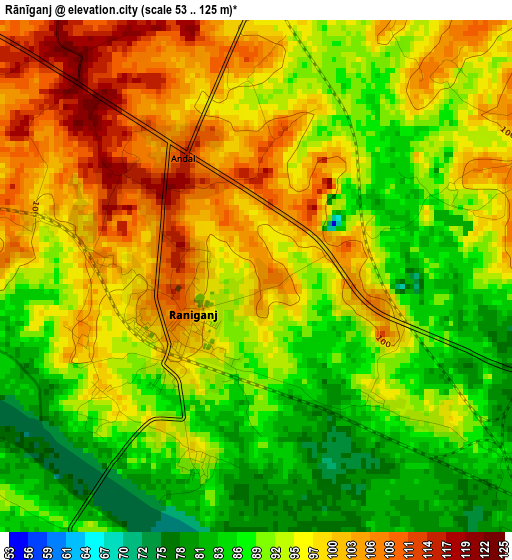
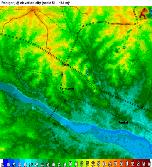
Below is the Elevation map of Rānīganj, which displays elevation range with different colors. Scale of the first map is from 53 to 125 m (174 to 410 ft) with average elevation of 94 meters (=308 ft) [note 1]
These maps also provides idea of topography and contour of this city, they are displayed at different zoom levels. More info about maps, scale and edge coordinates you can find below images.
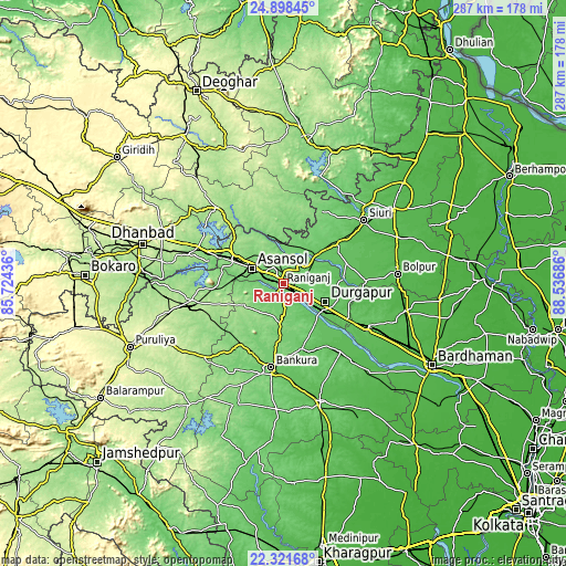
| \ | Map #1 | Map #2 | Topo.Map |
| Scale [m] | 53..125 m | 51..161 m | × |
| Scale [ft] | 174..410 ft | 167..528 ft | × |
| Average | 94 m = 308 ft | 94.7 m = 311 ft | × |
| Width | 8.95 km = 5.6 mi | 17.91 km = 11.1 mi | 286.5 km = 178 mi |
| Height | 8.95 km = 5.6 mi | 17.91 km = 11.1 mi | 286.5 km = 178 mi |
| ↑Max Latitude | 23.656659° | 23.696905° | 24.89845° |
| Latitude at center | 23.6164° | 23.6164° | 23.6164° |
| ↓Min Latitude | 23.576129° | 23.535846° | 22.32168° |
| ← Min Longitude | 87.086665° | 87.042719° | 85.72436° |
| Longitude center | 87.13061° | 87.13061° | 87.13061° |
| →Max Longitude | 87.174555° | 87.218501° | 88.53686° |
Nearby cities:
Cities around Rānīganj sort by population:
• Durgapur elevation 100 m
21.3 km,  121°
121°
• Āsansol 119 m
16.7 km,  296°
296°
• Kulti 156 m
31.9 km,  293°
293°
• Jāmuria 132 m
11.1 km,  331°
331°
• Bānkura 94 m
43.1 km,  188°
188°
• Chittaranjan 157 m
35.4 km,  319°
319°
• Dubrājpur 100 m
31.6 km,  52°
52°
• Bahula 102 m
5.2 km,  41°
41°
• Barjora 81 m
26.6 km,  142°
142°
• Beliātor 87 m
34.2 km,  164°
164°
• Mugma 145 m
44.5 km, 292°
• Bakreswar 92 m
38.6 km, 39°
Multilingual:
 En español:
Rānīganj elevación 103 m.
 En France:
Rānīganj élévation 103 m.
 Auf Deutsch:
Rānīganj höhe über dem Meeresspiegel ist 103 m.

Sources and notes:
- [note 1] Map square and city borders are not equal. Map elevation data is calculated only from area inside that square.
- [src 1] Elevation data from geonames database provided with same terms of usage.
- [src 2] The elevation map of Rānīganj is generated using elevation data from NASA's 3 arcsec (90m) resolution SRTM data.
- [src 3] Base (background) map © OpenStreetMap contributors tiles are generated by Geofabrik and OpenTopoMap.
Copyright & License:
This Rānīganj Elevation Map is licensed under CC BY-SA. You may reuse any part from this page, if you give a proper credit by linking to this URL:
 More info on terms of use page.