Guskhara elevation
Guskhara (West Bengal, Barddhamān), India elevation is 41 meters and Guskhara elevation in feet is 135 ft above sea level [src 1]. Guskhara is a populated place (feature code) with elevation that is 252 meters (827 ft) smaller than average city elevation in India.
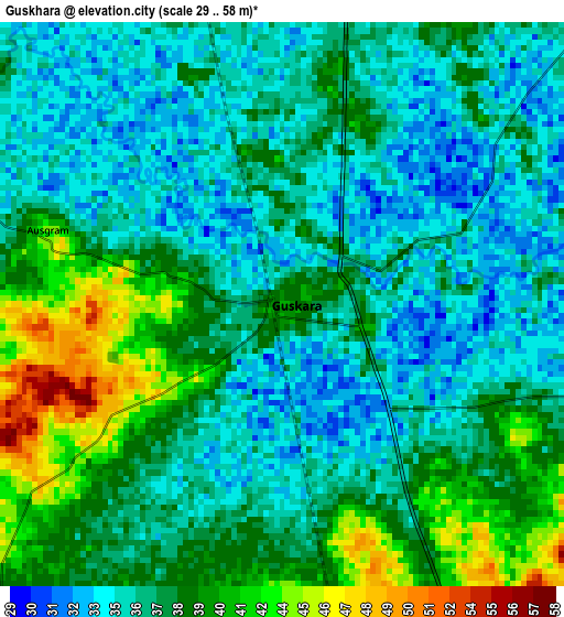
Below is the Elevation map of Guskhara, which displays elevation range with different colors. Scale of the first map is from 29 to 58 m (95 to 190 ft) with average elevation of 37.1 meters (=122 ft) [note 1]
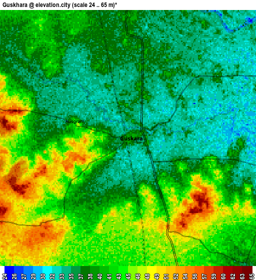
These maps also provides idea of topography and contour of this city, they are displayed at different zoom levels. More info about maps, scale and edge coordinates you can find below images.
| \ | Map #1 | Map #2 | Topo.Map |
| Scale [m] | 29..58 m | 24..65 m | × |
| Scale [ft] | 95..190 ft | 79..213 ft | × |
| Average | 37.1 m = 122 ft | 40.1 m = 132 ft | × |
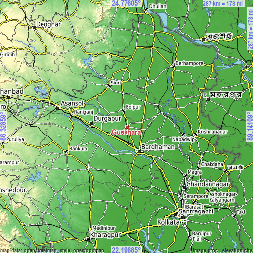
| Width | 8.96 km = 5.6 mi | 17.93 km = 11.1 mi | 286.8 km = 178.2 mi |
| Height | 8.96 km = 5.6 mi | 17.92 km = 11.1 mi | 286.8 km = 178.2 mi |
| ↑Max Latitude | 23.533057° | 23.573341° | 24.77605° |
| Latitude at center | 23.49276° | 23.49276° | 23.49276° |
| ↓Min Latitude | 23.452451° | 23.41213° | 22.19685° |
| ← Min Longitude | 87.690895° | 87.646949° | 86.32859° |
| Longitude center | 87.73484° | 87.73484° | 87.73484° |
| →Max Longitude | 87.778785° | 87.822731° | 89.14109° |
Nearby cities:
Cities around Guskhara sort by population:
• Durgapur elevation 100 m
43.6 km,  273°
273°
• Barddhamān 34 m
29.2 km,  154°
154°
• Kātoya 22 m
44 km,  67°
67°
• Bolpur 57 m
19.3 km,  348°
348°
• Siuri 84 m
50.8 km,  335°
335°
• Memāri 25 m
51.1 km,  133°
133°
• Sainthia 60 m
50.9 km, 353°
• Dubrājpur 100 m
49.3 km,  312°
312°
• Sonāmukhi 66 m
38.9 km,  237°
237°
• Barjora 81 m
45.9 km,  260°
260°
• Pātrasāer 58 m
38.8 km,  212°
212°
• Ahmadpur 51 m
37.8 km, 352°
Multilingual:
 En español:
Guskhara elevación 41 m.
 En France:
Guskhara élévation 41 m.


Sources and notes:
- [note 1] Map square and city borders are not equal. Map elevation data is calculated only from area inside that square.
- [src 1] Elevation data from geonames database provided with same terms of usage.
- [src 2] The elevation map of Guskhara is generated using elevation data from NASA's 3 arcsec (90m) resolution SRTM data.
- [src 3] Base (background) map © OpenStreetMap contributors tiles are generated by Geofabrik and OpenTopoMap.
Copyright & License:
This Guskhara Elevation Map is licensed under CC BY-SA. You may reuse any part from this page, if you give a proper credit by linking to this URL:
 More info on terms of use page.