Ahmadpur elevation
Ahmadpur (West Bengal, Bīrbhūm), India elevation is 51 meters and Ahmadpur elevation in feet is 167 ft above sea level [src 1]. Ahmadpur is a populated place (feature code) with elevation that is 242 meters (794 ft) smaller than average city elevation in India.
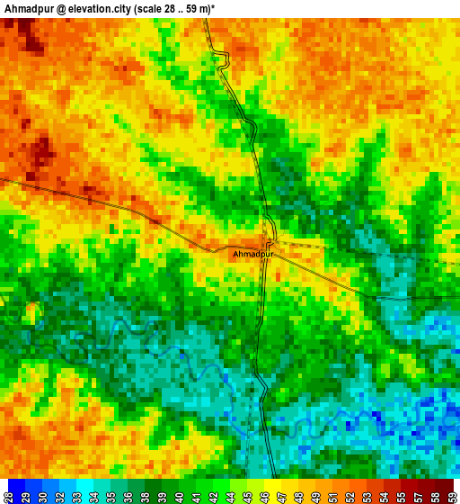
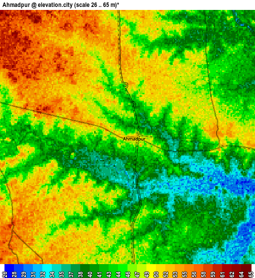
Below is the Elevation map of Ahmadpur, which displays elevation range with different colors. Scale of the first map is from 28 to 59 m (92 to 194 ft) with average elevation of 43.5 meters (=143 ft) [note 1]
These maps also provides idea of topography and contour of this city, they are displayed at different zoom levels. More info about maps, scale and edge coordinates you can find below images.
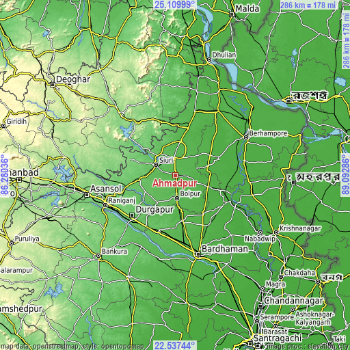
| \ | Map #1 | Map #2 | Topo.Map |
| Scale [m] | 28..59 m | 26..65 m | × |
| Scale [ft] | 92..194 ft | 85..213 ft | × |
| Average | 43.5 m = 143 ft | 45.4 m = 149 ft | × |
| Width | 8.94 km = 5.6 mi | 17.88 km = 11.1 mi | 286 km = 177.7 mi |
| Height | 8.94 km = 5.6 mi | 17.88 km = 11.1 mi | 286.1 km = 177.8 mi |
| ↑Max Latitude | 23.870283° | 23.910463° | 25.10999° |
| Latitude at center | 23.83009° | 23.83009° | 23.83009° |
| ↓Min Latitude | 23.789885° | 23.749667° | 22.53744° |
| ← Min Longitude | 87.642665° | 87.598719° | 86.28036° |
| Longitude center | 87.68661° | 87.68661° | 87.68661° |
| →Max Longitude | 87.730555° | 87.774501° | 89.09286° |
Nearby cities:
Cities around Ahmadpur sort by population:
• Durgapur elevation 100 m
52 km,  227°
227°
• Kātoya 22 m
49.8 km,  114°
114°
• Bolpur 57 m
18.6 km,  176°
176°
• Siuri 84 m
18.3 km,  298°
298°
• Kāndi 26 m
38.7 km,  68°
68°
• Rampur Hat 42 m
39.8 km,  14°
14°
• Sainthia 60 m
13.2 km,  357°
357°
• Dubrājpur 100 m
31.9 km,  261°
261°
• Guskhara 41 m
37.8 km,  172°
172°
• Nalhāti 54 m
53.9 km,  15°
15°
• Bahula 102 m
56.7 km,  249°
249°
• Bakreswar 92 m
32.5 km,  280°
280°
Multilingual:
 En español:
Ahmadpur elevación 51 m.
 En France:
Ahmadpur élévation 51 m.


Sources and notes:
- [note 1] Map square and city borders are not equal. Map elevation data is calculated only from area inside that square.
- [src 1] Elevation data from geonames database provided with same terms of usage.
- [src 2] The elevation map of Ahmadpur is generated using elevation data from NASA's 3 arcsec (90m) resolution SRTM data.
- [src 3] Base (background) map © OpenStreetMap contributors tiles are generated by Geofabrik and OpenTopoMap.
Copyright & License:
This Ahmadpur Elevation Map is licensed under CC BY-SA. You may reuse any part from this page, if you give a proper credit by linking to this URL:
 More info on terms of use page.