Bhuma elevation
Bhuma (Rajasthan, Sīkar), India elevation is 354 meters and Bhuma elevation in feet is 1161 ft above sea level [src 1]. Bhuma is a populated place (feature code) with elevation that is 61 meters (200 ft) bigger than average city elevation in India.
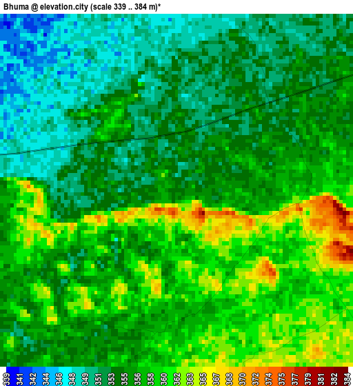
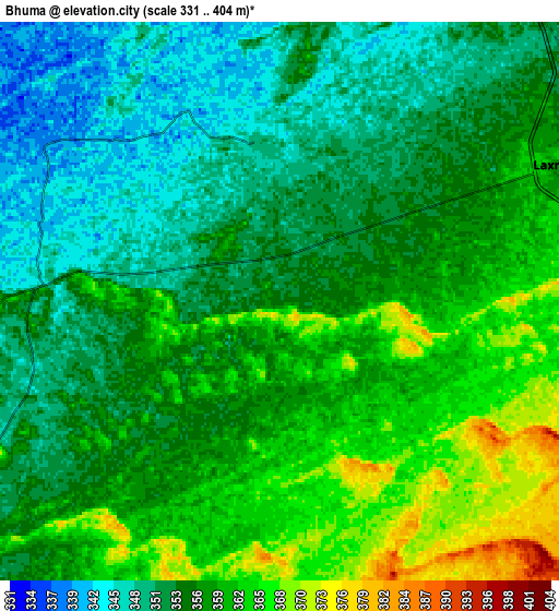
Below is the Elevation map of Bhuma, which displays elevation range with different colors. Scale of the first map is from 339 to 384 m (1112 to 1260 ft) with average elevation of 355.7 meters (=1167 ft) [note 1]
These maps also provides idea of topography and contour of this city, they are displayed at different zoom levels. More info about maps, scale and edge coordinates you can find below images.
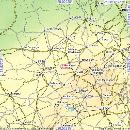
| \ | Map #1 | Map #2 | Topo.Map |
| Scale [m] | 339..384 m | 331..404 m | × |
| Scale [ft] | 1112..1260 ft | 1086..1325 ft | × |
| Average | 355.7 m = 1167 ft | 356.2 m = 1169 ft | × |
| Width | 8.65 km = 5.4 mi | 17.29 km = 10.7 mi | 276.7 km = 171.9 mi |
| Height | 8.65 km = 5.4 mi | 17.29 km = 10.7 mi | 276.7 km = 171.9 mi |
| ↑Max Latitude | 27.822202° | 27.86106° | 29.02028° |
| Latitude at center | 27.78333° | 27.78333° | 27.78333° |
| ↓Min Latitude | 27.744444° | 27.705544° | 26.53215° |
| ← Min Longitude | 74.889385° | 74.845439° | 73.52708° |
| Longitude center | 74.93333° | 74.93333° | 74.93333° |
| →Max Longitude | 74.977275° | 75.021221° | 76.33958° |
Nearby cities:
Cities around Bhuma sort by population:
• Sīkar elevation 435 m
27.9 km,  133°
133°
• Sūjāngarh 319 m
46.8 km,  258°
258°
• Fatehpur 329 m
23.6 km,  5°
5°
• Ratangarh 312 m
45.3 km,  316°
316°
• Nawalgarh 391 m
34.3 km,  77°
77°
• Lachhmangarh Sīkar 365 m
10.3 km,  64°
64°
• Udaipur 446 m
53.4 km,  97°
97°
• Losal 418 m
42.7 km,  182°
182°
• Rājaldesar 308 m
52.7 km,  301°
301°
• Bissāu 299 m
53.5 km,  15°
15°
• Chhāpar 311 m
48.7 km,  274°
274°
• Meethari Marwar 342 m
33.5 km,  226°
226°
Multilingual:
 En español:
Bhuma elevación 354 m.
 En France:
Bhuma élévation 354 m.


Sources and notes:
- [note 1] Map square and city borders are not equal. Map elevation data is calculated only from area inside that square.
- [src 1] Elevation data from geonames database provided with same terms of usage.
- [src 2] The elevation map of Bhuma is generated using elevation data from NASA's 3 arcsec (90m) resolution SRTM data.
- [src 3] Base (background) map © OpenStreetMap contributors tiles are generated by Geofabrik and OpenTopoMap.
Copyright & License:
This Bhuma Elevation Map is licensed under CC BY-SA. You may reuse any part from this page, if you give a proper credit by linking to this URL:
 More info on terms of use page.