Lachhmangarh Sīkar elevation
Lachhmangarh Sīkar (Rajasthan, Sīkar), India elevation is 365 meters and Lachhmangarh Sīkar elevation in feet is 1198 ft above sea level [src 1]. Lachhmangarh Sīkar is a populated place (feature code) with elevation that is 72 meters (236 ft) bigger than average city elevation in India.
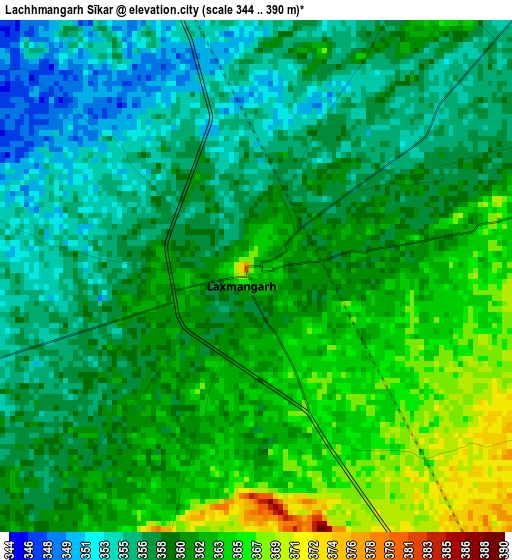
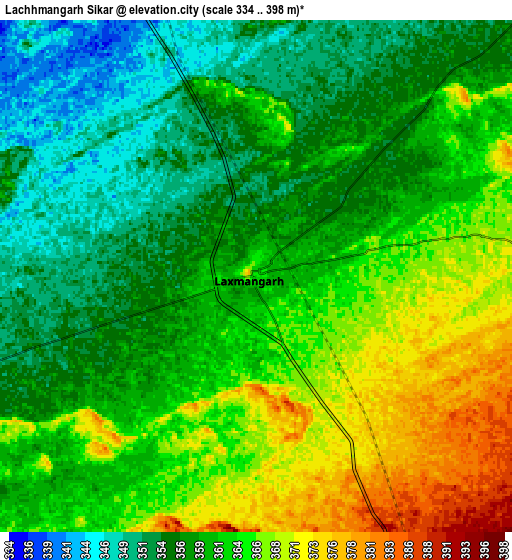
Below is the Elevation map of Lachhmangarh Sīkar, which displays elevation range with different colors. Scale of the first map is from 344 to 390 m (1129 to 1280 ft) with average elevation of 359.5 meters (=1179 ft) [note 1]
These maps also provides idea of topography and contour of this city, they are displayed at different zoom levels. More info about maps, scale and edge coordinates you can find below images.
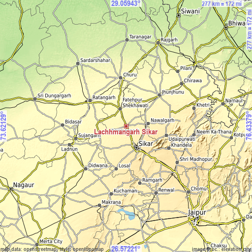
| \ | Map #1 | Map #2 | Topo.Map |
| Scale [m] | 344..390 m | 334..398 m | × |
| Scale [ft] | 1129..1280 ft | 1096..1306 ft | × |
| Average | 359.5 m = 1179 ft | 360.7 m = 1183 ft | × |
| Width | 8.64 km = 5.4 mi | 17.29 km = 10.7 mi | 276.6 km = 171.9 mi |
| Height | 8.64 km = 5.4 mi | 17.29 km = 10.7 mi | 276.6 km = 171.9 mi |
| ↑Max Latitude | 27.861798° | 27.900642° | 29.05943° |
| Latitude at center | 27.82294° | 27.82294° | 27.82294° |
| ↓Min Latitude | 27.784068° | 27.745182° | 26.57221° |
| ← Min Longitude | 74.983595° | 74.939649° | 73.62129° |
| Longitude center | 75.02754° | 75.02754° | 75.02754° |
| →Max Longitude | 75.071485° | 75.115431° | 76.43379° |
Nearby cities:
Cities around Lachhmangarh Sīkar sort by population:
• Sīkar elevation 435 m
25.9 km,  154°
154°
• Jhunjhunūn 343 m
49.6 km,  47°
47°
• Chūru 291 m
53.8 km,  353°
353°
• Fatehpur 329 m
20.4 km,  339°
339°
• Ratangarh 312 m
49.4 km,  305°
305°
• Nawalgarh 391 m
24.4 km,  82°
82°
• Udaipur 446 m
45.1 km,  104°
104°
• Losal 418 m
48.3 km,  193°
193°
• Khandela 489 m
52.6 km,  117°
117°
• Bissāu 299 m
47.4 km,  5°
5°
• Meethari Marwar 342 m
43.4 km,  230°
230°
• Bhuma 354 m
10.3 km,  244°
244°
Multilingual:
 En español:
Lachhmangarh Sīkar elevación 365 m.
 En France:
Lachhmangarh Sīkar élévation 365 m.
 Auf Deutsch:
Lachhmangarh Sīkar höhe über dem Meeresspiegel ist 365 m.
 На русском:
Lachhmangarh Sīkar высота над уровнем моря 365 м
Sources and notes:
- [note 1] Map square and city borders are not equal. Map elevation data is calculated only from area inside that square.
- [src 1] Elevation data from geonames database provided with same terms of usage.
- [src 2] The elevation map of Lachhmangarh Sīkar is generated using elevation data from NASA's 3 arcsec (90m) resolution SRTM data.
- [src 3] Base (background) map © OpenStreetMap contributors tiles are generated by Geofabrik and OpenTopoMap.
Copyright & License:
This Lachhmangarh Sīkar Elevation Map is licensed under CC BY-SA. You may reuse any part from this page, if you give a proper credit by linking to this URL:
 More info on terms of use page.