Bijapur elevation
Bijapur (Karnataka, Bijāpur), India elevation is 606 meters and Bijapur elevation in feet is 1988 ft above sea level [src 1]. Bijapur is a populated place (feature code) with elevation that is 313 meters (1027 ft) bigger than average city elevation in India.
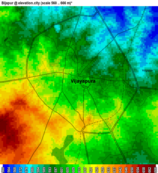
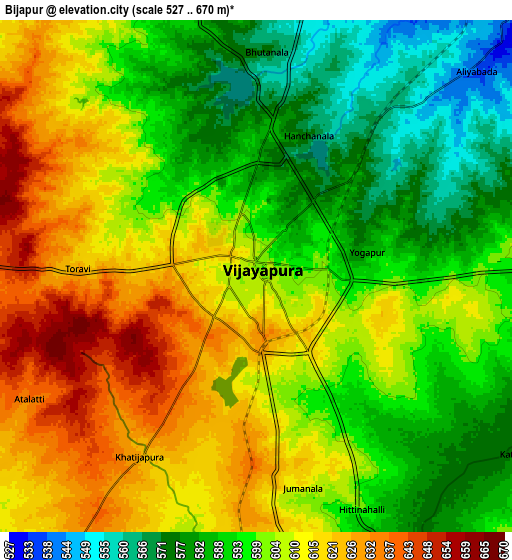
Below is the Elevation map of Bijapur, which displays elevation range with different colors. Scale of the first map is from 560 to 666 m (1837 to 2185 ft) with average elevation of 605.6 meters (=1987 ft) [note 1]
These maps also provides idea of topography and contour of this city, they are displayed at different zoom levels. More info about maps, scale and edge coordinates you can find below images.
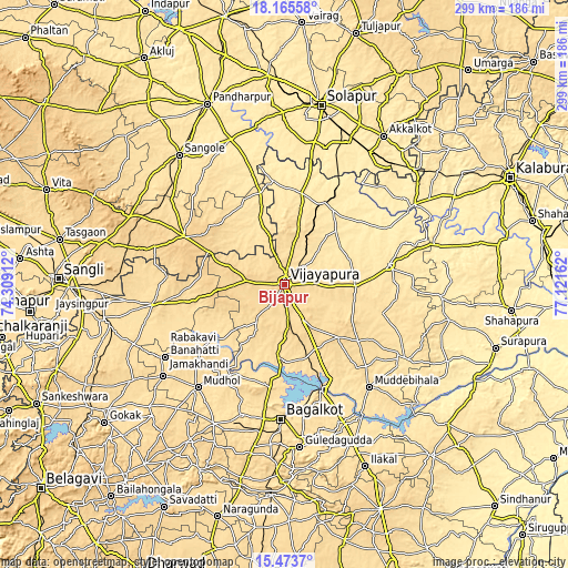
| \ | Map #1 | Map #2 | Topo.Map |
| Scale [m] | 560..666 m | 527..670 m | × |
| Scale [ft] | 1837..2185 ft | 1729..2198 ft | × |
| Average | 605.6 m = 1987 ft | 601.7 m = 1974 ft | × |
| Width | 9.35 km = 5.8 mi | 18.71 km = 11.6 mi | 299.3 km = 186 mi |
| Height | 9.35 km = 5.8 mi | 18.71 km = 11.6 mi | 299.3 km = 186 mi |
| ↑Max Latitude | 16.86648° | 16.90853° | 18.16558° |
| Latitude at center | 16.82442° | 16.82442° | 16.82442° |
| ↓Min Latitude | 16.782351° | 16.740273° | 15.4737° |
| ← Min Longitude | 75.671425° | 75.627479° | 74.30912° |
| Longitude center | 75.71537° | 75.71537° | 75.71537° |
| →Max Longitude | 75.759315° | 75.803261° | 77.12162° |
Nearby cities:
Cities around Bijapur sort by population:
• Bagalkot elevation 532 m
70.9 km,  181°
181°
• Rabkavi 547 m
75.2 km,  238°
238°
• Jamkhandi 563 m
57.5 km,  231°
231°
• Mudhol 547 m
71.4 km,  220°
220°
• Athni 573 m
70.2 km,  261°
261°
• Indi 466 m
46.7 km,  32°
32°
• Sindgi 503 m
56.1 km,  79°
79°
• Muddebihāl 586 m
70 km,  140°
140°
• Basavana Bāgevādi 618 m
39.2 km, 135°
• Tālīkota 513 m
74.5 km,  121°
121°
• Terdāl 550 m
80.2 km, 242°
• Bilgi 566 m
54.1 km,  191°
191°
Multilingual:
 En español:
Bijapur elevación 606 m.
 En France:
Bîjâpur élévation 606 m.


Sources and notes:
- [note 1] Map square and city borders are not equal. Map elevation data is calculated only from area inside that square.
- [src 1] Elevation data from geonames database provided with same terms of usage.
- [src 2] The elevation map of Bijapur is generated using elevation data from NASA's 3 arcsec (90m) resolution SRTM data.
- [src 3] Base (background) map © OpenStreetMap contributors tiles are generated by Geofabrik and OpenTopoMap.
Copyright & License:
This Bijapur Elevation Map is licensed under CC BY-SA. You may reuse any part from this page, if you give a proper credit by linking to this URL:
 More info on terms of use page.