Terdāl elevation
Terdāl (Karnataka, Bagalkot), India elevation is 550 meters and Terdāl elevation in feet is 1804 ft above sea level [src 1]. Terdāl is a populated place (feature code) with elevation that is 257 meters (843 ft) bigger than average city elevation in India.
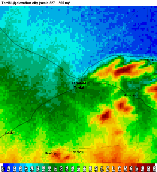
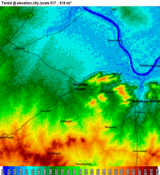
Below is the Elevation map of Terdāl, which displays elevation range with different colors. Scale of the first map is from 527 to 595 m (1729 to 1952 ft) with average elevation of 550.7 meters (=1807 ft) [note 1]
These maps also provides idea of topography and contour of this city, they are displayed at different zoom levels. More info about maps, scale and edge coordinates you can find below images.
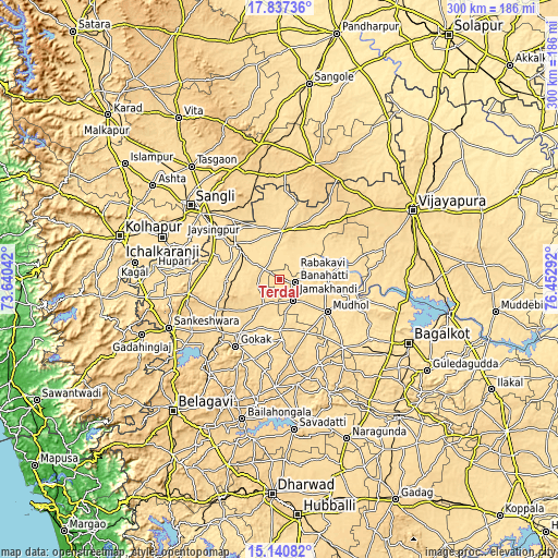
| \ | Map #1 | Map #2 | Topo.Map |
| Scale [m] | 527..595 m | 517..619 m | × |
| Scale [ft] | 1729..1952 ft | 1696..2031 ft | × |
| Average | 550.7 m = 1807 ft | 555.2 m = 1822 ft | × |
| Width | 9.37 km = 5.8 mi | 18.74 km = 11.6 mi | 299.8 km = 186.3 mi |
| Height | 9.37 km = 5.8 mi | 18.74 km = 11.6 mi | 299.8 km = 186.3 mi |
| ↑Max Latitude | 16.535922° | 16.578046° | 17.83736° |
| Latitude at center | 16.49379° | 16.49379° | 16.49379° |
| ↓Min Latitude | 16.451648° | 16.409498° | 15.14082° |
| ← Min Longitude | 75.002725° | 74.958779° | 73.64042° |
| Longitude center | 75.04667° | 75.04667° | 75.04667° |
| →Max Longitude | 75.090615° | 75.134561° | 76.45292° |
Nearby cities:
Cities around Terdāl sort by population:
• Rabkavi elevation 547 m
7.1 km,  106°
106°
• Gokak 555 m
43.2 km,  213°
213°
• Jamkhandi 563 m
26.1 km,  87°
87°
• Mudhol 547 m
30.9 km,  125°
125°
• Athni 573 m
25.9 km,  4°
4°
• Chikodi 638 m
49.7 km,  261°
261°
• Mahālingpur 573 m
13.4 km,  150°
150°
• Shiraguppi 540 m
38.6 km,  291°
291°
• Kurandvād 546 m
53.1 km, 293°
• Kudachi 547 m
25.4 km,  305°
305°
• Konnūr 622 m
45.5 km,  224°
224°
• Rāybāg 585 m
29.1 km,  269°
269°
Multilingual:
 En español:
Terdāl elevación 550 m.
 En France:
Terdāl élévation 550 m.


Sources and notes:
- [note 1] Map square and city borders are not equal. Map elevation data is calculated only from area inside that square.
- [src 1] Elevation data from geonames database provided with same terms of usage.
- [src 2] The elevation map of Terdāl is generated using elevation data from NASA's 3 arcsec (90m) resolution SRTM data.
- [src 3] Base (background) map © OpenStreetMap contributors tiles are generated by Geofabrik and OpenTopoMap.
Copyright & License:
This Terdāl Elevation Map is licensed under CC BY-SA. You may reuse any part from this page, if you give a proper credit by linking to this URL:
 More info on terms of use page.