Bagalkot elevation
Bagalkot (Karnataka), India elevation is 532 meters and Bagalkot elevation in feet is 1745 ft above sea level [src 1]. Bagalkot is a populated place (feature code) with elevation that is 239 meters (784 ft) bigger than average city elevation in India.
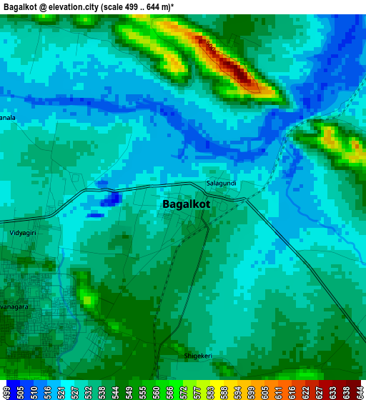
Below is the Elevation map of Bagalkot, which displays elevation range with different colors. Scale of the first map is from 499 to 644 m (1637 to 2113 ft) with average elevation of 533.9 meters (=1752 ft) [note 1]
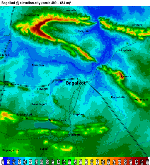
These maps also provides idea of topography and contour of this city, they are displayed at different zoom levels. More info about maps, scale and edge coordinates you can find below images.
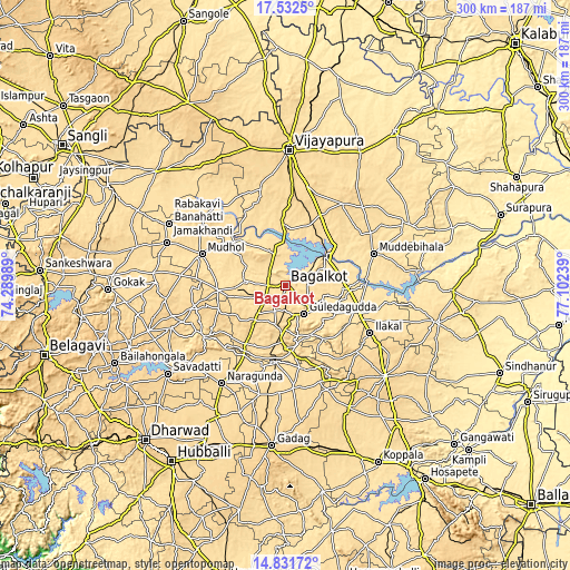
| \ | Map #1 | Map #2 | Topo.Map |
| Scale [m] | 499..644 m | 499..684 m | × |
| Scale [ft] | 1637..2113 ft | 1637..2244 ft | × |
| Average | 533.9 m = 1752 ft | 546.6 m = 1793 ft | × |
| Width | 9.39 km = 5.8 mi | 18.77 km = 11.7 mi | 300.3 km = 186.6 mi |
| Height | 9.39 km = 5.8 mi | 18.77 km = 11.7 mi | 300.3 km = 186.6 mi |
| ↑Max Latitude | 16.228929° | 16.271118° | 17.5325° |
| Latitude at center | 16.18673° | 16.18673° | 16.18673° |
| ↓Min Latitude | 16.144522° | 16.102305° | 14.83172° |
| ← Min Longitude | 75.652195° | 75.608249° | 74.28989° |
| Longitude center | 75.69614° | 75.69614° | 75.69614° |
| →Max Longitude | 75.740085° | 75.784031° | 77.10239° |
Nearby cities:
Cities around Bagalkot sort by population:
• Jamkhandi elevation 563 m
55.8 km,  309°
309°
• Ilkal 564 m
51.3 km,  119°
119°
• Mudhol 547 m
47 km,  290°
290°
• Guledagudda 540 m
18.2 km,  146°
146°
• Muddebihāl 586 m
49.4 km,  70°
70°
• Basavana Bāgevādi 618 m
52.1 km,  34°
34°
• Gajendragarh 643 m
58 km, 149°
• Bādāmi 560 m
30.3 km,  183°
183°
• Ron 581 m
54.3 km, 175°
• Hungund 539 m
41.1 km,  109°
109°
• Kerūr 629 m
25 km,  219°
219°
• Bilgi 566 m
19.7 km,  334°
334°
Multilingual:
 En español:
Bagalkot elevación 532 m.
 En France:
Bagalakote élévation 532 m.
 Auf Deutsch:
Bagalkot höhe über dem Meeresspiegel ist 532 m.

Sources and notes:
- [note 1] Map square and city borders are not equal. Map elevation data is calculated only from area inside that square.
- [src 1] Elevation data from geonames database provided with same terms of usage.
- [src 2] The elevation map of Bagalkot is generated using elevation data from NASA's 3 arcsec (90m) resolution SRTM data.
- [src 3] Base (background) map © OpenStreetMap contributors tiles are generated by Geofabrik and OpenTopoMap.
Copyright & License:
This Bagalkot Elevation Map is licensed under CC BY-SA. You may reuse any part from this page, if you give a proper credit by linking to this URL:
 More info on terms of use page.