Bilāspur elevation
Bilāspur (Haryana, Yamunanagar), India elevation is 306 meters and Bilāspur elevation in feet is 1004 ft above sea level [src 1]. Bilāspur is a populated place (feature code) with elevation that is 13 meters (43 ft) bigger than average city elevation in India.
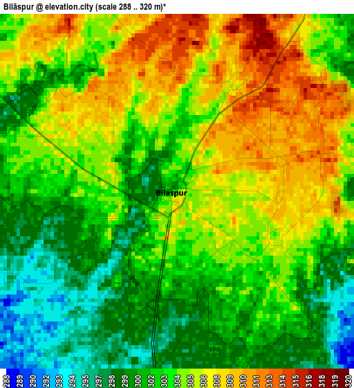
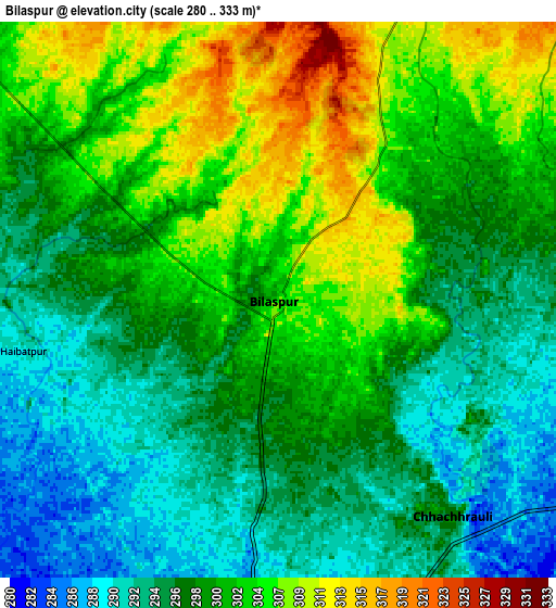
Below is the Elevation map of Bilāspur, which displays elevation range with different colors. Scale of the first map is from 288 to 320 m (945 to 1050 ft) with average elevation of 303.6 meters (=996 ft) [note 1]
These maps also provides idea of topography and contour of this city, they are displayed at different zoom levels. More info about maps, scale and edge coordinates you can find below images.
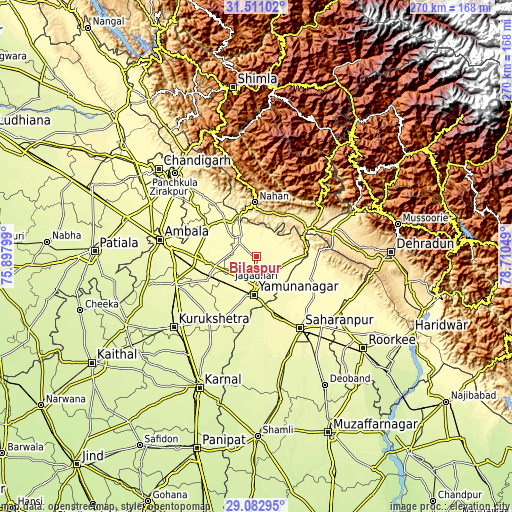
| \ | Map #1 | Map #2 | Topo.Map |
| Scale [m] | 288..320 m | 280..333 m | × |
| Scale [ft] | 945..1050 ft | 919..1093 ft | × |
| Average | 303.6 m = 996 ft | 299.8 m = 984 ft | × |
| Width | 8.44 km = 5.2 mi | 16.87 km = 10.5 mi | 270 km = 167.8 mi |
| Height | 8.44 km = 5.2 mi | 16.87 km = 10.5 mi | 270 km = 167.8 mi |
| ↑Max Latitude | 30.342433° | 30.380352° | 31.51102° |
| Latitude at center | 30.3045° | 30.3045° | 30.3045° |
| ↓Min Latitude | 30.266552° | 30.22859° | 29.08295° |
| ← Min Longitude | 77.260295° | 77.216349° | 75.89799° |
| Longitude center | 77.30424° | 77.30424° | 77.30424° |
| →Max Longitude | 77.348185° | 77.392131° | 78.71049° |
Nearby cities:
Cities around Bilāspur sort by population:
• Yamunānagar elevation 278 m
19.7 km,  185°
185°
• Jagādhri 292 m
15.3 km,  180°
180°
• Nāhan 909 m
28.5 km,  358°
358°
• Lādwa 266 m
42.6 km,  215°
215°
• Nakūr 272 m
42.8 km, 179°
• Pāonta Sāhib 403 m
34.1 km,  64°
64°
• Narāyangarh 332 m
25.6 km,  318°
318°
• Behat 306 m
33.2 km,  116°
116°
• Radaur 270 m
34.2 km,  205°
205°
• Chhachhrauli 298 m
8.5 km,  140°
140°
• Būriya 286 m
17 km,  162°
162°
• Mustafābād 284 m
18.8 km,  232°
232°
Multilingual:
 En español:
Bilāspur elevación 306 m.
 En France:
Bilāspur élévation 306 m.
 Auf Deutsch:
Bilāspur höhe über dem Meeresspiegel ist 306 m.

Sources and notes:
- [note 1] Map square and city borders are not equal. Map elevation data is calculated only from area inside that square.
- [src 1] Elevation data from geonames database provided with same terms of usage.
- [src 2] The elevation map of Bilāspur is generated using elevation data from NASA's 3 arcsec (90m) resolution SRTM data.
- [src 3] Base (background) map © OpenStreetMap contributors tiles are generated by Geofabrik and OpenTopoMap.
Copyright & License:
This Bilāspur Elevation Map is licensed under CC BY-SA. You may reuse any part from this page, if you give a proper credit by linking to this URL:
 More info on terms of use page.