Deori elevation
Deori (Chhattisgarh, Raipur), India elevation is 267 meters and Deori elevation in feet is 876 ft above sea level [src 1]. Deori is a populated place (feature code) with elevation that is 26 meters (85 ft) smaller than average city elevation in India.
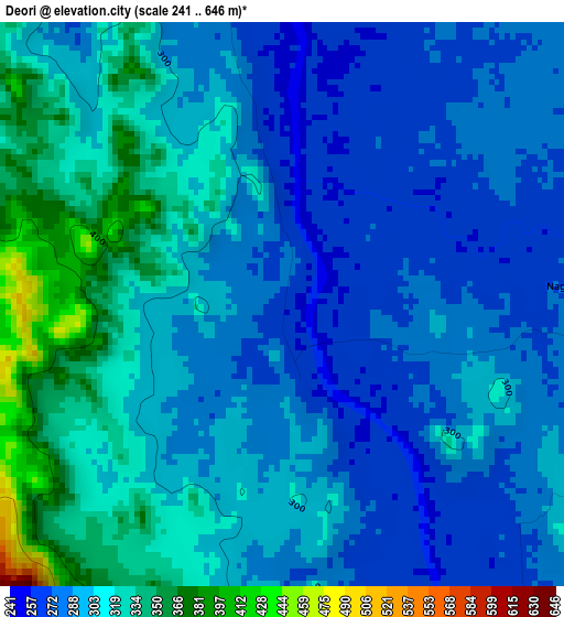
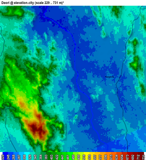
Below is the Elevation map of Deori, which displays elevation range with different colors. Scale of the first map is from 241 to 646 m (791 to 2119 ft) with average elevation of 299.6 meters (=983 ft) [note 1]
These maps also provides idea of topography and contour of this city, they are displayed at different zoom levels. More info about maps, scale and edge coordinates you can find below images.
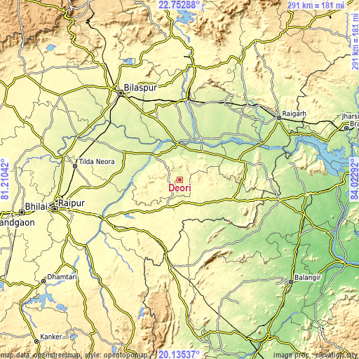
| \ | Map #1 | Map #2 | Topo.Map |
| Scale [m] | 241..646 m | 229..731 m | × |
| Scale [ft] | 791..2119 ft | 751..2398 ft | × |
| Average | 299.6 m = 983 ft | 322.2 m = 1057 ft | × |
| Width | 9.1 km = 5.7 mi | 18.19 km = 11.3 mi | 291 km = 180.8 mi |
| Height | 9.1 km = 5.7 mi | 18.19 km = 11.3 mi | 291.1 km = 180.9 mi |
| ↑Max Latitude | 21.490896° | 21.53178° | 22.75288° |
| Latitude at center | 21.45° | 21.45° | 21.45° |
| ↓Min Latitude | 21.409093° | 21.368174° | 20.13537° |
| ← Min Longitude | 82.572725° | 82.528779° | 81.21042° |
| Longitude center | 82.61667° | 82.61667° | 82.61667° |
| →Max Longitude | 82.660615° | 82.704561° | 84.02292° |
Nearby cities:
Cities around Deori sort by population:
• Mahāsamund elevation 299 m
66.1 km,  234°
234°
• Chāmpa 254 m
65.1 km,  2°
2°
• Jānjgīr 278 m
62.3 km,  356°
356°
• Baloda Bāzār 259 m
52.5 km,  295°
295°
• Akaltara 287 m
66.8 km,  342°
342°
• Saraipali 271 m
43 km,  110°
110°
• Sārangarh 235 m
50.1 km,  72°
72°
• Basna 277 m
28.9 km,  131°
131°
• Kharod 244 m
32.9 km,  353°
353°
• Seorīnārāyan 228 m
30.2 km, 355°
• Pithora 301 m
24.5 km,  204°
204°
• Khamharia 328 m
64.9 km,  215°
215°
Multilingual:
 En español:
Deori elevación 267 m.
 En France:
Deori élévation 267 m.


Sources and notes:
- [note 1] Map square and city borders are not equal. Map elevation data is calculated only from area inside that square.
- [src 1] Elevation data from geonames database provided with same terms of usage.
- [src 2] The elevation map of Deori is generated using elevation data from NASA's 3 arcsec (90m) resolution SRTM data.
- [src 3] Base (background) map © OpenStreetMap contributors tiles are generated by Geofabrik and OpenTopoMap.
Copyright & License:
This Deori Elevation Map is licensed under CC BY-SA. You may reuse any part from this page, if you give a proper credit by linking to this URL:
 More info on terms of use page.