Akaltara elevation
Akaltara (Chhattisgarh, Janjgir-Champa), India elevation is 287 meters and Akaltara elevation in feet is 942 ft above sea level [src 1]. Akaltara is a populated place (feature code) with elevation that is 6 meters (20 ft) smaller than average city elevation in India.
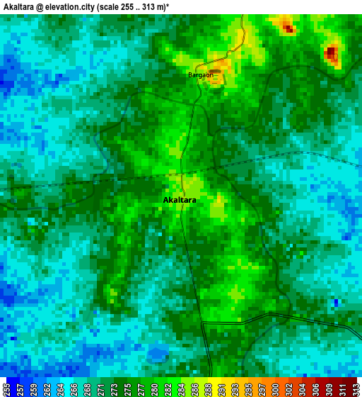
Below is the Elevation map of Akaltara, which displays elevation range with different colors. Scale of the first map is from 255 to 313 m (837 to 1027 ft) with average elevation of 271.8 meters (=892 ft) [note 1]
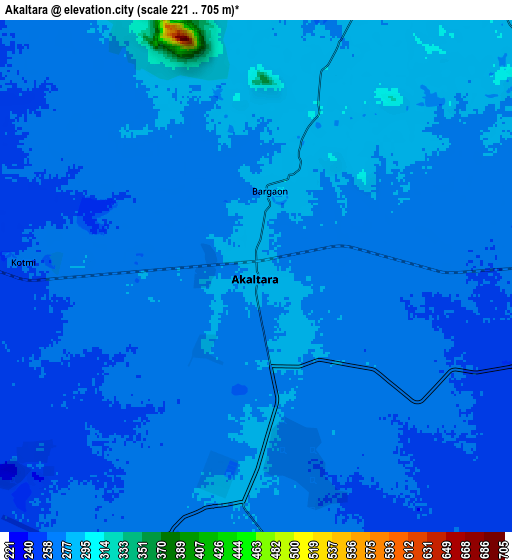
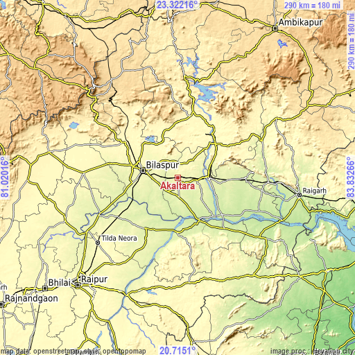
These maps also provides idea of topography and contour of this city, they are displayed at different zoom levels. More info about maps, scale and edge coordinates you can find below images.
| \ | Map #1 | Map #2 | Topo.Map |
| Scale [m] | 255..313 m | 221..705 m | × |
| Scale [ft] | 837..1027 ft | 725..2313 ft | × |
| Average | 271.8 m = 892 ft | 270 m = 886 ft | × |
| Width | 9.06 km = 5.6 mi | 18.12 km = 11.3 mi | 289.9 km = 180.1 mi |
| Height | 9.06 km = 5.6 mi | 18.12 km = 11.3 mi | 289.9 km = 180.1 mi |
| ↑Max Latitude | 22.065362° | 22.106083° | 23.32216° |
| Latitude at center | 22.02463° | 22.02463° | 22.02463° |
| ↓Min Latitude | 21.983886° | 21.94313° | 20.7151° |
| ← Min Longitude | 82.382465° | 82.338519° | 81.02016° |
| Longitude center | 82.42641° | 82.42641° | 82.42641° |
| →Max Longitude | 82.470355° | 82.514301° | 83.83266° |
Nearby cities:
Cities around Akaltara sort by population:
• Korba elevation 289 m
45.2 km,  37°
37°
• Bilāspur 265 m
28.6 km,  282°
282°
• Chāmpa 254 m
22.3 km,  86°
86°
• Jānjgīr 278 m
15.7 km,  96°
96°
• Baloda Bāzār 259 m
49.2 km,  213°
213°
• Saktī 245 m
55.1 km, 89°
• Ratanpur 304 m
39.4 km,  317°
317°
• Katghora 325 m
54.5 km,  12°
12°
• Kotā 333 m
51.2 km,  305°
305°
• Baloda 297 m
13.9 km,  24°
24°
• Kharod 244 m
34.9 km,  153°
153°
• Seorīnārāyan 228 m
37.9 km, 152°
Multilingual:
 En español:
Akaltara elevación 287 m.
 En France:
Akaltara élévation 287 m.
 Auf Deutsch:
Akaltara höhe über dem Meeresspiegel ist 287 m.

Sources and notes:
- [note 1] Map square and city borders are not equal. Map elevation data is calculated only from area inside that square.
- [src 1] Elevation data from geonames database provided with same terms of usage.
- [src 2] The elevation map of Akaltara is generated using elevation data from NASA's 3 arcsec (90m) resolution SRTM data.
- [src 3] Base (background) map © OpenStreetMap contributors tiles are generated by Geofabrik and OpenTopoMap.
Copyright & License:
This Akaltara Elevation Map is licensed under CC BY-SA. You may reuse any part from this page, if you give a proper credit by linking to this URL:
 More info on terms of use page.