Saraipali elevation
Saraipali (Chhattisgarh, Mahasamund), India elevation is 271 meters and Saraipali elevation in feet is 889 ft above sea level [src 1]. Saraipali is a populated place (feature code) with elevation that is 22 meters (72 ft) smaller than average city elevation in India.
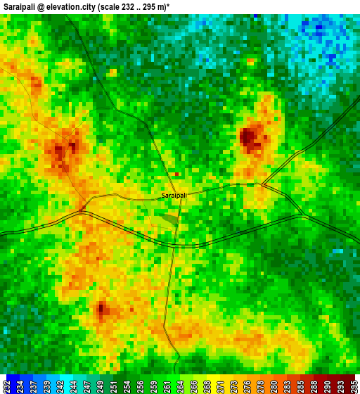
Below is the Elevation map of Saraipali, which displays elevation range with different colors. Scale of the first map is from 232 to 295 m (761 to 968 ft) with average elevation of 260.8 meters (=856 ft) [note 1]
These maps also provides idea of topography and contour of this city, they are displayed at different zoom levels. More info about maps, scale and edge coordinates you can find below images.
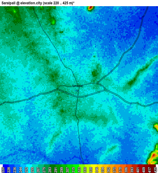
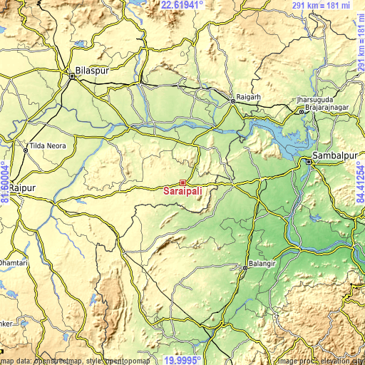
| \ | Map #1 | Map #2 | Topo.Map |
| Scale [m] | 232..295 m | 220..425 m | × |
| Scale [ft] | 761..968 ft | 722..1394 ft | × |
| Average | 260.8 m = 856 ft | 255.1 m = 837 ft | × |
| Width | 9.1 km = 5.7 mi | 18.21 km = 11.3 mi | 291.3 km = 181 mi |
| Height | 9.1 km = 5.7 mi | 18.21 km = 11.3 mi | 291.3 km = 181 mi |
| ↑Max Latitude | 21.356233° | 21.397156° | 22.61941° |
| Latitude at center | 21.3153° | 21.3153° | 21.3153° |
| ↓Min Latitude | 21.274355° | 21.233399° | 19.9995° |
| ← Min Longitude | 82.962345° | 82.918399° | 81.60004° |
| Longitude center | 83.00629° | 83.00629° | 83.00629° |
| →Max Longitude | 83.050235° | 83.094181° | 84.41254° |
Nearby cities:
Cities around Saraipali sort by population:
• Raigarh elevation 224 m
76.3 km,  31°
31°
• Bargarh 179 m
63.5 km,  88°
88°
• Barpāli 182 m
61.8 km,  103°
103°
• Patnāgarh 246 m
68.8 km,  169°
169°
• Kharsia 262 m
75.7 km,  7°
7°
• Padampur 200 m
35.6 km, 170°
• Sārangarh 235 m
31 km, 13°
• Deori 267 m
43 km,  290°
290°
• Basna 277 m
19 km,  257°
257°
• Kharod 244 m
65 km,  317°
317°
• Seorīnārāyan 228 m
62.1 km, 316°
• Pithora 301 m
51.2 km, 261°
Multilingual:
 En español:
Saraipali elevación 271 m.
 En France:
Saraipali élévation 271 m.
 Auf Deutsch:
Saraipali höhe über dem Meeresspiegel ist 271 m.

Sources and notes:
- [note 1] Map square and city borders are not equal. Map elevation data is calculated only from area inside that square.
- [src 1] Elevation data from geonames database provided with same terms of usage.
- [src 2] The elevation map of Saraipali is generated using elevation data from NASA's 3 arcsec (90m) resolution SRTM data.
- [src 3] Base (background) map © OpenStreetMap contributors tiles are generated by Geofabrik and OpenTopoMap.
Copyright & License:
This Saraipali Elevation Map is licensed under CC BY-SA. You may reuse any part from this page, if you give a proper credit by linking to this URL:
 More info on terms of use page.