Kharsia elevation
Kharsia (Chhattisgarh, Raigarh), India elevation is 262 meters and Kharsia elevation in feet is 860 ft above sea level [src 1]. Kharsia is a populated place (feature code) with elevation that is 31 meters (102 ft) smaller than average city elevation in India.
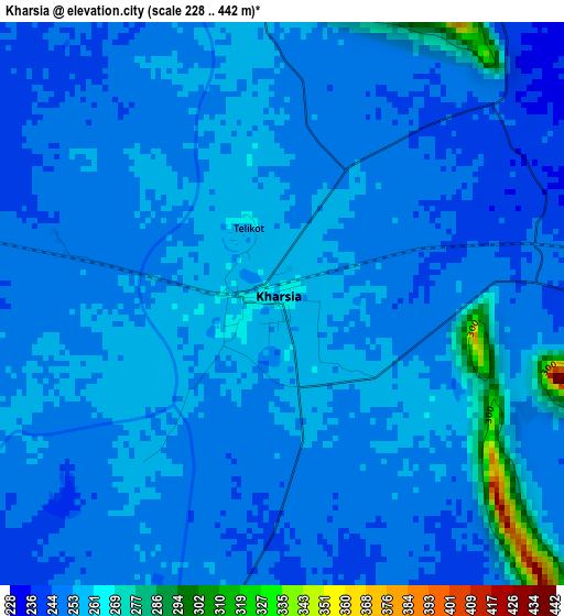
Below is the Elevation map of Kharsia, which displays elevation range with different colors. Scale of the first map is from 228 to 442 m (748 to 1450 ft) with average elevation of 252.8 meters (=829 ft) [note 1]
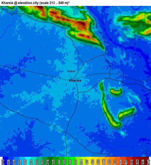
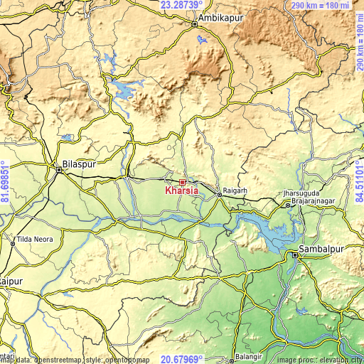
These maps also provides idea of topography and contour of this city, they are displayed at different zoom levels. More info about maps, scale and edge coordinates you can find below images.
| \ | Map #1 | Map #2 | Topo.Map |
| Scale [m] | 228..442 m | 213..549 m | × |
| Scale [ft] | 748..1450 ft | 699..1801 ft | × |
| Average | 252.8 m = 829 ft | 257.4 m = 844 ft | × |
| Width | 9.06 km = 5.6 mi | 18.12 km = 11.3 mi | 289.9 km = 180.1 mi |
| Height | 9.06 km = 5.6 mi | 18.12 km = 11.3 mi | 290 km = 180.2 mi |
| ↑Max Latitude | 22.030273° | 22.071003° | 23.28739° |
| Latitude at center | 21.98953° | 21.98953° | 21.98953° |
| ↓Min Latitude | 21.948776° | 21.90801° | 20.67969° |
| ← Min Longitude | 83.060815° | 83.016869° | 81.69851° |
| Longitude center | 83.10476° | 83.10476° | 83.10476° |
| →Max Longitude | 83.148705° | 83.192651° | 84.51101° |
Nearby cities:
Cities around Kharsia sort by population:
• Korba elevation 289 m
57.8 km,  313°
313°
• Raigarh 224 m
31.8 km,  108°
108°
• Chāmpa 254 m
47.9 km,  276°
276°
• Jānjgīr 278 m
54.4 km,  272°
272°
• Saktī 245 m
15.4 km,  285°
285°
• Akaltara 287 m
70 km, 273°
• Pathalgaon 573 m
73.1 km,  30°
30°
• Sārangarh 235 m
44.9 km,  183°
183°
• Baloda 297 m
66.3 km, 284°
• Kharod 244 m
60.7 km,  243°
243°
• Seorīnārāyan 228 m
60.7 km, 240°
• Gharghoda 294 m
32.7 km,  51°
51°
Multilingual:
 En español:
Kharsia elevación 262 m.
 En France:
Kharsia élévation 262 m.


Sources and notes:
- [note 1] Map square and city borders are not equal. Map elevation data is calculated only from area inside that square.
- [src 1] Elevation data from geonames database provided with same terms of usage.
- [src 2] The elevation map of Kharsia is generated using elevation data from NASA's 3 arcsec (90m) resolution SRTM data.
- [src 3] Base (background) map © OpenStreetMap contributors tiles are generated by Geofabrik and OpenTopoMap.
Copyright & License:
This Kharsia Elevation Map is licensed under CC BY-SA. You may reuse any part from this page, if you give a proper credit by linking to this URL:
 More info on terms of use page.