Erraguntla elevation
Erraguntla (Andhra Pradesh, Cuddapah), India elevation is 169 meters and Erraguntla elevation in feet is 554 ft above sea level [src 1]. Erraguntla is a populated place (feature code) with elevation that is 124 meters (407 ft) smaller than average city elevation in India.
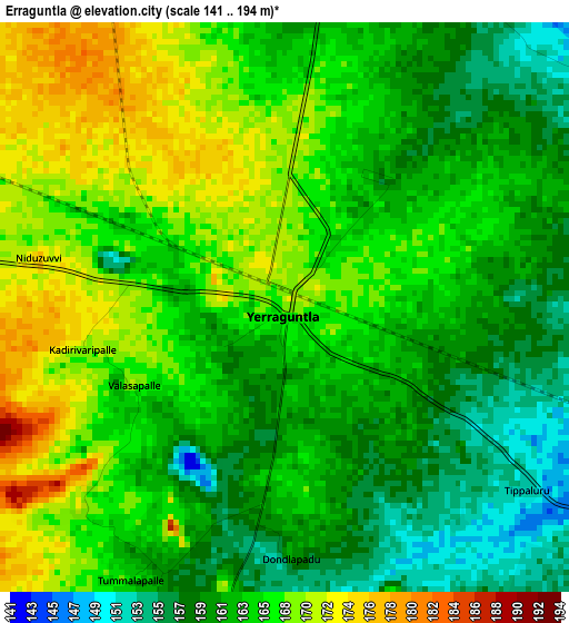
Below is the Elevation map of Erraguntla, which displays elevation range with different colors. Scale of the first map is from 141 to 194 m (463 to 636 ft) with average elevation of 164.3 meters (=539 ft) [note 1]
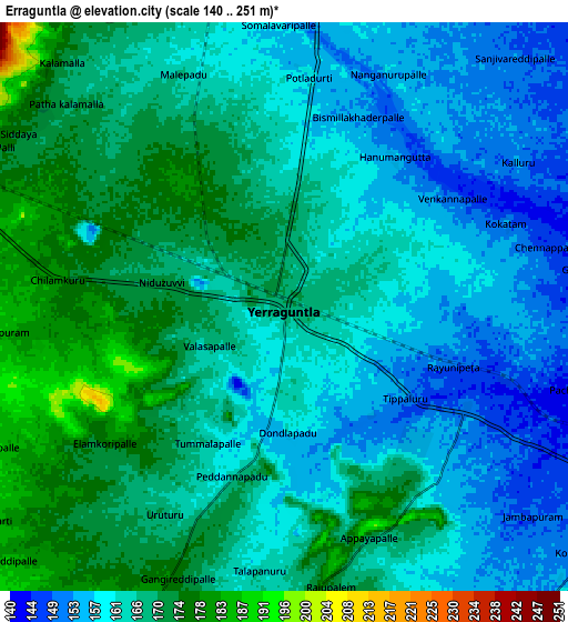
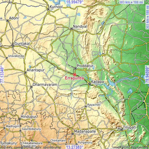
These maps also provides idea of topography and contour of this city, they are displayed at different zoom levels. More info about maps, scale and edge coordinates you can find below images.
| \ | Map #1 | Map #2 | Topo.Map |
| Scale [m] | 141..194 m | 140..251 m | × |
| Scale [ft] | 463..636 ft | 459..823 ft | × |
| Average | 164.3 m = 539 ft | 164.4 m = 539 ft | × |
| Width | 9.46 km = 5.9 mi | 18.91 km = 11.8 mi | 302.5 km = 188 mi |
| Height | 9.46 km = 5.9 mi | 18.91 km = 11.8 mi | 302.6 km = 188 mi |
| ↑Max Latitude | 14.681045° | 14.723551° | 15.99479° |
| Latitude at center | 14.63853° | 14.63853° | 14.63853° |
| ↓Min Latitude | 14.596007° | 14.553476° | 13.27383° |
| ← Min Longitude | 78.495795° | 78.451849° | 77.13349° |
| Longitude center | 78.53974° | 78.53974° | 78.53974° |
| →Max Longitude | 78.583685° | 78.627631° | 79.94599° |
Nearby cities:
Cities around Erraguntla sort by population:
• Proddatūr elevation 160 m
12.4 km,  4°
4°
• Cuddapah 135 m
35.3 km,  120°
120°
• Tādpatri 240 m
64.3 km,  297°
297°
• Kadiri 519 m
71.5 km,  214°
214°
• Rāyachoti 361 m
68.5 km,  160°
160°
• Chinnachowk 135 m
36.6 km, 119°
• Jammalamadugu 188 m
28.6 km,  323°
323°
• Pulivendla 273 m
41.6 km,  234°
234°
• Banganapalle 231 m
82.7 km,  335°
335°
• Badvel 139 m
57.5 km,  78°
78°
• Kāmalāpuram 141 m
14.7 km,  107°
107°
• Nāgireddipalli 150 m
73 km, 124°
Multilingual:
 En español:
Erraguntla elevación 169 m.
 En France:
Erraguntla élévation 169 m.
 Auf Deutsch:
Erraguntla höhe über dem Meeresspiegel ist 169 m.

Sources and notes:
- [note 1] Map square and city borders are not equal. Map elevation data is calculated only from area inside that square.
- [src 1] Elevation data from geonames database provided with same terms of usage.
- [src 2] The elevation map of Erraguntla is generated using elevation data from NASA's 3 arcsec (90m) resolution SRTM data.
- [src 3] Base (background) map © OpenStreetMap contributors tiles are generated by Geofabrik and OpenTopoMap.
Copyright & License:
This Erraguntla Elevation Map is licensed under CC BY-SA. You may reuse any part from this page, if you give a proper credit by linking to this URL:
 More info on terms of use page.