Gundlupēt elevation
Gundlupēt (Karnataka, Chamrajnagar), India elevation is 799 meters and Gundlupēt elevation in feet is 2621 ft above sea level [src 1]. Gundlupēt is a populated place (feature code) with elevation that is 506 meters (1660 ft) bigger than average city elevation in India.
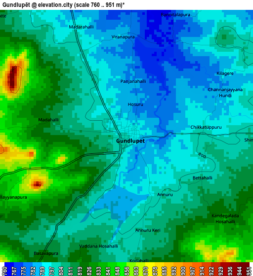
Below is the Elevation map of Gundlupēt, which displays elevation range with different colors. Scale of the first map is from 760 to 951 m (2493 to 3120 ft) with average elevation of 808.1 meters (=2651 ft) [note 1]
These maps also provides idea of topography and contour of this city, they are displayed at different zoom levels. More info about maps, scale and edge coordinates you can find below images.
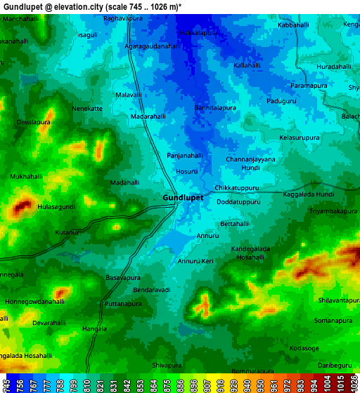
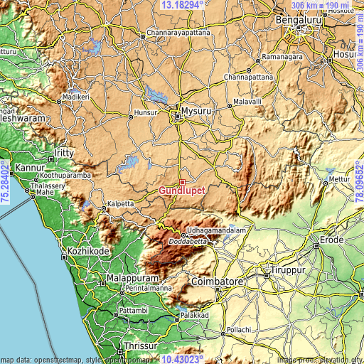
| \ | Map #1 | Map #2 | Topo.Map |
| Scale [m] | 760..951 m | 745..1026 m | × |
| Scale [ft] | 2493..3120 ft | 2444..3366 ft | × |
| Average | 808.1 m = 2651 ft | 827.3 m = 2714 ft | × |
| Width | 9.57 km = 5.9 mi | 19.13 km = 11.9 mi | 306.1 km = 190.2 mi |
| Height | 9.57 km = 5.9 mi | 19.13 km = 11.9 mi | 306.1 km = 190.2 mi |
| ↑Max Latitude | 11.853052° | 11.896057° | 13.18294° |
| Latitude at center | 11.81004° | 11.81004° | 11.81004° |
| ↓Min Latitude | 11.767022° | 11.723996° | 10.43023° |
| ← Min Longitude | 76.646325° | 76.602379° | 75.28402° |
| Longitude center | 76.69027° | 76.69027° | 76.69027° |
| →Max Longitude | 76.734215° | 76.778161° | 78.09652° |
Nearby cities:
Cities around Gundlupēt sort by population:
• Ooty elevation 2242 m
44.1 km,  179°
179°
• Chamrajnagar 717 m
29.9 km,  65°
65°
• Nanjangūd 666 m
34.2 km,  358°
358°
• Kotagiri 1902 m
47.1 km,  156°
156°
• Wellington 1847 m
50.5 km,  168°
168°
• Heggadadevankote 702 m
50 km,  308°
308°
• Naduvattam 1855 m
39.9 km,  203°
203°
• Sargūr 693 m
38.3 km,  303°
303°
• Tirumakūdal Narsipur 654 m
50.3 km,  27°
27°
• Masinigudi 946 m
27.4 km,  191°
191°
• Yelandūr 663 m
45.4 km,  54°
54°
• Aruvankad 1920 m
50.2 km, 171°
Multilingual:
 En español:
Gundlupēt elevación 799 m.
 En France:
Gundlupēt élévation 799 m.
 Auf Deutsch:
Gundlupēt höhe über dem Meeresspiegel ist 799 m.

Sources and notes:
- [note 1] Map square and city borders are not equal. Map elevation data is calculated only from area inside that square.
- [src 1] Elevation data from geonames database provided with same terms of usage.
- [src 2] The elevation map of Gundlupēt is generated using elevation data from NASA's 3 arcsec (90m) resolution SRTM data.
- [src 3] Base (background) map © OpenStreetMap contributors tiles are generated by Geofabrik and OpenTopoMap.
Copyright & License:
This Gundlupēt Elevation Map is licensed under CC BY-SA. You may reuse any part from this page, if you give a proper credit by linking to this URL:
 More info on terms of use page.