Handiā elevation
Handiā (Uttar Pradesh, Allahābād), India elevation is 97 meters and Handiā elevation in feet is 318 ft above sea level [src 1]. Handiā is a populated place (feature code) with elevation that is 196 meters (643 ft) smaller than average city elevation in India.
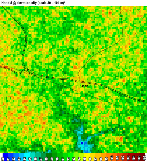
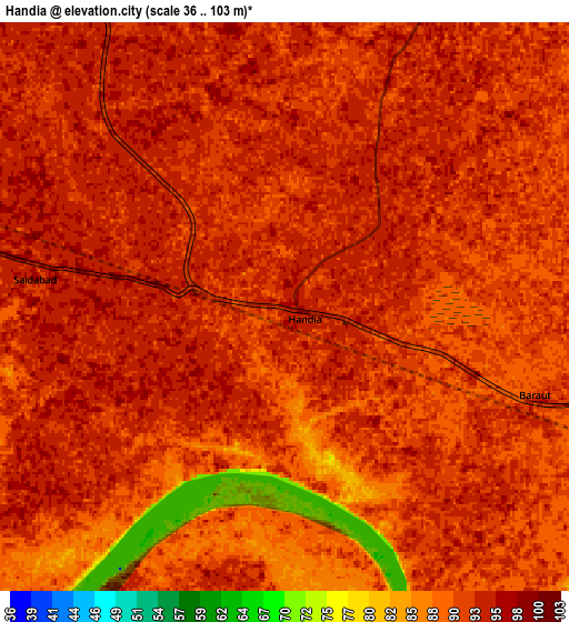
Below is the Elevation map of Handiā, which displays elevation range with different colors. Scale of the first map is from 80 to 101 m (262 to 331 ft) with average elevation of 92.8 meters (=304 ft) [note 1]
These maps also provides idea of topography and contour of this city, they are displayed at different zoom levels. More info about maps, scale and edge coordinates you can find below images.
| \ | Map #1 | Map #2 | Topo.Map |
| Scale [m] | 80..101 m | 36..103 m | × |
| Scale [ft] | 262..331 ft | 118..338 ft | × |
| Average | 92.8 m = 304 ft | 91.7 m = 301 ft | × |
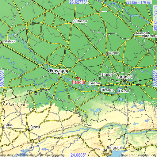
| Width | 8.83 km = 5.5 mi | 17.66 km = 11 mi | 282.6 km = 175.6 mi |
| Height | 8.83 km = 5.5 mi | 17.66 km = 11 mi | 282.6 km = 175.6 mi |
| ↑Max Latitude | 25.403493° | 25.443182° | 26.62773° |
| Latitude at center | 25.36379° | 25.36379° | 25.36379° |
| ↓Min Latitude | 25.324074° | 25.284345° | 24.0865° |
| ← Min Longitude | 82.142605° | 82.098659° | 80.7803° |
| Longitude center | 82.18655° | 82.18655° | 82.18655° |
| →Max Longitude | 82.230495° | 82.274441° | 83.5928° |
Nearby cities:
Cities around Handiā sort by population:
• Allahābād elevation 99 m
35.6 km,  284°
284°
• Mirzāpur 90 m
45.2 km,  122°
122°
• Bhadohi 94 m
38.7 km,  84°
84°
• Machhlīshahr 98 m
42.3 km,  32°
32°
• Phulpur 102 m
22.8 km,  334°
334°
• Mariāhu 94 m
49.7 km,  57°
57°
• Mau Aimma 103 m
45.3 km,  324°
324°
• Suriānwān 91 m
25.9 km, 64°
• Jhūsi 95 m
29.4 km,  286°
286°
• Kachhwa 82 m
55.9 km,  108°
108°
• Gyānpur 91 m
28.3 km,  97°
97°
• Sirsā 96 m
14.7 km,  220°
220°
Multilingual:
 En español:
Handiā elevación 97 m.
 En France:
Handiā élévation 97 m.


Sources and notes:
- [note 1] Map square and city borders are not equal. Map elevation data is calculated only from area inside that square.
- [src 1] Elevation data from geonames database provided with same terms of usage.
- [src 2] The elevation map of Handiā is generated using elevation data from NASA's 3 arcsec (90m) resolution SRTM data.
- [src 3] Base (background) map © OpenStreetMap contributors tiles are generated by Geofabrik and OpenTopoMap.
Copyright & License:
This Handiā Elevation Map is licensed under CC BY-SA. You may reuse any part from this page, if you give a proper credit by linking to this URL:
 More info on terms of use page.