Kachhwa elevation
Kachhwa (Uttar Pradesh, Mirzāpur), India elevation is 82 meters and Kachhwa elevation in feet is 269 ft above sea level [src 1]. Kachhwa is a populated place (feature code) with elevation that is 211 meters (692 ft) smaller than average city elevation in India.
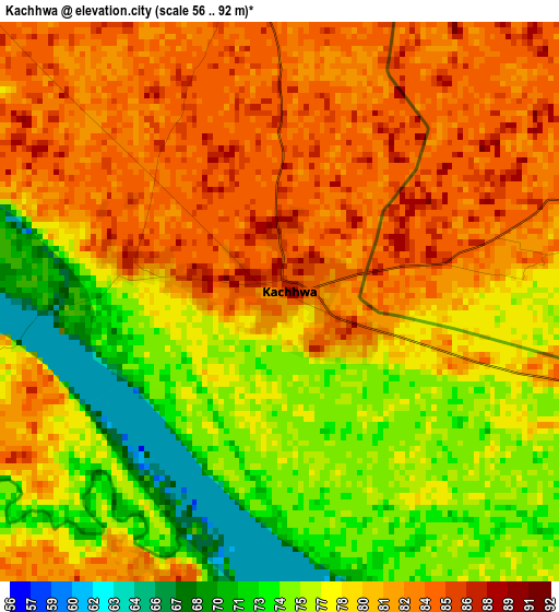
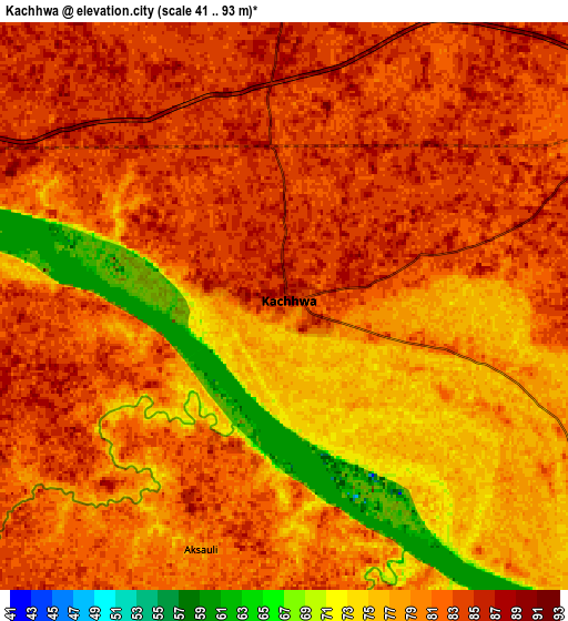
Below is the Elevation map of Kachhwa, which displays elevation range with different colors. Scale of the first map is from 56 to 92 m (184 to 302 ft) with average elevation of 79 meters (=259 ft) [note 1]
These maps also provides idea of topography and contour of this city, they are displayed at different zoom levels. More info about maps, scale and edge coordinates you can find below images.
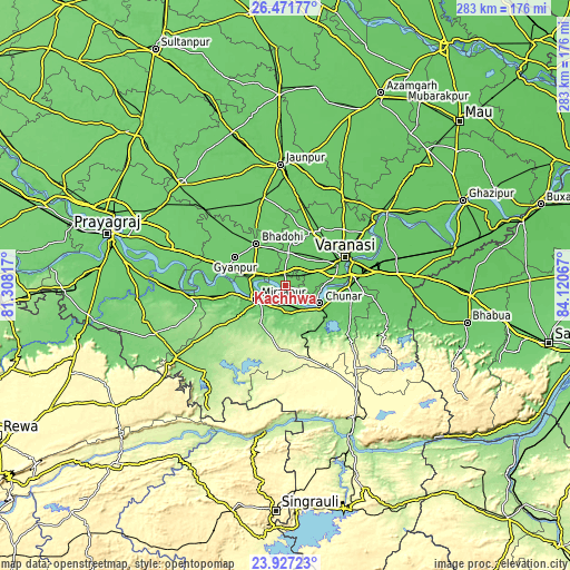
| \ | Map #1 | Map #2 | Topo.Map |
| Scale [m] | 56..92 m | 41..93 m | × |
| Scale [ft] | 184..302 ft | 135..305 ft | × |
| Average | 79 m = 259 ft | 80 m = 262 ft | × |
| Width | 8.84 km = 5.5 mi | 17.68 km = 11 mi | 282.9 km = 175.8 mi |
| Height | 8.84 km = 5.5 mi | 17.68 km = 11 mi | 282.9 km = 175.8 mi |
| ↑Max Latitude | 25.245904° | 25.285646° | 26.47177° |
| Latitude at center | 25.20615° | 25.20615° | 25.20615° |
| ↓Min Latitude | 25.166383° | 25.126602° | 23.92723° |
| ← Min Longitude | 82.670475° | 82.626529° | 81.30817° |
| Longitude center | 82.71442° | 82.71442° | 82.71442° |
| →Max Longitude | 82.758365° | 82.802311° | 84.12067° |
Nearby cities:
Cities around Kachhwa sort by population:
• Varanasi elevation 86 m
32.2 km,  67°
67°
• Mirzāpur 90 m
16.5 km,  245°
245°
• Mughal Sarāi 85 m
41.6 km,  78°
78°
• Bhadohi 94 m
25.5 km,  325°
325°
• Rāmnagar 84 m
32.5 km, 77°
• Chunār 83 m
19 km,  117°
117°
• Ahraura 106 m
38.4 km, 123°
• Mariāhu 94 m
45.6 km,  345°
345°
• Suriānwān 91 m
41.2 km,  314°
314°
• Gyānpur 91 m
28.6 km,  299°
299°
• Barāgaon 89 m
26.9 km,  22°
22°
• Ghorāwal 300 m
50.6 km,  172°
172°
Multilingual:
 En español:
Kachhwa elevación 82 m.
 En France:
Kachhwa élévation 82 m.


Sources and notes:
- [note 1] Map square and city borders are not equal. Map elevation data is calculated only from area inside that square.
- [src 1] Elevation data from geonames database provided with same terms of usage.
- [src 2] The elevation map of Kachhwa is generated using elevation data from NASA's 3 arcsec (90m) resolution SRTM data.
- [src 3] Base (background) map © OpenStreetMap contributors tiles are generated by Geofabrik and OpenTopoMap.
Copyright & License:
This Kachhwa Elevation Map is licensed under CC BY-SA. You may reuse any part from this page, if you give a proper credit by linking to this URL:
 More info on terms of use page.