Jalgaon elevation
Jalgaon (Maharashtra), India elevation is 227 meters and Jalgaon elevation in feet is 745 ft above sea level [src 1]. Jalgaon is a populated place (feature code) with elevation that is 66 meters (217 ft) smaller than average city elevation in India.
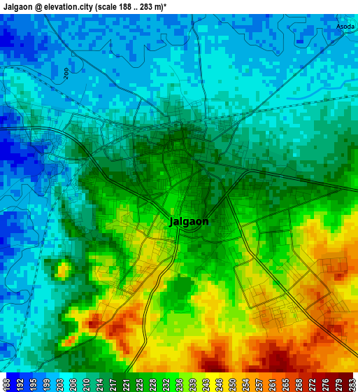
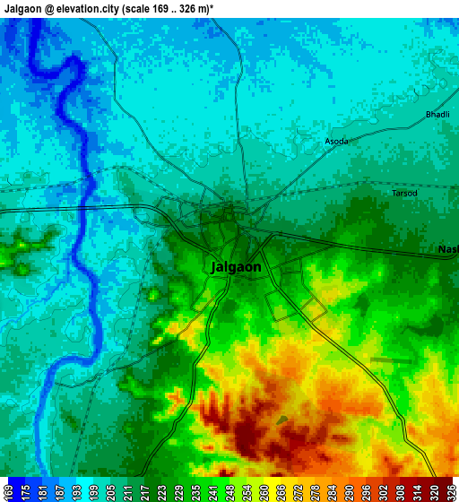
Below is the Elevation map of Jalgaon, which displays elevation range with different colors. Scale of the first map is from 188 to 283 m (617 to 928 ft) with average elevation of 220.1 meters (=722 ft) [note 1]
These maps also provides idea of topography and contour of this city, they are displayed at different zoom levels. More info about maps, scale and edge coordinates you can find below images.
| \ | Map #1 | Map #2 | Topo.Map |
| Scale [m] | 188..283 m | 169..326 m | × |
| Scale [ft] | 617..928 ft | 554..1070 ft | × |
| Average | 220.1 m = 722 ft | 218.5 m = 717 ft | × |
| Width | 9.12 km = 5.7 mi | 18.25 km = 11.3 mi | 291.9 km = 181.4 mi |
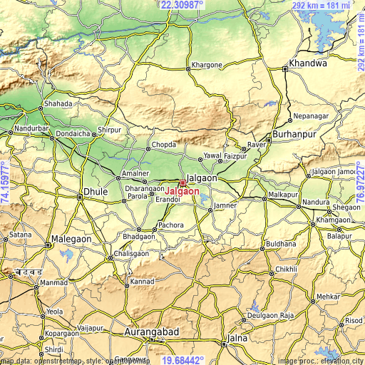
| Height | 9.12 km = 5.7 mi | 18.25 km = 11.3 mi | 291.9 km = 181.4 mi |
| ↑Max Latitude | 21.04394° | 21.084949° | 22.30987° |
| Latitude at center | 21.00292° | 21.00292° | 21.00292° |
| ↓Min Latitude | 20.961889° | 20.920846° | 19.68442° |
| ← Min Longitude | 75.522075° | 75.478129° | 74.15977° |
| Longitude center | 75.56602° | 75.56602° | 75.56602° |
| →Max Longitude | 75.609965° | 75.653911° | 76.97227° |
Nearby cities:
Cities around Jalgaon sort by population:
• Bhusāval elevation 206 m
23.2 km,  78°
78°
• Amalner 189 m
52.8 km,  274°
274°
• Chopda 195 m
38.6 km,  314°
314°
• Pāchora 262 m
43.4 km,  210°
210°
• Varangaon 223 m
35.8 km,  87°
87°
• Parola 256 m
48.3 km,  253°
253°
• Dharangaon 218 m
30.3 km, 271°
• Yāval 215 m
22.9 km,  36°
36°
• Erandol 226 m
26.5 km, 250°
• Faizpur 227 m
35.6 km,  59°
59°
• Soygaon 377 m
45.6 km,  173°
173°
• Sāvda 224 m
37.3 km, 63°
Multilingual:
 En español:
Jalgaon elevación 227 m.
 En France:
Jalgaon élévation 227 m.
 Auf Deutsch:
Jalgaon höhe über dem Meeresspiegel ist 227 m.
 На русском:
Джалгаоне, Джалгаон высота над уровнем моря 227 м
Sources and notes:
- [note 1] Map square and city borders are not equal. Map elevation data is calculated only from area inside that square.
- [src 1] Elevation data from geonames database provided with same terms of usage.
- [src 2] The elevation map of Jalgaon is generated using elevation data from NASA's 3 arcsec (90m) resolution SRTM data.
- [src 3] Base (background) map © OpenStreetMap contributors tiles are generated by Geofabrik and OpenTopoMap.
Copyright & License:
This Jalgaon Elevation Map is licensed under CC BY-SA. You may reuse any part from this page, if you give a proper credit by linking to this URL:
 More info on terms of use page.