Jasdan elevation
Jasdan (Gujarat, Rājkot), India elevation is 204 meters and Jasdan elevation in feet is 669 ft above sea level [src 1]. Jasdan is a populated place (feature code) with elevation that is 89 meters (292 ft) smaller than average city elevation in India.
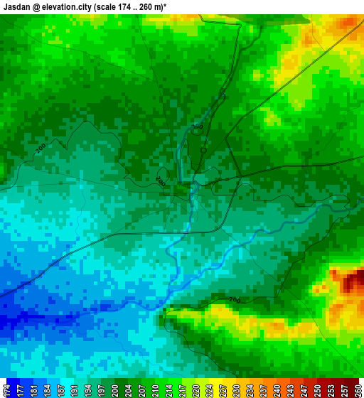
Below is the Elevation map of Jasdan, which displays elevation range with different colors. Scale of the first map is from 174 to 260 m (571 to 853 ft) with average elevation of 202.3 meters (=664 ft) [note 1]
These maps also provides idea of topography and contour of this city, they are displayed at different zoom levels. More info about maps, scale and edge coordinates you can find below images.
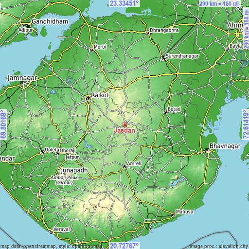
| \ | Map #1 | Map #2 | Topo.Map |
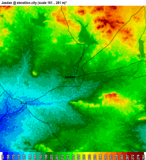
| Scale [m] | 174..260 m | 161..281 m | × |
| Scale [ft] | 571..853 ft | 528..922 ft | × |
| Average | 202.3 m = 664 ft | 208.9 m = 685 ft | × |
| Width | 9.06 km = 5.6 mi | 18.12 km = 11.3 mi | 289.9 km = 180.1 mi |
| Height | 9.06 km = 5.6 mi | 18.12 km = 11.3 mi | 289.9 km = 180.1 mi |
| ↑Max Latitude | 22.077819° | 22.118536° | 23.33451° |
| Latitude at center | 22.03709° | 22.03709° | 22.03709° |
| ↓Min Latitude | 21.996349° | 21.955597° | 20.72767° |
| ← Min Longitude | 71.163995° | 71.120049° | 69.80169° |
| Longitude center | 71.20794° | 71.20794° | 71.20794° |
| →Max Longitude | 71.251885° | 71.295831° | 72.61419° |
Nearby cities:
Cities around Jasdan sort by population:
• Rājkot elevation 140 m
51.2 km,  303°
303°
• Botād 89 m
49.5 km,  72°
72°
• Gondal 139 m
42.6 km,  258°
258°
• Amreli 123 m
48.6 km,  179°
179°
• Gadhada 89 m
38.9 km,  101°
101°
• Lāthi 130 m
39.6 km,  151°
151°
• Bābra 161 m
23.5 km, 154°
• Dāmnagar 94 m
49.9 km,  140°
140°
• Chotila 210 m
43 km,  358°
358°
• Shāhpur 182 m
47 km,  286°
286°
• Vinchia 175 m
26.1 km,  42°
42°
• Pāliyād 115 m
43.8 km,  55°
55°
Multilingual:
 En español:
Jasdan elevación 204 m.
 En France:
Jasdan élévation 204 m.


Sources and notes:
- [note 1] Map square and city borders are not equal. Map elevation data is calculated only from area inside that square.
- [src 1] Elevation data from geonames database provided with same terms of usage.
- [src 2] The elevation map of Jasdan is generated using elevation data from NASA's 3 arcsec (90m) resolution SRTM data.
- [src 3] Base (background) map © OpenStreetMap contributors tiles are generated by Geofabrik and OpenTopoMap.
Copyright & License:
This Jasdan Elevation Map is licensed under CC BY-SA. You may reuse any part from this page, if you give a proper credit by linking to this URL:
 More info on terms of use page.