Lāthi elevation
Lāthi (Gujarat, Amreli), India elevation is 130 meters and Lāthi elevation in feet is 427 ft above sea level [src 1]. Lāthi is a populated place (feature code) with elevation that is 163 meters (535 ft) smaller than average city elevation in India.
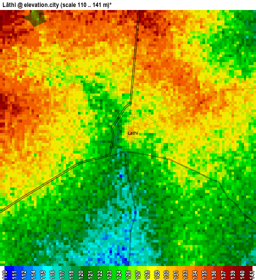
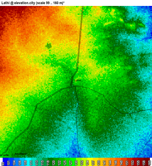
Below is the Elevation map of Lāthi, which displays elevation range with different colors. Scale of the first map is from 110 to 141 m (361 to 463 ft) with average elevation of 126.5 meters (=415 ft) [note 1]
These maps also provides idea of topography and contour of this city, they are displayed at different zoom levels. More info about maps, scale and edge coordinates you can find below images.
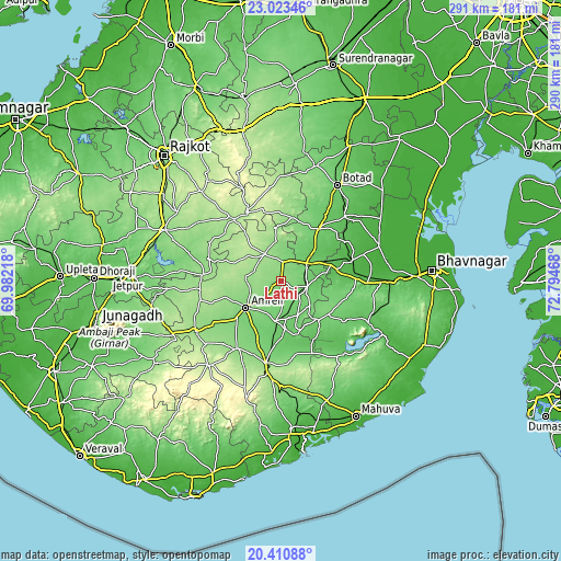
| \ | Map #1 | Map #2 | Topo.Map |
| Scale [m] | 110..141 m | 99..160 m | × |
| Scale [ft] | 361..463 ft | 325..525 ft | × |
| Average | 126.5 m = 415 ft | 125.7 m = 412 ft | × |
| Width | 9.08 km = 5.6 mi | 18.16 km = 11.3 mi | 290.5 km = 180.5 mi |
| Height | 9.08 km = 5.6 mi | 18.16 km = 11.3 mi | 290.5 km = 180.5 mi |
| ↑Max Latitude | 21.763919° | 21.804726° | 23.02346° |
| Latitude at center | 21.7231° | 21.7231° | 21.7231° |
| ↓Min Latitude | 21.68227° | 21.641428° | 20.41088° |
| ← Min Longitude | 71.344485° | 71.300539° | 69.98218° |
| Longitude center | 71.38843° | 71.38843° | 71.38843° |
| →Max Longitude | 71.432375° | 71.476321° | 72.79468° |
Nearby cities:
Cities around Lāthi sort by population:
• Amreli elevation 123 m
22.8 km,  233°
233°
• Kundla 134 m
43.2 km,  191°
191°
• Savarkundla 145 m
43.8 km, 191°
• Pālitāna 67 m
50 km,  116°
116°
• Jasdan 204 m
39.6 km,  331°
331°
• Gariadhar 98 m
28.3 km,  136°
136°
• Gadhada 89 m
33.7 km,  35°
35°
• Bābra 161 m
16.1 km, 327°
• Dāmnagar 94 m
13.8 km,  104°
104°
• Chalāla 139 m
41.6 km,  213°
213°
• Umrāla 27 m
44.9 km,  72°
72°
• Dhola 35 m
43.4 km, 66°
Multilingual:
 En español:
Lāthi elevación 130 m.
 En France:
Lāthi élévation 130 m.


Sources and notes:
- [note 1] Map square and city borders are not equal. Map elevation data is calculated only from area inside that square.
- [src 1] Elevation data from geonames database provided with same terms of usage.
- [src 2] The elevation map of Lāthi is generated using elevation data from NASA's 3 arcsec (90m) resolution SRTM data.
- [src 3] Base (background) map © OpenStreetMap contributors tiles are generated by Geofabrik and OpenTopoMap.
Copyright & License:
This Lāthi Elevation Map is licensed under CC BY-SA. You may reuse any part from this page, if you give a proper credit by linking to this URL:
 More info on terms of use page.