Kālādhūngi elevation
Kālādhūngi (Uttarakhand, Naini Tāl), India elevation is 408 meters and Kālādhūngi elevation in feet is 1339 ft above sea level [src 1]. Kālādhūngi is a populated place (feature code) with elevation that is 115 meters (377 ft) bigger than average city elevation in India.
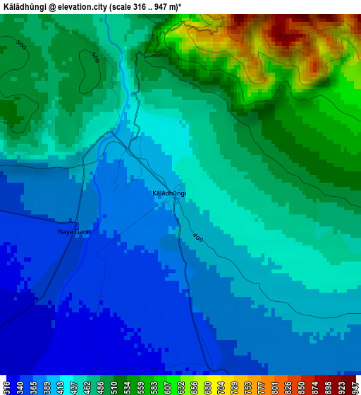
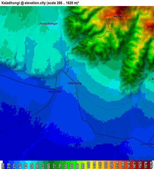
Below is the Elevation map of Kālādhūngi, which displays elevation range with different colors. Scale of the first map is from 316 to 947 m (1037 to 3107 ft) with average elevation of 449.8 meters (=1476 ft) [note 1]
These maps also provides idea of topography and contour of this city, they are displayed at different zoom levels. More info about maps, scale and edge coordinates you can find below images.
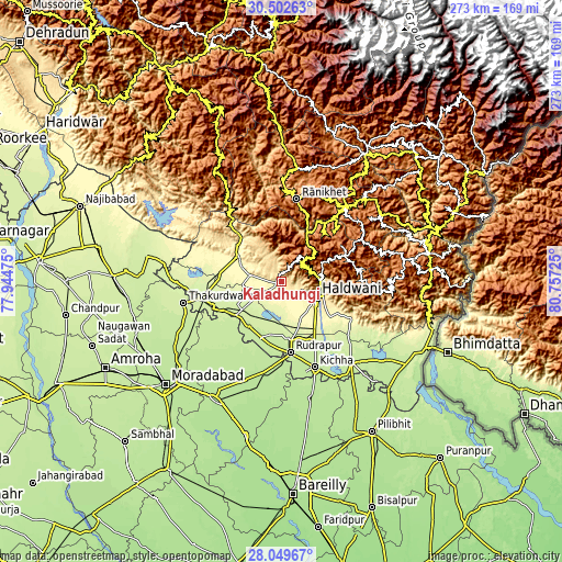
| \ | Map #1 | Map #2 | Topo.Map |
| Scale [m] | 316..947 m | 266..1628 m | × |
| Scale [ft] | 1037..3107 ft | 873..5341 ft | × |
| Average | 449.8 m = 1476 ft | 512.3 m = 1681 ft | × |
| Width | 8.52 km = 5.3 mi | 17.05 km = 10.6 mi | 272.7 km = 169.4 mi |
| Height | 8.52 km = 5.3 mi | 17.05 km = 10.6 mi | 272.8 km = 169.5 mi |
| ↑Max Latitude | 29.321832° | 29.36014° | 30.50263° |
| Latitude at center | 29.28351° | 29.28351° | 29.28351° |
| ↓Min Latitude | 29.245173° | 29.206822° | 28.04967° |
| ← Min Longitude | 79.307055° | 79.263109° | 77.94475° |
| Longitude center | 79.351° | 79.351° | 79.351° |
| →Max Longitude | 79.394945° | 79.438891° | 80.75725° |
Nearby cities:
Cities around Kālādhūngi sort by population:
• Haldwani elevation 447 m
18.5 km,  111°
111°
• Kashipur 239 m
39 km,  258°
258°
• Rāmnagar 364 m
24.8 km,  299°
299°
• Naini Tāl 2077 m
15.7 km,  36°
36°
• Bīlāspur 199 m
44.8 km,  190°
190°
• Kichha 208 m
44.5 km,  158°
158°
• Almora 1600 m
45.9 km, 40°
• Suār 211 m
40.3 km,  225°
225°
• Bāzpur 227 m
27.7 km,  238°
238°
• Rānikhet 1804 m
40.5 km,  11°
11°
• Bhīm Tāl 1343 m
21.7 km,  71°
71°
• Bhowali 1791 m
19 km,  51°
51°
Multilingual:
 En español:
Kālādhūngi elevación 408 m.
 En France:
Kālādhūngi élévation 408 m.
 Auf Deutsch:
Kālādhūngi höhe über dem Meeresspiegel ist 408 m.

Sources and notes:
- [note 1] Map square and city borders are not equal. Map elevation data is calculated only from area inside that square.
- [src 1] Elevation data from geonames database provided with same terms of usage.
- [src 2] The elevation map of Kālādhūngi is generated using elevation data from NASA's 3 arcsec (90m) resolution SRTM data.
- [src 3] Base (background) map © OpenStreetMap contributors tiles are generated by Geofabrik and OpenTopoMap.
Copyright & License:
This Kālādhūngi Elevation Map is licensed under CC BY-SA. You may reuse any part from this page, if you give a proper credit by linking to this URL:
 More info on terms of use page.