Kashipur elevation
Kashipur (Uttarakhand, Udham Singh Nagar), India elevation is 239 meters and Kashipur elevation in feet is 784 ft above sea level [src 1]. Kashipur is a populated place (feature code) with elevation that is 54 meters (177 ft) smaller than average city elevation in India.
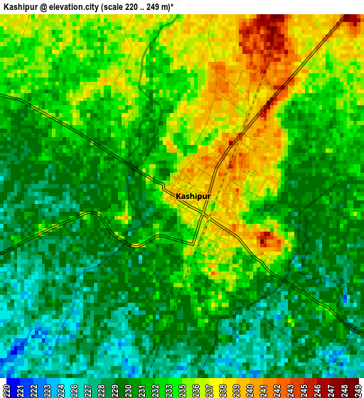
Below is the Elevation map of Kashipur, which displays elevation range with different colors. Scale of the first map is from 220 to 249 m (722 to 817 ft) with average elevation of 232.3 meters (=762 ft) [note 1]
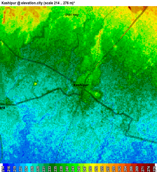
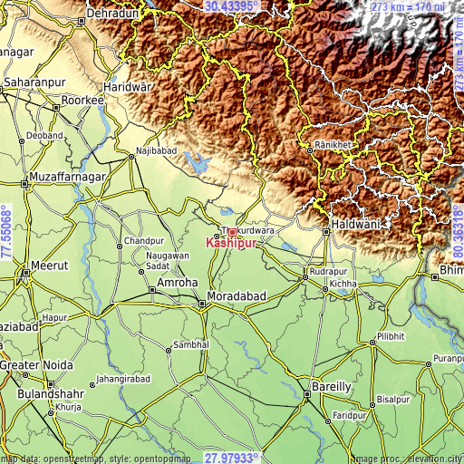
These maps also provides idea of topography and contour of this city, they are displayed at different zoom levels. More info about maps, scale and edge coordinates you can find below images.
| \ | Map #1 | Map #2 | Topo.Map |
| Scale [m] | 220..249 m | 214..276 m | × |
| Scale [ft] | 722..817 ft | 702..906 ft | × |
| Average | 232.3 m = 762 ft | 233.1 m = 765 ft | × |
| Width | 8.53 km = 5.3 mi | 17.06 km = 10.6 mi | 272.9 km = 169.6 mi |
| Height | 8.53 km = 5.3 mi | 17.06 km = 10.6 mi | 272.9 km = 169.6 mi |
| ↑Max Latitude | 29.252338° | 29.290672° | 30.43395° |
| Latitude at center | 29.21399° | 29.21399° | 29.21399° |
| ↓Min Latitude | 29.175627° | 29.13725° | 27.97933° |
| ← Min Longitude | 78.912985° | 78.869039° | 77.55068° |
| Longitude center | 78.95693° | 78.95693° | 78.95693° |
| →Max Longitude | 79.000875° | 79.044821° | 80.36318° |
Nearby cities:
Cities around Kashipur sort by population:
• Rāmnagar elevation 364 m
25.9 km,  39°
39°
• Seohāra 232 m
35.8 km,  269°
269°
• Tānda 208 m
26.5 km,  183°
183°
• Jaspur 245 m
14.5 km,  300°
300°
• Thakurdwara 229 m
9.6 km,  255°
255°
• Suār 211 m
22.8 km,  154°
154°
• Afzalgarh 234 m
33.9 km,  306°
306°
• Kānth 219 m
36.1 km,  241°
241°
• Sahaspur 224 m
34 km,  252°
252°
• Bāzpur 227 m
16.2 km,  114°
114°
• Kālāgarh Project Colony 289 m
33.8 km,  330°
330°
• Kālādhūngi 408 m
39 km,  78°
78°
Multilingual:
 En español:
Kashipur elevación 239 m.
 En France:
Kashipur élévation 239 m.
 Auf Deutsch:
Kashipur höhe über dem Meeresspiegel ist 239 m.

Sources and notes:
- [note 1] Map square and city borders are not equal. Map elevation data is calculated only from area inside that square.
- [src 1] Elevation data from geonames database provided with same terms of usage.
- [src 2] The elevation map of Kashipur is generated using elevation data from NASA's 3 arcsec (90m) resolution SRTM data.
- [src 3] Base (background) map © OpenStreetMap contributors tiles are generated by Geofabrik and OpenTopoMap.
Copyright & License:
This Kashipur Elevation Map is licensed under CC BY-SA. You may reuse any part from this page, if you give a proper credit by linking to this URL:
 More info on terms of use page.