Kānker elevation
Kānker (Chhattisgarh, Uttar Bastar Kanker), India elevation is 401 meters and Kānker elevation in feet is 1316 ft above sea level [src 1]. Kānker is a populated place (feature code) with elevation that is 108 meters (354 ft) bigger than average city elevation in India.
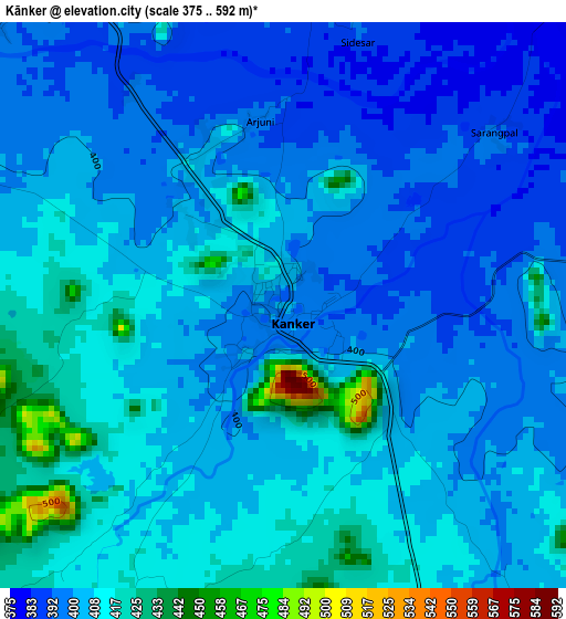
Below is the Elevation map of Kānker, which displays elevation range with different colors. Scale of the first map is from 375 to 592 m (1230 to 1942 ft) with average elevation of 405.2 meters (=1329 ft) [note 1]
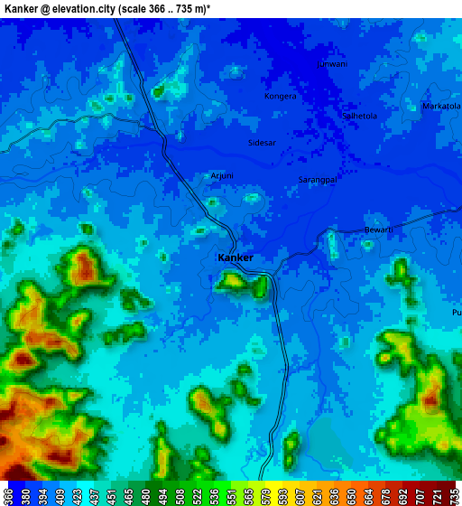
These maps also provides idea of topography and contour of this city, they are displayed at different zoom levels. More info about maps, scale and edge coordinates you can find below images.
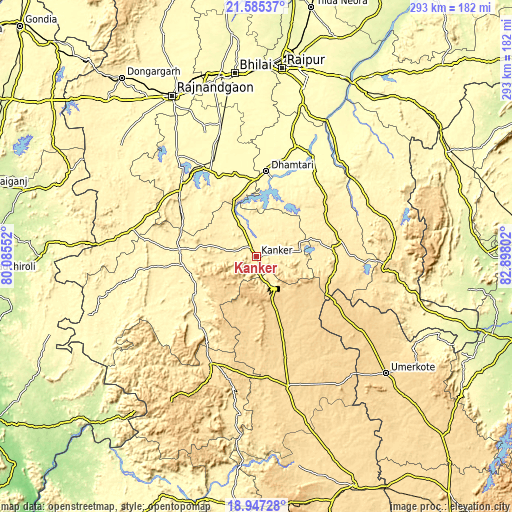
| \ | Map #1 | Map #2 | Topo.Map |
| Scale [m] | 375..592 m | 366..735 m | × |
| Scale [ft] | 1230..1942 ft | 1201..2411 ft | × |
| Average | 405.2 m = 1329 ft | 427.9 m = 1404 ft | × |
| Width | 9.17 km = 5.7 mi | 18.33 km = 11.4 mi | 293.3 km = 182.2 mi |
| Height | 9.17 km = 5.7 mi | 18.33 km = 11.4 mi | 293.3 km = 182.2 mi |
| ↑Max Latitude | 20.313148° | 20.354355° | 21.58537° |
| Latitude at center | 20.27193° | 20.27193° | 20.27193° |
| ↓Min Latitude | 20.230701° | 20.189462° | 18.94728° |
| ← Min Longitude | 81.447825° | 81.403879° | 80.08552° |
| Longitude center | 81.49177° | 81.49177° | 81.49177° |
| →Max Longitude | 81.535715° | 81.579661° | 82.89802° |
Nearby cities:
Cities around Kānker sort by population:
• Rāj-Nāndgaon elevation 306 m
103.6 km,  332°
332°
• Dhamtari 325 m
48.8 km,  6°
6°
• Kondagaon 597 m
77.8 km,  166°
166°
• Umarkot 615 m
100.6 km,  132°
132°
• Balod 329 m
59.1 km, 329°
• Dongargaon 318 m
102.5 km,  319°
319°
• Kurud 311 m
66.6 km,  21°
21°
• Gariāband 348 m
71.7 km,  55°
55°
• Pātan 300 m
84.8 km,  2°
2°
• Ambāgarh Chauki 335 m
95.8 km,  305°
305°
• Bhatgaon 294 m
100 km, 12°
• Narharpur 402 m
23.8 km,  34°
34°
Multilingual:
 En español:
Kānker elevación 401 m.
 En France:
Kānker élévation 401 m.


Sources and notes:
- [note 1] Map square and city borders are not equal. Map elevation data is calculated only from area inside that square.
- [src 1] Elevation data from geonames database provided with same terms of usage.
- [src 2] The elevation map of Kānker is generated using elevation data from NASA's 3 arcsec (90m) resolution SRTM data.
- [src 3] Base (background) map © OpenStreetMap contributors tiles are generated by Geofabrik and OpenTopoMap.
Copyright & License:
This Kānker Elevation Map is licensed under CC BY-SA. You may reuse any part from this page, if you give a proper credit by linking to this URL:
 More info on terms of use page.