Kenda elevation
Kenda (West Bengal, Puruliya), India elevation is 242 meters and Kenda elevation in feet is 794 ft above sea level [src 1]. Kenda is a populated place (feature code) with elevation that is 51 meters (167 ft) smaller than average city elevation in India.
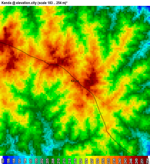
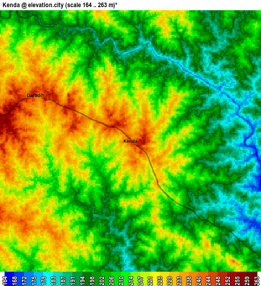
Below is the Elevation map of Kenda, which displays elevation range with different colors. Scale of the first map is from 183 to 254 m (600 to 833 ft) with average elevation of 220.2 meters (=722 ft) [note 1]
These maps also provides idea of topography and contour of this city, they are displayed at different zoom levels. More info about maps, scale and edge coordinates you can find below images.
| \ | Map #1 | Map #2 | Topo.Map |
| Scale [m] | 183..254 m | 164..263 m | × |
| Scale [ft] | 600..833 ft | 538..863 ft | × |
| Average | 220.2 m = 722 ft | 210.9 m = 692 ft | × |
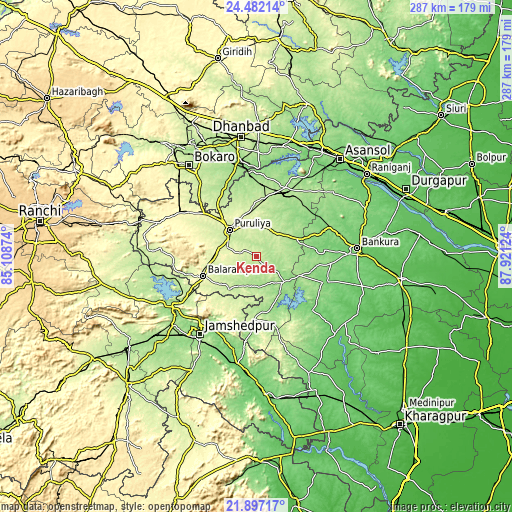
| Width | 8.98 km = 5.6 mi | 17.97 km = 11.2 mi | 287.4 km = 178.6 mi |
| Height | 8.98 km = 5.6 mi | 17.97 km = 11.2 mi | 287.4 km = 178.6 mi |
| ↑Max Latitude | 23.236287° | 23.276661° | 24.48214° |
| Latitude at center | 23.1959° | 23.1959° | 23.1959° |
| ↓Min Latitude | 23.155501° | 23.11509° | 21.89717° |
| ← Min Longitude | 86.471045° | 86.427099° | 85.10874° |
| Longitude center | 86.51499° | 86.51499° | 86.51499° |
| →Max Longitude | 86.558935° | 86.602881° | 87.92124° |
Nearby cities:
Cities around Kenda sort by population:
• Jamshedpur elevation 171 m
55.2 km,  217°
217°
• Bānkura 94 m
57 km,  85°
85°
• Puruliya 255 m
21.6 km,  313°
313°
• Jugsālai 157 m
57.7 km, 216°
• Pāthardih 162 m
52.9 km,  350°
350°
• Lakhyabad 142 m
54.6 km,  16°
16°
• Balarāmpur 281 m
31.8 km,  249°
249°
• Raghunathpur 176 m
41.4 km, 22°
• Adra 191 m
37.6 km,  27°
27°
• Khātra 148 m
42.5 km,  125°
125°
• Bhojudih 158 m
49.9 km, 351°
• Chāndil 182 m
54.2 km,  240°
240°
Multilingual:
 En español:
Kenda elevación 242 m.
 En France:
Kenda élévation 242 m.


Sources and notes:
- [note 1] Map square and city borders are not equal. Map elevation data is calculated only from area inside that square.
- [src 1] Elevation data from geonames database provided with same terms of usage.
- [src 2] The elevation map of Kenda is generated using elevation data from NASA's 3 arcsec (90m) resolution SRTM data.
- [src 3] Base (background) map © OpenStreetMap contributors tiles are generated by Geofabrik and OpenTopoMap.
Copyright & License:
This Kenda Elevation Map is licensed under CC BY-SA. You may reuse any part from this page, if you give a proper credit by linking to this URL:
 More info on terms of use page.