Khātra elevation
Khātra (West Bengal, Bānkurā), India elevation is 148 meters and Khātra elevation in feet is 486 ft above sea level [src 1]. Khātra is a populated place (feature code) with elevation that is 145 meters (476 ft) smaller than average city elevation in India.
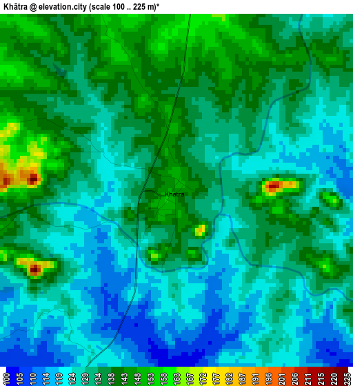
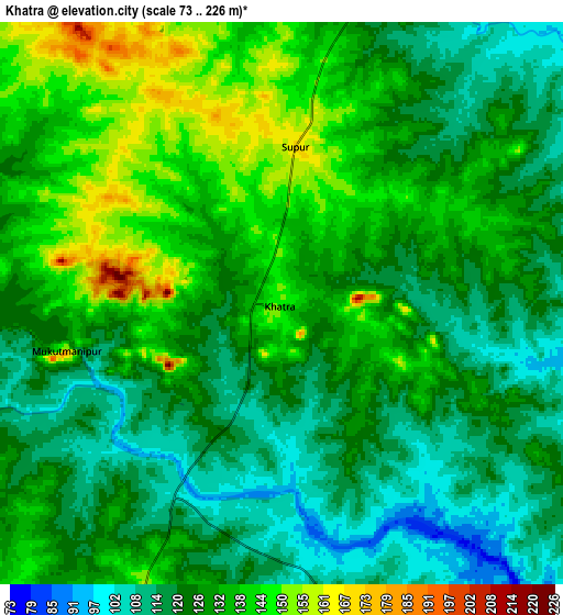
Below is the Elevation map of Khātra, which displays elevation range with different colors. Scale of the first map is from 100 to 225 m (328 to 738 ft) with average elevation of 132.4 meters (=434 ft) [note 1]
These maps also provides idea of topography and contour of this city, they are displayed at different zoom levels. More info about maps, scale and edge coordinates you can find below images.
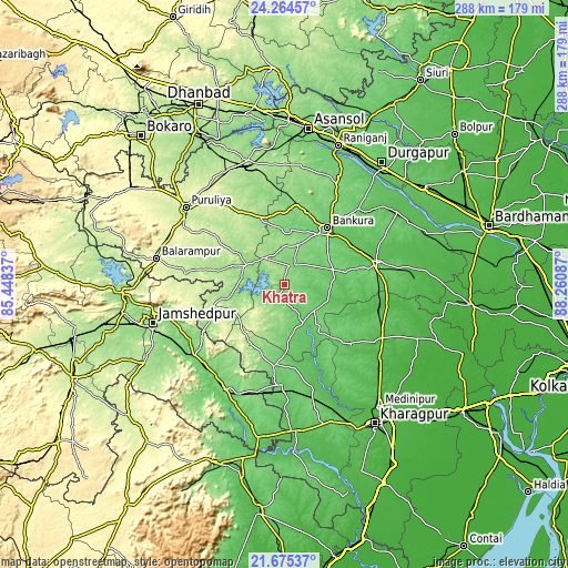
| \ | Map #1 | Map #2 | Topo.Map |
| Scale [m] | 100..225 m | 73..226 m | × |
| Scale [ft] | 328..738 ft | 240..741 ft | × |
| Average | 132.4 m = 434 ft | 128.2 m = 421 ft | × |
| Width | 9 km = 5.6 mi | 17.99 km = 11.2 mi | 287.9 km = 178.9 mi |
| Height | 9 km = 5.6 mi | 17.99 km = 11.2 mi | 287.9 km = 178.9 mi |
| ↑Max Latitude | 23.016623° | 23.057064° | 24.26457° |
| Latitude at center | 22.97617° | 22.97617° | 22.97617° |
| ↓Min Latitude | 22.935705° | 22.895228° | 21.67537° |
| ← Min Longitude | 86.810675° | 86.766729° | 85.44837° |
| Longitude center | 86.85462° | 86.85462° | 86.85462° |
| →Max Longitude | 86.898565° | 86.942511° | 88.26087° |
Nearby cities:
Cities around Khātra sort by population:
• Bānkura elevation 94 m
36.1 km,  37°
37°
• Puruliya 255 m
63.9 km,  308°
308°
• Bishnupur 73 m
48.8 km,  77°
77°
• Jhārgrām 81 m
59.8 km,  166°
166°
• Ghātsīla 103 m
58.2 km,  221°
221°
• Mushābani 122 m
65.8 km, 218°
• Raghunathpur 176 m
65.2 km,  343°
343°
• Adra 191 m
60.5 km, 343°
• Āmlāgora 57 m
51.3 km,  106°
106°
• Kenda 242 m
42.5 km, 305°
• Chākuliā 122 m
56.6 km,  194°
194°
• Beliātor 87 m
53.6 km, 44°
Multilingual:
 En español:
Khātra elevación 148 m.
 En France:
Khātra élévation 148 m.


Sources and notes:
- [note 1] Map square and city borders are not equal. Map elevation data is calculated only from area inside that square.
- [src 1] Elevation data from geonames database provided with same terms of usage.
- [src 2] The elevation map of Khātra is generated using elevation data from NASA's 3 arcsec (90m) resolution SRTM data.
- [src 3] Base (background) map © OpenStreetMap contributors tiles are generated by Geofabrik and OpenTopoMap.
Copyright & License:
This Khātra Elevation Map is licensed under CC BY-SA. You may reuse any part from this page, if you give a proper credit by linking to this URL:
 More info on terms of use page.