Adra elevation
Adra (West Bengal, Puruliya), India elevation is 191 meters and Adra elevation in feet is 627 ft above sea level [src 1]. Adra is a populated place (feature code) with elevation that is 102 meters (335 ft) smaller than average city elevation in India.
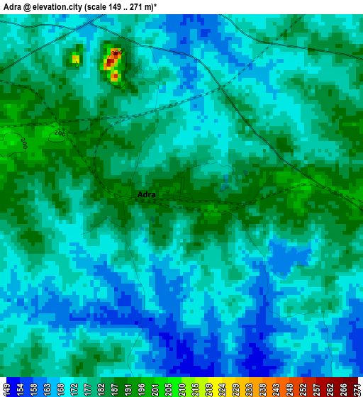
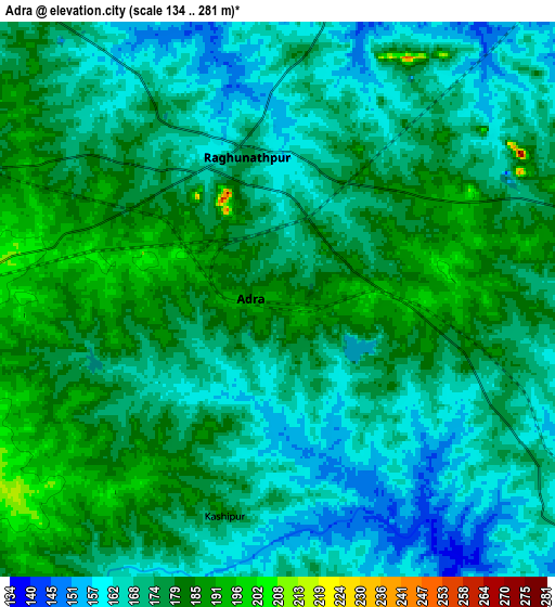
Below is the Elevation map of Adra, which displays elevation range with different colors. Scale of the first map is from 149 to 271 m (489 to 889 ft) with average elevation of 175.9 meters (=577 ft) [note 1]
These maps also provides idea of topography and contour of this city, they are displayed at different zoom levels. More info about maps, scale and edge coordinates you can find below images.
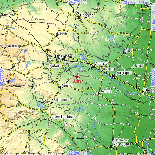
| \ | Map #1 | Map #2 | Topo.Map |
| Scale [m] | 149..271 m | 134..281 m | × |
| Scale [ft] | 489..889 ft | 440..922 ft | × |
| Average | 175.9 m = 577 ft | 173.3 m = 569 ft | × |
| Width | 8.96 km = 5.6 mi | 17.92 km = 11.1 mi | 286.8 km = 178.2 mi |
| Height | 8.96 km = 5.6 mi | 17.92 km = 11.1 mi | 286.8 km = 178.2 mi |
| ↑Max Latitude | 23.536975° | 23.577258° | 24.77993° |
| Latitude at center | 23.49668° | 23.49668° | 23.49668° |
| ↓Min Latitude | 23.456372° | 23.416052° | 22.20081° |
| ← Min Longitude | 86.639685° | 86.595739° | 85.27738° |
| Longitude center | 86.68363° | 86.68363° | 86.68363° |
| →Max Longitude | 86.727575° | 86.771521° | 88.08988° |
Nearby cities:
Cities around Adra sort by population:
• Āsansol elevation 119 m
36.9 km,  55°
55°
• Kulti 156 m
30.8 km,  31°
31°
• Puruliya 255 m
37.6 km,  240°
240°
• Jharia 204 m
38.6 km,  314°
314°
• Pāthardih 162 m
31.8 km, 306°
• Jāmadoba 179 m
37.9 km, 310°
• Lakhyabad 142 m
19 km,  354°
354°
• Raghunathpur 176 m
4.8 km, 347°
• Kenda 242 m
37.6 km,  207°
207°
• Nirsā 142 m
32.1 km,  4°
4°
• Bhojudih 158 m
29.4 km,  302°
302°
• Mugma 145 m
30.7 km,  8°
8°
Multilingual:
 En español:
Adra elevación 191 m.
 En France:
Adra élévation 191 m.


Sources and notes:
- [note 1] Map square and city borders are not equal. Map elevation data is calculated only from area inside that square.
- [src 1] Elevation data from geonames database provided with same terms of usage.
- [src 2] The elevation map of Adra is generated using elevation data from NASA's 3 arcsec (90m) resolution SRTM data.
- [src 3] Base (background) map © OpenStreetMap contributors tiles are generated by Geofabrik and OpenTopoMap.
Copyright & License:
This Adra Elevation Map is licensed under CC BY-SA. You may reuse any part from this page, if you give a proper credit by linking to this URL:
 More info on terms of use page.