Khamānon Kalān elevation
Khamānon Kalān (Punjab, Fatehgarh Sahib), India elevation is 275 meters and Khamānon Kalān elevation in feet is 902 ft above sea level [src 1]. Khamānon Kalān is a populated place (feature code) with elevation that is 18 meters (59 ft) smaller than average city elevation in India.
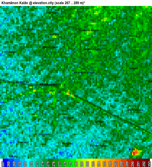
Below is the Elevation map of Khamānon Kalān, which displays elevation range with different colors. Scale of the first map is from 267 to 289 m (876 to 948 ft) with average elevation of 274 meters (=899 ft) [note 1]
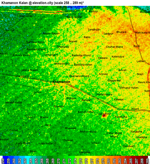
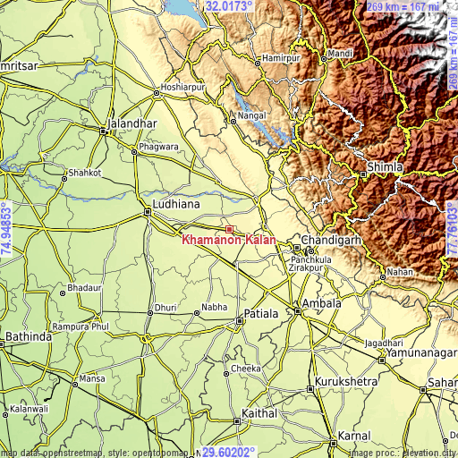
These maps also provides idea of topography and contour of this city, they are displayed at different zoom levels. More info about maps, scale and edge coordinates you can find below images.
| \ | Map #1 | Map #2 | Topo.Map |
| Scale [m] | 267..289 m | 258..289 m | × |
| Scale [ft] | 876..948 ft | 846..948 ft | × |
| Average | 274 m = 899 ft | 273.2 m = 896 ft | × |
| Width | 8.39 km = 5.2 mi | 16.79 km = 10.4 mi | 268.6 km = 166.9 mi |
| Height | 8.39 km = 5.2 mi | 16.79 km = 10.4 mi | 268.6 km = 166.9 mi |
| ↑Max Latitude | 30.854983° | 30.892701° | 32.0173° |
| Latitude at center | 30.81725° | 30.81725° | 30.81725° |
| ↓Min Latitude | 30.779502° | 30.741739° | 29.60202° |
| ← Min Longitude | 76.310835° | 76.266889° | 74.94853° |
| Longitude center | 76.35478° | 76.35478° | 76.35478° |
| →Max Longitude | 76.398725° | 76.442671° | 77.76103° |
Nearby cities:
Cities around Khamānon Kalān sort by population:
• Khanna elevation 269 m
17.8 km,  225°
225°
• Sirhind 270 m
19.6 km,  171°
171°
• Ropar 287 m
23.5 km,  44°
44°
• Kharar 313 m
29 km,  105°
105°
• Dorāha 262 m
31.7 km,  266°
266°
• Morinda 284 m
14.1 km,  102°
102°
• Māchhīwāra 261 m
18.4 km,  306°
306°
• Bālāchor 277 m
27.5 km,  349°
349°
• Samrāla 271 m
15.6 km,  277°
277°
• Basi 275 m
15 km,  162°
162°
• Amloh 267 m
26 km,  206°
206°
• Chīma 264 m
29.5 km,  240°
240°
Multilingual:
 En español:
Khamānon Kalān elevación 275 m.
 En France:
Khamānon Kalān élévation 275 m.
 Auf Deutsch:
Khamānon Kalān höhe über dem Meeresspiegel ist 275 m.

Sources and notes:
- [note 1] Map square and city borders are not equal. Map elevation data is calculated only from area inside that square.
- [src 1] Elevation data from geonames database provided with same terms of usage.
- [src 2] The elevation map of Khamānon Kalān is generated using elevation data from NASA's 3 arcsec (90m) resolution SRTM data.
- [src 3] Base (background) map © OpenStreetMap contributors tiles are generated by Geofabrik and OpenTopoMap.
Copyright & License:
This Khamānon Kalān Elevation Map is licensed under CC BY-SA. You may reuse any part from this page, if you give a proper credit by linking to this URL:
 More info on terms of use page.