Khetia elevation
Khetia (Maharashtra), India elevation is 214 meters and Khetia elevation in feet is 702 ft above sea level [src 1]. Khetia is a populated place (feature code) with elevation that is 79 meters (259 ft) smaller than average city elevation in India.
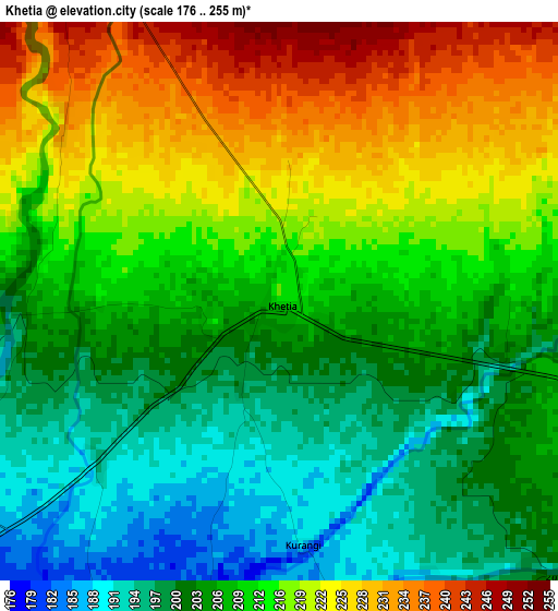
Below is the Elevation map of Khetia, which displays elevation range with different colors. Scale of the first map is from 176 to 255 m (577 to 837 ft) with average elevation of 211.2 meters (=693 ft) [note 1]
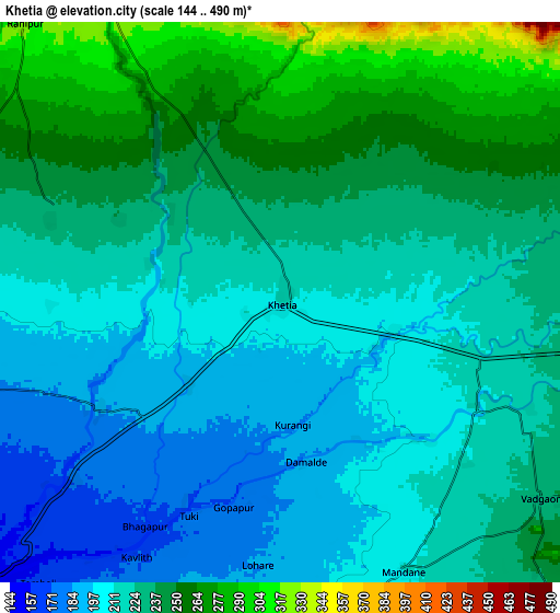
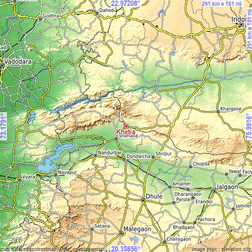
These maps also provides idea of topography and contour of this city, they are displayed at different zoom levels. More info about maps, scale and edge coordinates you can find below images.
| \ | Map #1 | Map #2 | Topo.Map |
| Scale [m] | 176..255 m | 144..490 m | × |
| Scale [ft] | 577..837 ft | 472..1608 ft | × |
| Average | 211.2 m = 693 ft | 226.4 m = 743 ft | × |
| Width | 9.08 km = 5.6 mi | 18.16 km = 11.3 mi | 290.6 km = 180.6 mi |
| Height | 9.08 km = 5.6 mi | 18.16 km = 11.3 mi | 290.6 km = 180.6 mi |
| ↑Max Latitude | 21.712073° | 21.752895° | 22.97208° |
| Latitude at center | 21.67124° | 21.67124° | 21.67124° |
| ↓Min Latitude | 21.630395° | 21.589539° | 20.35856° |
| ← Min Longitude | 74.541405° | 74.497459° | 73.1791° |
| Longitude center | 74.58535° | 74.58535° | 74.58535° |
| →Max Longitude | 74.629295° | 74.673241° | 75.9916° |
Nearby cities:
Cities around Khetia sort by population:
• Nandurbar elevation 216 m
49.2 km,  226°
226°
• Shirpur 157 m
47.1 km,  139°
139°
• Shāhāda 140 m
18.3 km,  220°
220°
• Sendhwa 410 m
52.8 km,  88°
88°
• Barwāni 182 m
51.6 km,  38°
38°
• Dondaicha 163 m
38.7 km,  182°
182°
• Taloda 126 m
40.4 km,  252°
252°
• Kukshi 176 m
62.1 km,  16°
16°
• Anjad 165 m
63.6 km,  49°
49°
• Rajpur 231 m
64.2 km,  62°
62°
• Pānsemāl 243 m
11.9 km,  96°
96°
• Kawānt 200 m
72.4 km,  310°
310°
Multilingual:
 En español:
Khetia elevación 214 m.
 En France:
Khetia élévation 214 m.


Sources and notes:
- [note 1] Map square and city borders are not equal. Map elevation data is calculated only from area inside that square.
- [src 1] Elevation data from geonames database provided with same terms of usage.
- [src 2] The elevation map of Khetia is generated using elevation data from NASA's 3 arcsec (90m) resolution SRTM data.
- [src 3] Base (background) map © OpenStreetMap contributors tiles are generated by Geofabrik and OpenTopoMap.
Copyright & License:
This Khetia Elevation Map is licensed under CC BY-SA. You may reuse any part from this page, if you give a proper credit by linking to this URL:
 More info on terms of use page.