Kuchinda elevation
Kuchinda (Odisha, Sambalpur), India elevation is 243 meters and Kuchinda elevation in feet is 797 ft above sea level [src 1]. Kuchinda is a populated place (feature code) with elevation that is 50 meters (164 ft) smaller than average city elevation in India.
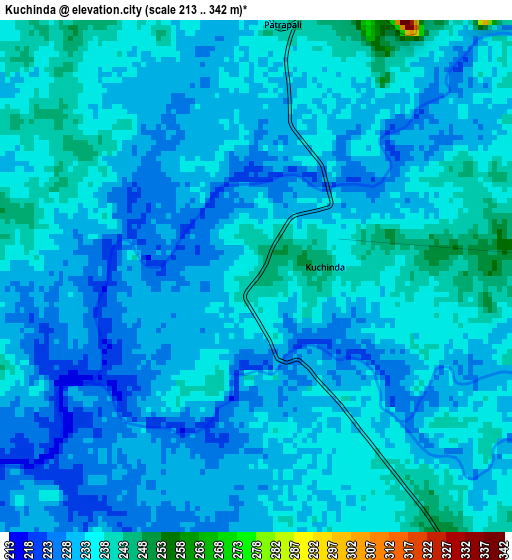
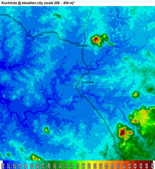
Below is the Elevation map of Kuchinda, which displays elevation range with different colors. Scale of the first map is from 213 to 342 m (699 to 1122 ft) with average elevation of 232.2 meters (=762 ft) [note 1]
These maps also provides idea of topography and contour of this city, they are displayed at different zoom levels. More info about maps, scale and edge coordinates you can find below images.
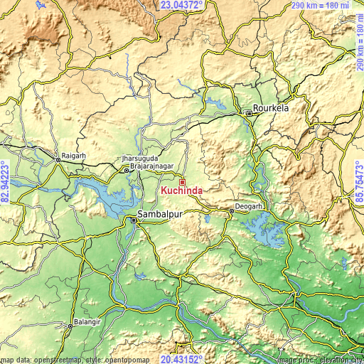
| \ | Map #1 | Map #2 | Topo.Map |
| Scale [m] | 213..342 m | 208..454 m | × |
| Scale [ft] | 699..1122 ft | 682..1490 ft | × |
| Average | 232.2 m = 762 ft | 243.1 m = 798 ft | × |
| Width | 9.08 km = 5.6 mi | 18.15 km = 11.3 mi | 290.4 km = 180.4 mi |
| Height | 9.08 km = 5.6 mi | 18.15 km = 11.3 mi | 290.5 km = 180.5 mi |
| ↑Max Latitude | 21.784373° | 21.825174° | 23.04372° |
| Latitude at center | 21.74356° | 21.74356° | 21.74356° |
| ↓Min Latitude | 21.702736° | 21.6619° | 20.43152° |
| ← Min Longitude | 84.304535° | 84.260589° | 82.94223° |
| Longitude center | 84.34848° | 84.34848° | 84.34848° |
| →Max Longitude | 84.392425° | 84.436371° | 85.75473° |
Nearby cities:
Cities around Kuchinda sort by population:
• Raurkela elevation 195 m
75.4 km,  44°
44°
• Sambalpur 152 m
49.4 km,  231°
231°
• Jharsuguda 219 m
37.4 km,  289°
289°
• Brājarājnagar 219 m
45.3 km,  280°
280°
• Bargarh 179 m
88.2 km,  238°
238°
• Sundargarh 239 m
52.7 km,  321°
321°
• Burla 167 m
55.6 km, 242°
• Birmitrapur 257 m
84.8 km,  30°
30°
• Hīrākud 168 m
54.8 km, 243°
• Deogarh 220 m
45.9 km,  119°
119°
• Bānposh 199 m
73.6 km, 40°
• Rengāli 216 m
32.4 km,  250°
250°
Multilingual:
 En español:
Kuchinda elevación 243 m.
 En France:
Kuchinda élévation 243 m.
 Auf Deutsch:
Kuchinda höhe über dem Meeresspiegel ist 243 m.

Sources and notes:
- [note 1] Map square and city borders are not equal. Map elevation data is calculated only from area inside that square.
- [src 1] Elevation data from geonames database provided with same terms of usage.
- [src 2] The elevation map of Kuchinda is generated using elevation data from NASA's 3 arcsec (90m) resolution SRTM data.
- [src 3] Base (background) map © OpenStreetMap contributors tiles are generated by Geofabrik and OpenTopoMap.
Copyright & License:
This Kuchinda Elevation Map is licensed under CC BY-SA. You may reuse any part from this page, if you give a proper credit by linking to this URL:
 More info on terms of use page.