Madhupur elevation
Madhupur (Jharkhand, Deogarh), India elevation is 250 meters and Madhupur elevation in feet is 820 ft above sea level [src 1]. Madhupur is a populated place (feature code) with elevation that is 43 meters (141 ft) smaller than average city elevation in India.
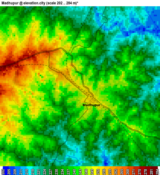
Below is the Elevation map of Madhupur, which displays elevation range with different colors. Scale of the first map is from 202 to 284 m (663 to 932 ft) with average elevation of 236.6 meters (=776 ft) [note 1]
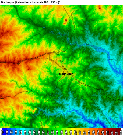
These maps also provides idea of topography and contour of this city, they are displayed at different zoom levels. More info about maps, scale and edge coordinates you can find below images.
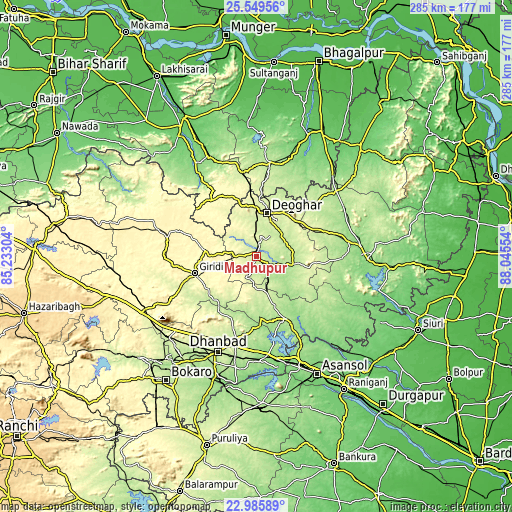
| \ | Map #1 | Map #2 | Topo.Map |
| Scale [m] | 202..284 m | 185..295 m | × |
| Scale [ft] | 663..932 ft | 607..968 ft | × |
| Average | 236.6 m = 776 ft | 234 m = 768 ft | × |
| Width | 8.91 km = 5.5 mi | 17.82 km = 11.1 mi | 285.1 km = 177.2 mi |
| Height | 8.91 km = 5.5 mi | 17.82 km = 11.1 mi | 285.1 km = 177.2 mi |
| ↑Max Latitude | 24.314244° | 24.354285° | 25.54956° |
| Latitude at center | 24.27419° | 24.27419° | 24.27419° |
| ↓Min Latitude | 24.234124° | 24.194045° | 22.98589° |
| ← Min Longitude | 86.595345° | 86.551399° | 85.23304° |
| Longitude center | 86.63929° | 86.63929° | 86.63929° |
| →Max Longitude | 86.683235° | 86.727181° | 88.04554° |
Nearby cities:
Cities around Madhupur sort by population:
• Dhanbād elevation 250 m
56.2 km,  200°
200°
• Gīrīdīh 305 m
34.9 km,  253°
253°
• Dumka 150 m
61.8 km,  90°
90°
• Chittaranjan 157 m
53.6 km,  149°
149°
• Jhā-Jhā 139 m
61.2 km,  334°
334°
• Jāmtāra 199 m
38.4 km, 154°
• Jasidih 272 m
26.6 km,  1°
1°
• Nirsā 142 m
54.9 km,  172°
172°
• Gobindpur 212 m
50.3 km,  194°
194°
• Kenduadīh 210 m
61.5 km,  205°
205°
• Topchānchi 302 m
60.9 km,  227°
227°
• Mugma 145 m
56.8 km, 170°
Multilingual:
 En español:
Madhupur elevación 250 m.
 En France:
Madhupur élévation 250 m.
 Auf Deutsch:
Madhupur höhe über dem Meeresspiegel ist 250 m.

Sources and notes:
- [note 1] Map square and city borders are not equal. Map elevation data is calculated only from area inside that square.
- [src 1] Elevation data from geonames database provided with same terms of usage.
- [src 2] The elevation map of Madhupur is generated using elevation data from NASA's 3 arcsec (90m) resolution SRTM data.
- [src 3] Base (background) map © OpenStreetMap contributors tiles are generated by Geofabrik and OpenTopoMap.
Copyright & License:
This Madhupur Elevation Map is licensed under CC BY-SA. You may reuse any part from this page, if you give a proper credit by linking to this URL:
 More info on terms of use page.