Jāmtāra elevation
Jāmtāra (Jharkhand, Jamtara), India elevation is 199 meters and Jāmtāra elevation in feet is 653 ft above sea level [src 1]. Jāmtāra is a populated place (feature code) with elevation that is 94 meters (308 ft) smaller than average city elevation in India.
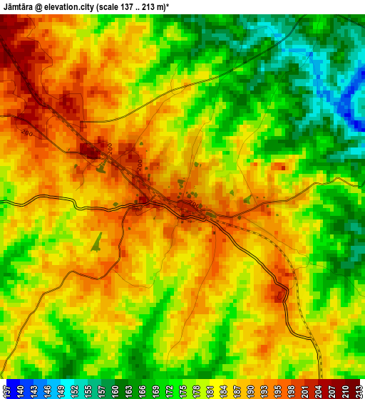
Below is the Elevation map of Jāmtāra, which displays elevation range with different colors. Scale of the first map is from 137 to 213 m (449 to 699 ft) with average elevation of 180.7 meters (=593 ft) [note 1]
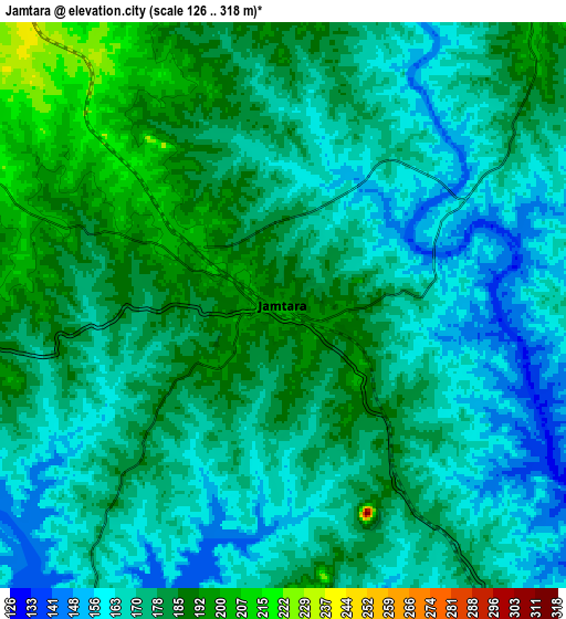
These maps also provides idea of topography and contour of this city, they are displayed at different zoom levels. More info about maps, scale and edge coordinates you can find below images.
| \ | Map #1 | Map #2 | Topo.Map |
| Scale [m] | 137..213 m | 126..318 m | × |
| Scale [ft] | 449..699 ft | 413..1043 ft | × |
| Average | 180.7 m = 593 ft | 175 m = 574 ft | × |
| Width | 8.93 km = 5.5 mi | 17.86 km = 11.1 mi | 285.7 km = 177.5 mi |
| Height | 8.93 km = 5.5 mi | 17.86 km = 11.1 mi | 285.8 km = 177.6 mi |
| ↑Max Latitude | 24.003151° | 24.04329° | 25.24155° |
| Latitude at center | 23.963° | 23.963° | 23.963° |
| ↓Min Latitude | 23.922836° | 23.88266° | 22.67164° |
| ← Min Longitude | 86.758905° | 86.714959° | 85.3966° |
| Longitude center | 86.80285° | 86.80285° | 86.80285° |
| →Max Longitude | 86.846795° | 86.890741° | 88.2091° |
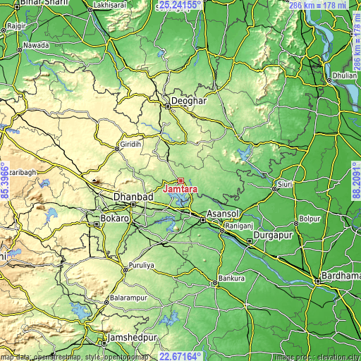
Nearby cities:
Cities around Jāmtāra sort by population:
• Āsansol elevation 119 m
36.1 km,  149°
149°
• Kulti 156 m
26.1 km,  170°
170°
• Dhanbād 250 m
40.7 km,  243°
243°
• Jāmuria 132 m
40.2 km,  135°
135°
• Jharia 204 m
46.6 km, 237°
• Madhupur 250 m
38.4 km,  334°
334°
• Chittaranjan 157 m
15.6 km, 139°
• Lakhyabad 142 m
35.7 km,  202°
202°
• Nirsā 142 m
22.1 km,  206°
206°
• Gobindpur 212 m
32.2 km, 243°
• Kenduadīh 210 m
48.1 km, 244°
• Mugma 145 m
22.8 km, 199°
Multilingual:
 En español:
Jāmtāra elevación 199 m.
 En France:
Jāmtāra élévation 199 m.


Sources and notes:
- [note 1] Map square and city borders are not equal. Map elevation data is calculated only from area inside that square.
- [src 1] Elevation data from geonames database provided with same terms of usage.
- [src 2] The elevation map of Jāmtāra is generated using elevation data from NASA's 3 arcsec (90m) resolution SRTM data.
- [src 3] Base (background) map © OpenStreetMap contributors tiles are generated by Geofabrik and OpenTopoMap.
Copyright & License:
This Jāmtāra Elevation Map is licensed under CC BY-SA. You may reuse any part from this page, if you give a proper credit by linking to this URL:
 More info on terms of use page.