Mahgawān elevation
Mahgawān (Madhya Pradesh, Bhind), India elevation is 154 meters and Mahgawān elevation in feet is 505 ft above sea level [src 1]. Mahgawān is a populated place (feature code) with elevation that is 139 meters (456 ft) smaller than average city elevation in India.
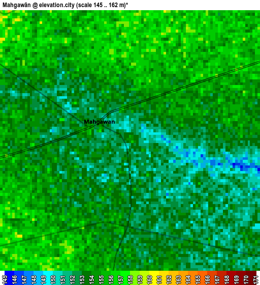
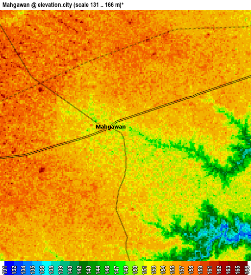
Below is the Elevation map of Mahgawān, which displays elevation range with different colors. Scale of the first map is from 145 to 162 m (476 to 531 ft) with average elevation of 153.6 meters (=504 ft) [note 1]
These maps also provides idea of topography and contour of this city, they are displayed at different zoom levels. More info about maps, scale and edge coordinates you can find below images.
| \ | Map #1 | Map #2 | Topo.Map |
| Scale [m] | 145..162 m | 131..166 m | × |
| Scale [ft] | 476..531 ft | 430..545 ft | × |
| Average | 153.6 m = 504 ft | 154 m = 505 ft | × |
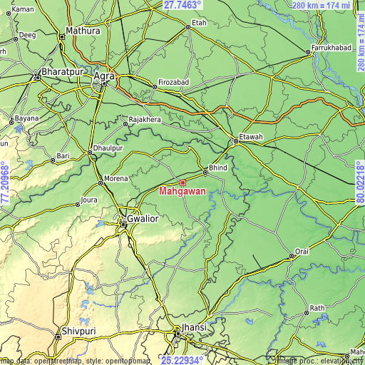
| Width | 8.75 km = 5.4 mi | 17.49 km = 10.9 mi | 279.9 km = 173.9 mi |
| Height | 8.75 km = 5.4 mi | 17.49 km = 10.9 mi | 279.9 km = 173.9 mi |
| ↑Max Latitude | 26.534033° | 26.573343° | 27.7463° |
| Latitude at center | 26.49471° | 26.49471° | 26.49471° |
| ↓Min Latitude | 26.455373° | 26.416023° | 25.22934° |
| ← Min Longitude | 78.571985° | 78.528039° | 77.20968° |
| Longitude center | 78.61593° | 78.61593° | 78.61593° |
| →Max Longitude | 78.659875° | 78.703821° | 80.02218° |
Nearby cities:
Cities around Mahgawān sort by population:
• Bhind elevation 157 m
18.8 km,  64°
64°
• Gohadi 158 m
18.6 km,  248°
248°
• Morār 207 m
49.1 km,  232°
232°
• Ambāh 176 m
45.2 km,  301°
301°
• Porsa 170 m
31.5 km,  309°
309°
• Lahār 158 m
46.6 km,  135°
135°
• Seondha 167 m
41.3 km,  156°
156°
• Pināhat 159 m
49.5 km,  331°
331°
• Mau 167 m
26 km,  167°
167°
• Mihona 152 m
43.2 km,  122°
122°
• Bāh 160 m
41.7 km,  356°
356°
• Umri 150 m
32 km,  86°
86°
Multilingual:
 En español:
Mahgawān elevación 154 m.
 En France:
Mahgawān élévation 154 m.
 Auf Deutsch:
Mahgawān höhe über dem Meeresspiegel ist 154 m.

Sources and notes:
- [note 1] Map square and city borders are not equal. Map elevation data is calculated only from area inside that square.
- [src 1] Elevation data from geonames database provided with same terms of usage.
- [src 2] The elevation map of Mahgawān is generated using elevation data from NASA's 3 arcsec (90m) resolution SRTM data.
- [src 3] Base (background) map © OpenStreetMap contributors tiles are generated by Geofabrik and OpenTopoMap.
Copyright & License:
This Mahgawān Elevation Map is licensed under CC BY-SA. You may reuse any part from this page, if you give a proper credit by linking to this URL:
 More info on terms of use page.