Lahār elevation
Lahār (Madhya Pradesh, Bhind), India elevation is 158 meters and Lahār elevation in feet is 518 ft above sea level [src 1]. Lahār is a populated place (feature code) with elevation that is 135 meters (443 ft) smaller than average city elevation in India.
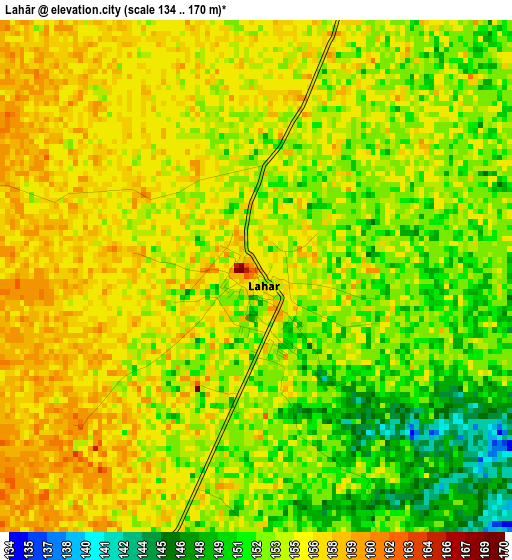
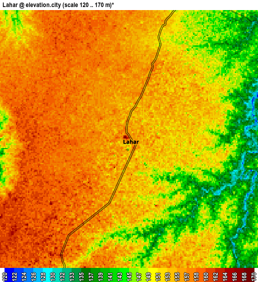
Below is the Elevation map of Lahār, which displays elevation range with different colors. Scale of the first map is from 134 to 170 m (440 to 558 ft) with average elevation of 154 meters (=505 ft) [note 1]
These maps also provides idea of topography and contour of this city, they are displayed at different zoom levels. More info about maps, scale and edge coordinates you can find below images.
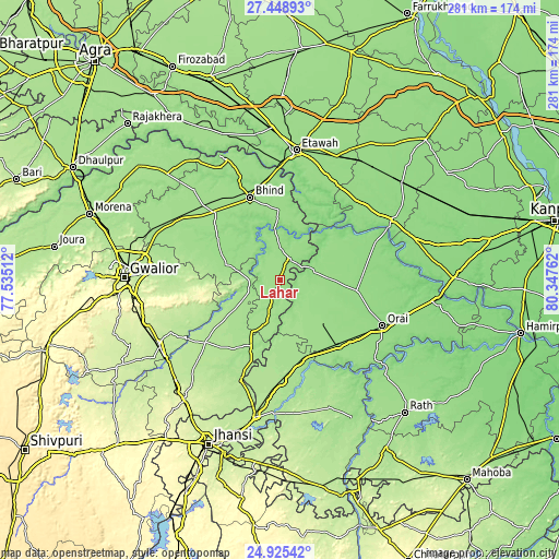
| \ | Map #1 | Map #2 | Topo.Map |
| Scale [m] | 134..170 m | 120..170 m | × |
| Scale [ft] | 440..558 ft | 394..558 ft | × |
| Average | 154 m = 505 ft | 152.1 m = 499 ft | × |
| Width | 8.77 km = 5.4 mi | 17.54 km = 10.9 mi | 280.6 km = 174.4 mi |
| Height | 8.77 km = 5.4 mi | 17.54 km = 10.9 mi | 280.6 km = 174.4 mi |
| ↑Max Latitude | 26.233436° | 26.272848° | 27.44893° |
| Latitude at center | 26.19401° | 26.19401° | 26.19401° |
| ↓Min Latitude | 26.154571° | 26.115119° | 24.92542° |
| ← Min Longitude | 78.897425° | 78.853479° | 77.53512° |
| Longitude center | 78.94137° | 78.94137° | 78.94137° |
| →Max Longitude | 78.985315° | 79.029261° | 80.34762° |
Nearby cities:
Cities around Lahār sort by population:
• Jālaun elevation 151 m
39.8 km,  97°
97°
• Konch 160 m
30.5 km,  136°
136°
• Samthar 177 m
39.1 km,  185°
185°
• Seondha 167 m
16.6 km,  254°
254°
• Mau 167 m
28.1 km,  286°
286°
• Daboh 165 m
22.3 km,  196°
196°
• Mihona 152 m
10.7 km,  21°
21°
• Rāmpura 149 m
29.6 km,  54°
54°
• Mādhogarh 149 m
26 km,  69°
69°
• Alampur 161 m
23.7 km,  217°
217°
• Umri 150 m
35.2 km,  359°
359°
• Nadīgaon 147 m
12.6 km, 139°
Multilingual:
 En español:
Lahār elevación 158 m.
 En France:
Lahār élévation 158 m.


Sources and notes:
- [note 1] Map square and city borders are not equal. Map elevation data is calculated only from area inside that square.
- [src 1] Elevation data from geonames database provided with same terms of usage.
- [src 2] The elevation map of Lahār is generated using elevation data from NASA's 3 arcsec (90m) resolution SRTM data.
- [src 3] Base (background) map © OpenStreetMap contributors tiles are generated by Geofabrik and OpenTopoMap.
Copyright & License:
This Lahār Elevation Map is licensed under CC BY-SA. You may reuse any part from this page, if you give a proper credit by linking to this URL:
 More info on terms of use page.