Mālegaon elevation
Mālegaon (Maharashtra, Nashik Division), India elevation is 432 meters and Mālegaon elevation in feet is 1417 ft above sea level [src 1]. Mālegaon is a populated place (feature code) with elevation that is 139 meters (456 ft) bigger than average city elevation in India.
Below is the Elevation map of Mālegaon, which displays elevation range with different colors. Scale of the first map is from 389 to 472 m (1276 to 1549 ft) with average elevation of 429.4 meters (=1409 ft) [note 1]
These maps also provides idea of topography and contour of this city, they are displayed at different zoom levels. More info about maps, scale and edge coordinates you can find below images.
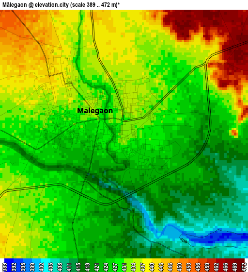
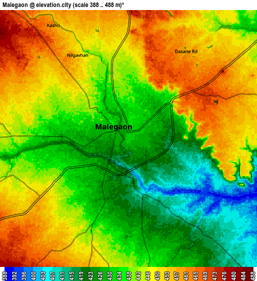
| \ | Map #1 | Map #2 | Topo.Map |
| Scale [m] | 389..472 m | 388..488 m | × |
| Scale [ft] | 1276..1549 ft | 1273..1601 ft | × |
| Average | 429.4 m = 1409 ft | 440.4 m = 1445 ft | × |
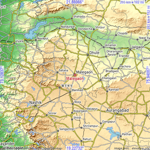
| Width | 9.15 km = 5.7 mi | 18.3 km = 11.4 mi | 292.8 km = 181.9 mi |
| Height | 9.15 km = 5.7 mi | 18.3 km = 11.4 mi | 292.8 km = 181.9 mi |
| ↑Max Latitude | 20.590803° | 20.631936° | 21.86066° |
| Latitude at center | 20.54966° | 20.54966° | 20.54966° |
| ↓Min Latitude | 20.508505° | 20.46734° | 19.22732° |
| ← Min Longitude | 74.490675° | 74.446729° | 73.12837° |
| Longitude center | 74.53462° | 74.53462° | 74.53462° |
| →Max Longitude | 74.578565° | 74.622511° | 75.94087° |
Nearby cities:
Cities around Mālegaon sort by population:
• Dhūlia elevation 266 m
46.5 km,  32°
32°
• Chālisgaon 346 m
51.2 km,  101°
101°
• Manmād 578 m
34.5 km,  197°
197°
• Kopargaon 504 m
74.4 km,  184°
184°
• Yeola 562 m
56.6 km, 184°
• Kannad 629 m
70.8 km,  117°
117°
• Vaijāpur 534 m
72.1 km,  163°
163°
• Parola 256 m
71.1 km,  58°
58°
• Satānā 557 m
34.9 km,  278°
278°
• Nāndgaon 480 m
29.8 km, 155°
• Chāndor 734 m
38.8 km,  231°
231°
• Lāsalgaon 590 m
54.7 km,  214°
214°
Multilingual:
 En español:
Mālegaon elevación 432 m.
 En France:
Mālegaon élévation 432 m.
 Auf Deutsch:
Malegaon höhe über dem Meeresspiegel ist 432 m.

Sources and notes:
- [note 1] Map square and city borders are not equal. Map elevation data is calculated only from area inside that square.
- [src 1] Elevation data from geonames database provided with same terms of usage.
- [src 2] The elevation map of Mālegaon is generated using elevation data from NASA's 3 arcsec (90m) resolution SRTM data.
- [src 3] Base (background) map © OpenStreetMap contributors tiles are generated by Geofabrik and OpenTopoMap.
Copyright & License:
This Mālegaon Elevation Map is licensed under CC BY-SA. You may reuse any part from this page, if you give a proper credit by linking to this URL:
 More info on terms of use page.