Mysore elevation
Mysore (Karnataka), India elevation is 757 meters and Mysore elevation in feet is 2484 ft above sea level [src 1]. Mysore is a seat of a second-order administrative division (feature code) with elevation that is 464 meters (1522 ft) bigger than average city elevation in India.
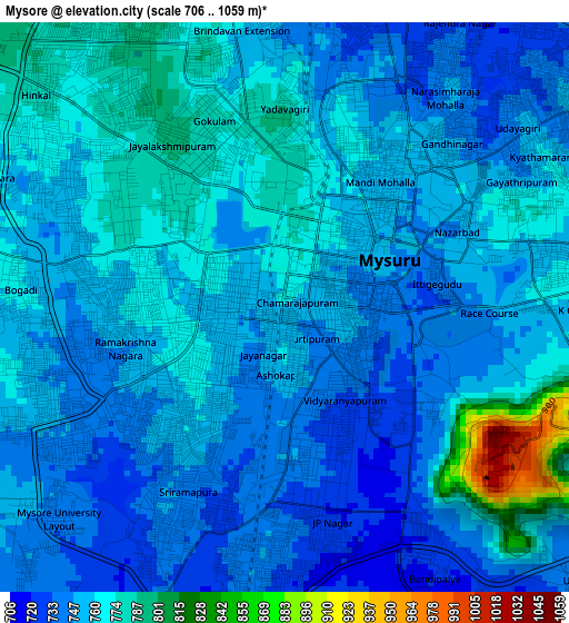
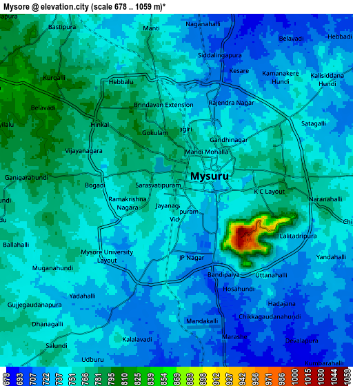
Below is the Elevation map of Mysore, which displays elevation range with different colors. Scale of the first map is from 706 to 1059 m (2316 to 3474 ft) with average elevation of 758 meters (=2487 ft) [note 1]
These maps also provides idea of topography and contour of this city, they are displayed at different zoom levels. More info about maps, scale and edge coordinates you can find below images.
| \ | Map #1 | Map #2 | Topo.Map |
| Scale [m] | 706..1059 m | 678..1059 m | × |
| Scale [ft] | 2316..3474 ft | 2224..3474 ft | × |
| Average | 758 m = 2487 ft | 746.8 m = 2450 ft | × |
| Width | 9.55 km = 5.9 mi | 19.1 km = 11.9 mi | 305.5 km = 189.8 mi |
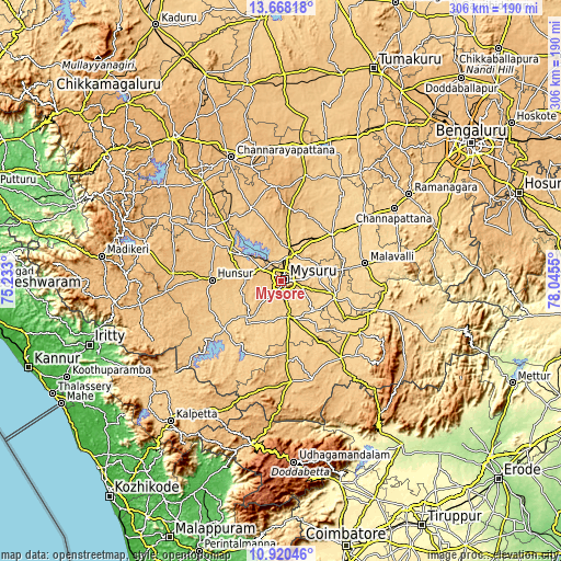
| Height | 9.55 km = 5.9 mi | 19.1 km = 11.9 mi | 305.5 km = 189.8 mi |
| ↑Max Latitude | 12.340843° | 12.38377° | 13.66818° |
| Latitude at center | 12.29791° | 12.29791° | 12.29791° |
| ↓Min Latitude | 12.25497° | 12.212022° | 10.92046° |
| ← Min Longitude | 76.595305° | 76.551359° | 75.233° |
| Longitude center | 76.63925° | 76.63925° | 76.63925° |
| →Max Longitude | 76.683195° | 76.727141° | 78.0455° |
Nearby cities:
Cities around Mysore sort by population:
• Mandya elevation 681 m
37.5 km,  48°
48°
• Nanjangūd 666 m
20.6 km,  166°
166°
• Hunsūr 794 m
37.6 km,  270°
270°
• Malavalli 621 m
46.8 km,  77°
77°
• Bannūr 677 m
24.5 km, 80°
• Krishnarājpet 815 m
44.1 km,  338°
338°
• Shrīrangapattana 689 m
14.7 km,  19°
19°
• French Rocks 734 m
22.9 km,  9°
9°
• Heggadadevankote 702 m
41 km,  235°
235°
• Sargūr 693 m
42.4 km,  218°
218°
• Tirumakūdal Narsipur 654 m
30.1 km,  108°
108°
• Melukote 1018 m
40.6 km,  1°
1°
Multilingual:
 En español:
Mysore elevación 757 m.
 En France:
Mysore élévation 757 m.


Sources and notes:
- [note 1] Map square and city borders are not equal. Map elevation data is calculated only from area inside that square.
- [src 1] Elevation data from geonames database provided with same terms of usage.
- [src 2] The elevation map of Mysore is generated using elevation data from NASA's 3 arcsec (90m) resolution SRTM data.
- [src 3] Base (background) map © OpenStreetMap contributors tiles are generated by Geofabrik and OpenTopoMap.
Copyright & License:
This Mysore Elevation Map is licensed under CC BY-SA. You may reuse any part from this page, if you give a proper credit by linking to this URL:
 More info on terms of use page.