Krishnarājpet elevation
Krishnarājpet (Karnataka, Mandya), India elevation is 815 meters and Krishnarājpet elevation in feet is 2674 ft above sea level [src 1]. Krishnarājpet is a populated place (feature code) with elevation that is 522 meters (1713 ft) bigger than average city elevation in India.
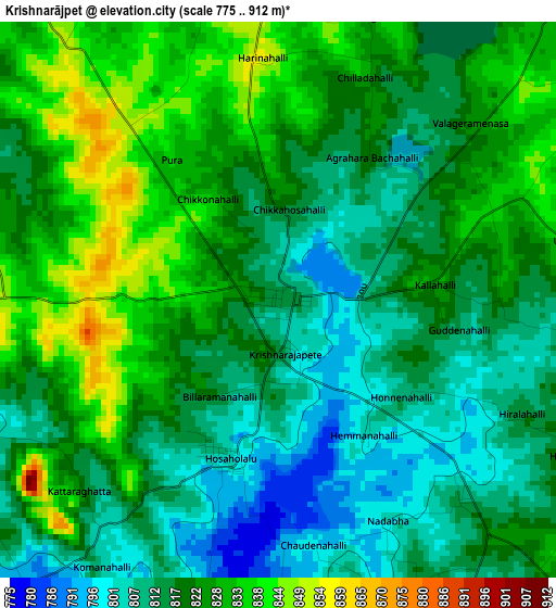
Below is the Elevation map of Krishnarājpet, which displays elevation range with different colors. Scale of the first map is from 775 to 912 m (2543 to 2992 ft) with average elevation of 820.1 meters (=2691 ft) [note 1]
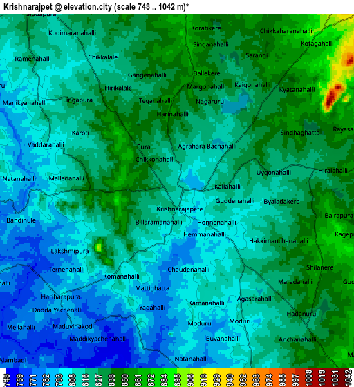
These maps also provides idea of topography and contour of this city, they are displayed at different zoom levels. More info about maps, scale and edge coordinates you can find below images.
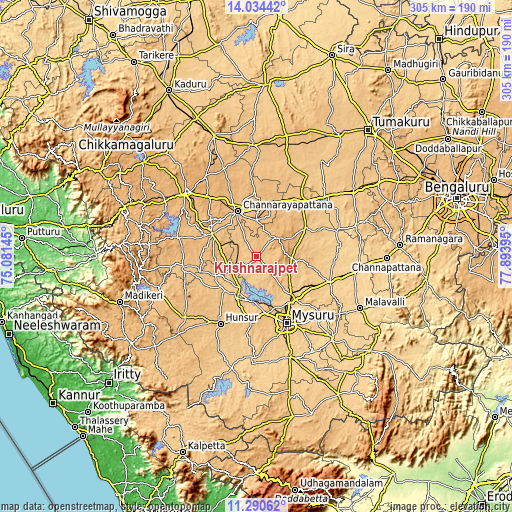
| \ | Map #1 | Map #2 | Topo.Map |
| Scale [m] | 775..912 m | 748..1042 m | × |
| Scale [ft] | 2543..2992 ft | 2454..3419 ft | × |
| Average | 820.1 m = 2691 ft | 819.2 m = 2688 ft | × |
| Width | 9.53 km = 5.9 mi | 19.07 km = 11.8 mi | 305.1 km = 189.6 mi |
| Height | 9.53 km = 5.9 mi | 19.07 km = 11.8 mi | 305.1 km = 189.6 mi |
| ↑Max Latitude | 12.709082° | 12.751947° | 14.03442° |
| Latitude at center | 12.66621° | 12.66621° | 12.66621° |
| ↓Min Latitude | 12.623331° | 12.580444° | 11.29062° |
| ← Min Longitude | 76.443755° | 76.399809° | 75.08145° |
| Longitude center | 76.4877° | 76.4877° | 76.4877° |
| →Max Longitude | 76.531645° | 76.575591° | 77.89395° |
Nearby cities:
Cities around Krishnarājpet sort by population:
• Mysore elevation 757 m
44.1 km,  158°
158°
• Mandya 681 m
47.3 km,  109°
109°
• Hunsūr 794 m
45.5 km,  207°
207°
• Channarāyapatna 855 m
28.8 km,  337°
337°
• Hole Narsipur 845 m
29.7 km,  296°
296°
• Shrīrangapattana 689 m
34.5 km,  141°
141°
• French Rocks 734 m
27.3 km,  132°
132°
• Nāgamangala 790 m
33.6 km,  59°
59°
• Konanūr 835 m
47.6 km,  265°
265°
• Bellūru 797 m
44 km,  37°
37°
• Srāvana Belgola 878 m
21.3 km,  0°
0°
• Melukote 1018 m
17.5 km,  91°
91°
Multilingual:
 En español:
Krishnarājpet elevación 815 m.
 En France:
Krishnarājpet élévation 815 m.
 Auf Deutsch:
Krishnarājpet höhe über dem Meeresspiegel ist 815 m.

Sources and notes:
- [note 1] Map square and city borders are not equal. Map elevation data is calculated only from area inside that square.
- [src 1] Elevation data from geonames database provided with same terms of usage.
- [src 2] The elevation map of Krishnarājpet is generated using elevation data from NASA's 3 arcsec (90m) resolution SRTM data.
- [src 3] Base (background) map © OpenStreetMap contributors tiles are generated by Geofabrik and OpenTopoMap.
Copyright & License:
This Krishnarājpet Elevation Map is licensed under CC BY-SA. You may reuse any part from this page, if you give a proper credit by linking to this URL:
 More info on terms of use page.