Naregal elevation
Naregal (Karnataka, Gadag), India elevation is 642 meters and Naregal elevation in feet is 2106 ft above sea level [src 1]. Naregal is a populated place (feature code) with elevation that is 349 meters (1145 ft) bigger than average city elevation in India.
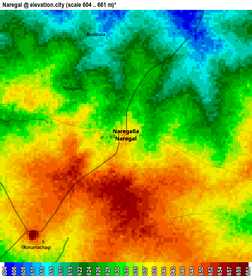
Below is the Elevation map of Naregal, which displays elevation range with different colors. Scale of the first map is from 604 to 661 m (1982 to 2169 ft) with average elevation of 633.5 meters (=2078 ft) [note 1]
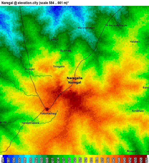
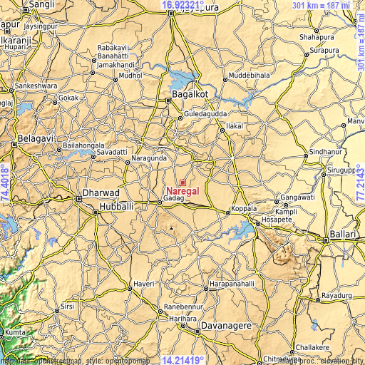
These maps also provides idea of topography and contour of this city, they are displayed at different zoom levels. More info about maps, scale and edge coordinates you can find below images.
| \ | Map #1 | Map #2 | Topo.Map |
| Scale [m] | 604..661 m | 584..661 m | × |
| Scale [ft] | 1982..2169 ft | 1916..2169 ft | × |
| Average | 633.5 m = 2078 ft | 624.3 m = 2048 ft | × |
| Width | 9.41 km = 5.8 mi | 18.83 km = 11.7 mi | 301.2 km = 187.2 mi |
| Height | 9.41 km = 5.8 mi | 18.83 km = 11.7 mi | 301.2 km = 187.2 mi |
| ↑Max Latitude | 15.615488° | 15.657807° | 16.92321° |
| Latitude at center | 15.57316° | 15.57316° | 15.57316° |
| ↓Min Latitude | 15.530824° | 15.488479° | 14.21419° |
| ← Min Longitude | 75.764105° | 75.720159° | 74.4018° |
| Longitude center | 75.80805° | 75.80805° | 75.80805° |
| →Max Longitude | 75.851995° | 75.895941° | 77.2143° |
Nearby cities:
Cities around Naregal sort by population:
• Gadag-Betageri elevation 665 m
26.9 km,  229°
229°
• Gadag 655 m
24.9 km, 230°
• Koppal 540 m
45 km,  124°
124°
• Gajendragarh 643 m
25.1 km,  43°
43°
• Bādāmi 560 m
40.5 km,  339°
339°
• Annigeri 631 m
43.4 km,  247°
247°
• Ron 581 m
16.1 km,  330°
330°
• Mundargi 534 m
41.5 km,  168°
168°
• Mulgund 687 m
44.7 km,  223°
223°
• Shirhatti 681 m
45 km,  212°
212°
• Yelbarga 604 m
22.3 km,  77°
77°
• Kavalūr 548 m
34.8 km,  155°
155°
Multilingual:
 En español:
Naregal elevación 642 m.
 En France:
Naregal élévation 642 m.


Sources and notes:
- [note 1] Map square and city borders are not equal. Map elevation data is calculated only from area inside that square.
- [src 1] Elevation data from geonames database provided with same terms of usage.
- [src 2] The elevation map of Naregal is generated using elevation data from NASA's 3 arcsec (90m) resolution SRTM data.
- [src 3] Base (background) map © OpenStreetMap contributors tiles are generated by Geofabrik and OpenTopoMap.
Copyright & License:
This Naregal Elevation Map is licensed under CC BY-SA. You may reuse any part from this page, if you give a proper credit by linking to this URL:
 More info on terms of use page.