Yelbarga elevation
Yelbarga (Karnataka, Koppal), India elevation is 604 meters and Yelbarga elevation in feet is 1982 ft above sea level [src 1]. Yelbarga is a populated place (feature code) with elevation that is 311 meters (1020 ft) bigger than average city elevation in India.
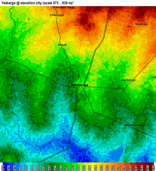
Below is the Elevation map of Yelbarga, which displays elevation range with different colors. Scale of the first map is from 573 to 639 m (1880 to 2096 ft) with average elevation of 601.2 meters (=1972 ft) [note 1]
These maps also provides idea of topography and contour of this city, they are displayed at different zoom levels. More info about maps, scale and edge coordinates you can find below images.
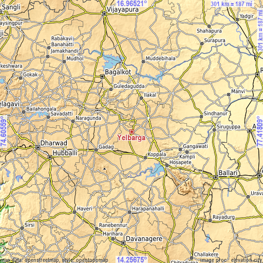
| \ | Map #1 | Map #2 | Topo.Map |
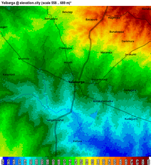
| Scale [m] | 573..639 m | 558..689 m | × |
| Scale [ft] | 1880..2096 ft | 1831..2260 ft | × |
| Average | 601.2 m = 1972 ft | 609.1 m = 1998 ft | × |
| Width | 9.41 km = 5.8 mi | 18.82 km = 11.7 mi | 301.2 km = 187.2 mi |
| Height | 9.41 km = 5.8 mi | 18.82 km = 11.7 mi | 301.2 km = 187.2 mi |
| ↑Max Latitude | 15.657769° | 15.700079° | 16.96521° |
| Latitude at center | 15.61545° | 15.61545° | 15.61545° |
| ↓Min Latitude | 15.573122° | 15.530786° | 14.25675° |
| ← Min Longitude | 75.967895° | 75.923949° | 74.60559° |
| Longitude center | 76.01184° | 76.01184° | 76.01184° |
| →Max Longitude | 76.055785° | 76.099731° | 77.41809° |
Nearby cities:
Cities around Yelbarga sort by population:
• Gadag-Betageri elevation 665 m
47.8 km,  242°
242°
• Gadag 655 m
45.9 km, 243°
• Koppal 540 m
33.7 km,  152°
152°
• Ilkal 564 m
39.7 km,  15°
15°
• Gajendragarh 643 m
14.2 km,  341°
341°
• Bādāmi 560 m
48.9 km,  312°
312°
• Kushtagi 645 m
24.8 km,  50°
50°
• Ron 581 m
31.2 km,  287°
287°
• Mundargi 534 m
47.5 km,  196°
196°
• Naregal 642 m
22.3 km,  257°
257°
• Munirābād 473 m
48.8 km,  134°
134°
• Kavalūr 548 m
37.1 km,  191°
191°
Multilingual:
 En español:
Yelbarga elevación 604 m.
 En France:
Yelbarga élévation 604 m.
 Auf Deutsch:
Yelbarga höhe über dem Meeresspiegel ist 604 m.

Sources and notes:
- [note 1] Map square and city borders are not equal. Map elevation data is calculated only from area inside that square.
- [src 1] Elevation data from geonames database provided with same terms of usage.
- [src 2] The elevation map of Yelbarga is generated using elevation data from NASA's 3 arcsec (90m) resolution SRTM data.
- [src 3] Base (background) map © OpenStreetMap contributors tiles are generated by Geofabrik and OpenTopoMap.
Copyright & License:
This Yelbarga Elevation Map is licensed under CC BY-SA. You may reuse any part from this page, if you give a proper credit by linking to this URL:
 More info on terms of use page.