Palwal elevation
Palwal (Haryana), India elevation is 201 meters and Palwal elevation in feet is 659 ft above sea level [src 1]. Palwal is a populated place (feature code) with elevation that is 92 meters (302 ft) smaller than average city elevation in India.
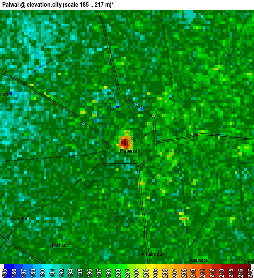
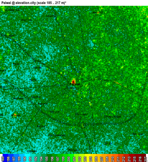
Below is the Elevation map of Palwal, which displays elevation range with different colors. Scale of the first map is from 185 to 217 m (607 to 712 ft) with average elevation of 195.9 meters (=643 ft) [note 1]
These maps also provides idea of topography and contour of this city, they are displayed at different zoom levels. More info about maps, scale and edge coordinates you can find below images.
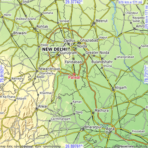
| \ | Map #1 | Map #2 | Topo.Map |
| Scale [m] | 185..217 m | 185..217 m | × |
| Scale [ft] | 607..712 ft | 607..712 ft | × |
| Average | 195.9 m = 643 ft | 195.4 m = 641 ft | × |
| Width | 8.62 km = 5.4 mi | 17.23 km = 10.7 mi | 275.7 km = 171.3 mi |
| Height | 8.62 km = 5.4 mi | 17.23 km = 10.7 mi | 275.7 km = 171.3 mi |
| ↑Max Latitude | 28.183432° | 28.22216° | 29.37742° |
| Latitude at center | 28.14469° | 28.14469° | 28.14469° |
| ↓Min Latitude | 28.105934° | 28.067164° | 26.89761° |
| ← Min Longitude | 77.281515° | 77.237569° | 75.91921° |
| Longitude center | 77.32546° | 77.32546° | 77.32546° |
| →Max Longitude | 77.369405° | 77.413351° | 78.73171° |
Nearby cities:
Cities around Palwal sort by population:
• Faridabad elevation 209 m
29.7 km,  357°
357°
• Hodal 199 m
28.4 km,  171°
171°
• Sohna 212 m
27.9 km,  294°
294°
• Jewar 200 m
22.9 km,  96°
96°
• Tāoru 270 m
37.6 km,  281°
281°
• Pūnāhāna 193 m
33.4 km,  200°
200°
• Rabūpura 200 m
29.6 km,  66°
66°
• Dankaur 207 m
32.1 km,  44°
44°
• Nūh 200 m
32.1 km,  261°
261°
• Jahāngīrpur 199 m
37.4 km,  84°
84°
• Hasanpur 194 m
25.6 km,  139°
139°
• Bīlāspur 207 m
40.1 km,  46°
46°
Multilingual:
 En español:
Palwal elevación 201 m.
 En France:
Palwal élévation 201 m.


Sources and notes:
- [note 1] Map square and city borders are not equal. Map elevation data is calculated only from area inside that square.
- [src 1] Elevation data from geonames database provided with same terms of usage.
- [src 2] The elevation map of Palwal is generated using elevation data from NASA's 3 arcsec (90m) resolution SRTM data.
- [src 3] Base (background) map © OpenStreetMap contributors tiles are generated by Geofabrik and OpenTopoMap.
Copyright & License:
This Palwal Elevation Map is licensed under CC BY-SA. You may reuse any part from this page, if you give a proper credit by linking to this URL:
 More info on terms of use page.