Hodal elevation
Hodal (Haryana, Palwal), India elevation is 199 meters and Hodal elevation in feet is 653 ft above sea level [src 1]. Hodal is a populated place (feature code) with elevation that is 94 meters (308 ft) smaller than average city elevation in India.
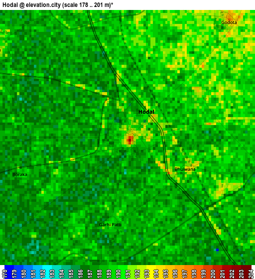
Below is the Elevation map of Hodal, which displays elevation range with different colors. Scale of the first map is from 178 to 201 m (584 to 659 ft) with average elevation of 188.2 meters (=617 ft) [note 1]
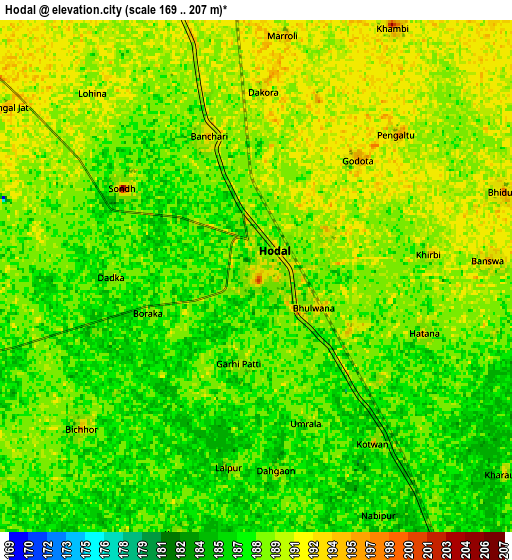
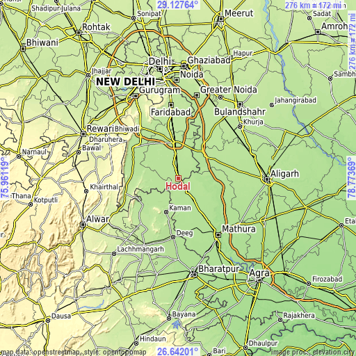
These maps also provides idea of topography and contour of this city, they are displayed at different zoom levels. More info about maps, scale and edge coordinates you can find below images.
| \ | Map #1 | Map #2 | Topo.Map |
| Scale [m] | 178..201 m | 169..207 m | × |
| Scale [ft] | 584..659 ft | 554..679 ft | × |
| Average | 188.2 m = 617 ft | 188.5 m = 618 ft | × |
| Width | 8.64 km = 5.4 mi | 17.27 km = 10.7 mi | 276.4 km = 171.7 mi |
| Height | 8.64 km = 5.4 mi | 17.27 km = 10.7 mi | 276.4 km = 171.7 mi |
| ↑Max Latitude | 27.930793° | 27.969613° | 29.12764° |
| Latitude at center | 27.89196° | 27.89196° | 27.89196° |
| ↓Min Latitude | 27.853113° | 27.814252° | 26.64201° |
| ← Min Longitude | 77.323495° | 77.279549° | 75.96119° |
| Longitude center | 77.36744° | 77.36744° | 77.36744° |
| →Max Longitude | 77.411385° | 77.455331° | 78.77369° |
Nearby cities:
Cities around Hodal sort by population:
• Palwal elevation 201 m
28.4 km,  351°
351°
• Kosi 195 m
12.8 km,  147°
147°
• Kāman 187 m
27.8 km,  200°
200°
• Jewar 200 m
31.7 km,  36°
36°
• Chhāta 195 m
23.3 km,  143°
143°
• Pūnāhāna 193 m
16.3 km,  258°
258°
• Nūh 200 m
42.9 km,  303°
303°
• Nandgaon 198 m
20.2 km,  174°
174°
• Hasanpur 194 m
15.2 km,  55°
55°
• Barsāna 188 m
27.1 km,  178°
178°
• Bājna 191 m
30.6 km,  88°
88°
• Rādhākund 190 m
42.6 km,  163°
163°
Multilingual:
 En español:
Hodal elevación 199 m.
 En France:
Hodal élévation 199 m.


Sources and notes:
- [note 1] Map square and city borders are not equal. Map elevation data is calculated only from area inside that square.
- [src 1] Elevation data from geonames database provided with same terms of usage.
- [src 2] The elevation map of Hodal is generated using elevation data from NASA's 3 arcsec (90m) resolution SRTM data.
- [src 3] Base (background) map © OpenStreetMap contributors tiles are generated by Geofabrik and OpenTopoMap.
Copyright & License:
This Hodal Elevation Map is licensed under CC BY-SA. You may reuse any part from this page, if you give a proper credit by linking to this URL:
 More info on terms of use page.