Pawni elevation
Pawni (Maharashtra, Bhandara), India elevation is 248 meters and Pawni elevation in feet is 814 ft above sea level [src 1]. Pawni is a populated place (feature code) with elevation that is 45 meters (148 ft) smaller than average city elevation in India.
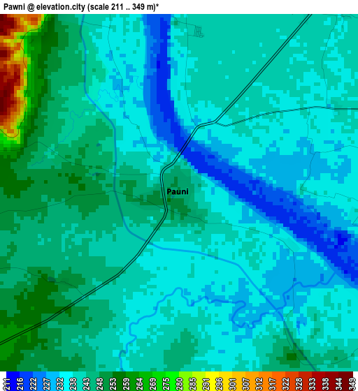
Below is the Elevation map of Pawni, which displays elevation range with different colors. Scale of the first map is from 211 to 349 m (692 to 1145 ft) with average elevation of 241.4 meters (=792 ft) [note 1]
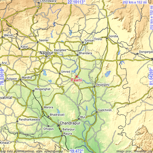
These maps also provides idea of topography and contour of this city, they are displayed at different zoom levels. More info about maps, scale and edge coordinates you can find below images.
| \ | Map #1 | Map #2 | Topo.Map |
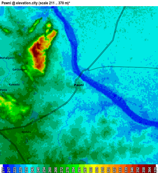
| Scale [m] | 211..349 m | 211..370 m | × |
| Scale [ft] | 692..1145 ft | 692..1214 ft | × |
| Average | 241.4 m = 792 ft | 246.4 m = 808 ft | × |
| Width | 9.14 km = 5.7 mi | 18.27 km = 11.4 mi | 292.3 km = 181.6 mi |
| Height | 9.14 km = 5.7 mi | 18.27 km = 11.4 mi | 292.4 km = 181.7 mi |
| ↑Max Latitude | 20.833368° | 20.874434° | 22.10113° |
| Latitude at center | 20.79229° | 20.79229° | 20.79229° |
| ↓Min Latitude | 20.751201° | 20.710101° | 19.472° |
| ← Min Longitude | 79.592495° | 79.548549° | 78.23019° |
| Longitude center | 79.63644° | 79.63644° | 79.63644° |
| →Max Longitude | 79.680385° | 79.724331° | 81.04269° |
Nearby cities:
Cities around Pawni sort by population:
• Nagpur elevation 319 m
69.5 km,  304°
304°
• Bhandāra 262 m
41.8 km,  1°
1°
• Kāmthi 288 m
65.6 km,  315°
315°
• Umred 289 m
33.1 km,  281°
281°
• Tumsar 278 m
66.5 km,  8°
8°
• Mūl 196 m
80.4 km,  176°
176°
• Rāmtek 336 m
74.4 km,  334°
334°
• Chicholi 291 m
75.6 km, 5°
• Sindi 249 m
77.9 km,  271°
271°
• Kāndri 344 m
79.2 km, 331°
• Mansar 330 m
77.5 km, 330°
• Korādi 307 m
74.8 km,  312°
312°
Multilingual:
 En español:
Pawni elevación 248 m.
 En France:
Pawni élévation 248 m.


Sources and notes:
- [note 1] Map square and city borders are not equal. Map elevation data is calculated only from area inside that square.
- [src 1] Elevation data from geonames database provided with same terms of usage.
- [src 2] The elevation map of Pawni is generated using elevation data from NASA's 3 arcsec (90m) resolution SRTM data.
- [src 3] Base (background) map © OpenStreetMap contributors tiles are generated by Geofabrik and OpenTopoMap.
Copyright & License:
This Pawni Elevation Map is licensed under CC BY-SA. You may reuse any part from this page, if you give a proper credit by linking to this URL:
 More info on terms of use page.