Rāichūr elevation
Rāichūr (Karnataka, Raichur), India elevation is 402 meters and Rāichūr elevation in feet is 1319 ft above sea level [src 1]. Rāichūr is a populated place (feature code) with elevation that is 109 meters (358 ft) bigger than average city elevation in India.
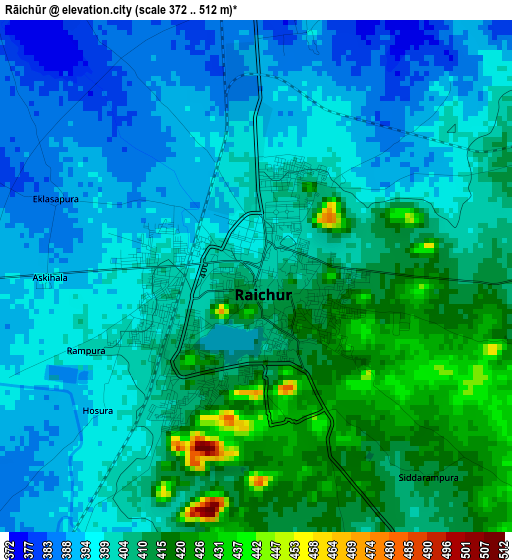
Below is the Elevation map of Rāichūr, which displays elevation range with different colors. Scale of the first map is from 372 to 512 m (1220 to 1680 ft) with average elevation of 403.1 meters (=1323 ft) [note 1]
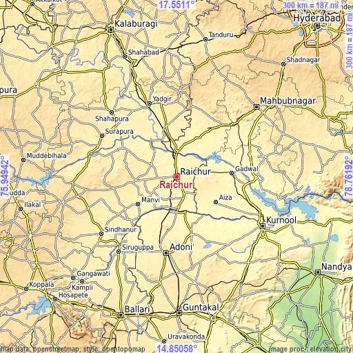
These maps also provides idea of topography and contour of this city, they are displayed at different zoom levels. More info about maps, scale and edge coordinates you can find below images.
| \ | Map #1 | Map #2 | Topo.Map |
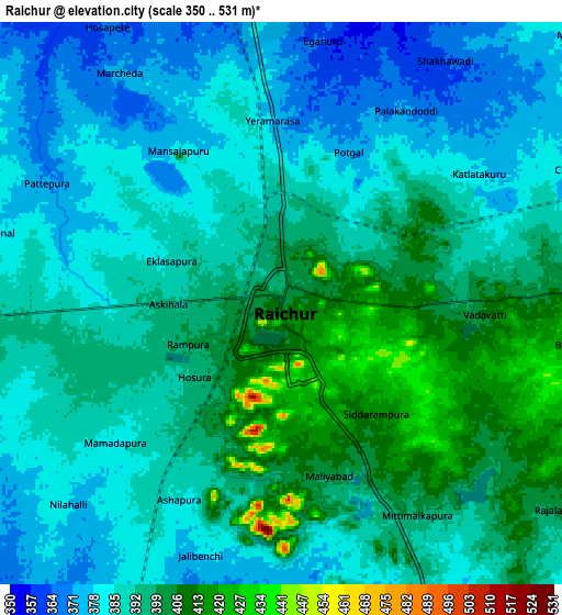
| Scale [m] | 372..512 m | 350..531 m | × |
| Scale [ft] | 1220..1680 ft | 1148..1742 ft | × |
| Average | 403.1 m = 1323 ft | 390.2 m = 1280 ft | × |
| Width | 9.38 km = 5.8 mi | 18.77 km = 11.7 mi | 300.3 km = 186.6 mi |
| Height | 9.38 km = 5.8 mi | 18.77 km = 11.7 mi | 300.3 km = 186.6 mi |
| ↑Max Latitude | 16.247655° | 16.28984° | 17.5511° |
| Latitude at center | 16.20546° | 16.20546° | 16.20546° |
| ↓Min Latitude | 16.163256° | 16.121043° | 14.85058° |
| ← Min Longitude | 77.311725° | 77.267779° | 75.94942° |
| Longitude center | 77.35567° | 77.35567° | 77.35567° |
| →Max Longitude | 77.399615° | 77.443561° | 78.76192° |
Nearby cities:
Cities around Rāichūr sort by population:
• Ādoni elevation 432 m
64.8 km,  187°
187°
• Emmiganūr 378 m
50.1 km,  164°
164°
• Yādgīr 379 m
66.9 km,  339°
339°
• Gadwāl 326 m
47.1 km,  85°
85°
• Wanparti 401 m
78.2 km,  76°
76°
• Shorāpur 480 m
72.8 km,  298°
298°
• Mānvi 375 m
40.4 km,  233°
233°
• Nārāyanpet 443 m
62.1 km,  13°
13°
• Shāhpur 418 m
77.3 km,  314°
314°
• Gurmatkāl 594 m
73.7 km,  2°
2°
• Kosigi 386 m
40.7 km,  196°
196°
• Gopālur 381 m
66.1 km,  46°
46°
Multilingual:
 En español:
Rāichūr elevación 402 m.
 En France:
Rāichūr élévation 402 m.


Sources and notes:
- [note 1] Map square and city borders are not equal. Map elevation data is calculated only from area inside that square.
- [src 1] Elevation data from geonames database provided with same terms of usage.
- [src 2] The elevation map of Rāichūr is generated using elevation data from NASA's 3 arcsec (90m) resolution SRTM data.
- [src 3] Base (background) map © OpenStreetMap contributors tiles are generated by Geofabrik and OpenTopoMap.
Copyright & License:
This Rāichūr Elevation Map is licensed under CC BY-SA. You may reuse any part from this page, if you give a proper credit by linking to this URL:
 More info on terms of use page.