Wanparti elevation
Wanparti (Telangana, Wanaparthy), India elevation is 401 meters and Wanparti elevation in feet is 1316 ft above sea level [src 1]. Wanparti is a seat of a second-order administrative division (feature code) with elevation that is 108 meters (354 ft) bigger than average city elevation in India.
Below is the Elevation map of Wanparti, which displays elevation range with different colors. Scale of the first map is from 366 to 525 m (1201 to 1722 ft) with average elevation of 409.8 meters (=1344 ft) [note 1]
These maps also provides idea of topography and contour of this city, they are displayed at different zoom levels. More info about maps, scale and edge coordinates you can find below images.
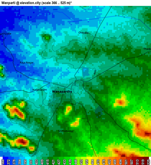
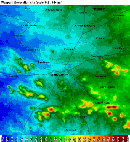
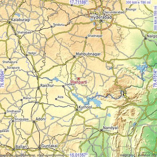
| \ | Map #1 | Map #2 | Topo.Map |
| Scale [m] | 366..525 m | 342..614 m | × |
| Scale [ft] | 1201..1722 ft | 1122..2014 ft | × |
| Average | 409.8 m = 1344 ft | 411.3 m = 1349 ft | × |
| Width | 9.38 km = 5.8 mi | 18.75 km = 11.7 mi | 300 km = 186.4 mi |
| Height | 9.38 km = 5.8 mi | 18.75 km = 11.7 mi | 300 km = 186.4 mi |
| ↑Max Latitude | 16.40954° | 16.451691° | 17.71186° |
| Latitude at center | 16.36738° | 16.36738° | 16.36738° |
| ↓Min Latitude | 16.325211° | 16.283033° | 15.01357° |
| ← Min Longitude | 78.024945° | 77.980999° | 76.66264° |
| Longitude center | 78.06889° | 78.06889° | 78.06889° |
| →Max Longitude | 78.112835° | 78.156781° | 79.47514° |
Nearby cities:
Cities around Wanparti sort by population:
• Kurnool elevation 286 m
60 km,  183°
183°
• Rāichūr 402 m
78.2 km,  256°
256°
• Mahbūbnagar 505 m
42.8 km,  348°
348°
• Emmiganūr 378 m
91.1 km,  223°
223°
• Gadwāl 326 m
32.7 km,  243°
243°
• Nandikotkūr 303 m
60.6 km,  159°
159°
• Farrukhnagar 647 m
80.3 km,  10°
10°
• Nārāyanpet 443 m
74.3 km,  304°
304°
• Atmakūr 295 m
77.4 km,  134°
134°
• Nāgar Karnūl 454 m
30.1 km,  64°
64°
• Ālampur 274 m
54.6 km,  172°
172°
• Gopālur 381 m
39 km,  314°
314°
Multilingual:
 En español:
Wanparti elevación 401 m.
 En France:
Wanparti élévation 401 m.
 Auf Deutsch:
Wanparti höhe über dem Meeresspiegel ist 401 m.

Sources and notes:
- [note 1] Map square and city borders are not equal. Map elevation data is calculated only from area inside that square.
- [src 1] Elevation data from geonames database provided with same terms of usage.
- [src 2] The elevation map of Wanparti is generated using elevation data from NASA's 3 arcsec (90m) resolution SRTM data.
- [src 3] Base (background) map © OpenStreetMap contributors tiles are generated by Geofabrik and OpenTopoMap.
Copyright & License:
This Wanparti Elevation Map is licensed under CC BY-SA. You may reuse any part from this page, if you give a proper credit by linking to this URL:
 More info on terms of use page.