Rājpura elevation
Rājpura (Punjab, Patiala), India elevation is 273 meters and Rājpura elevation in feet is 896 ft above sea level [src 1]. Rājpura is a populated place (feature code) with elevation that is 20 meters (66 ft) smaller than average city elevation in India.
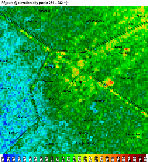
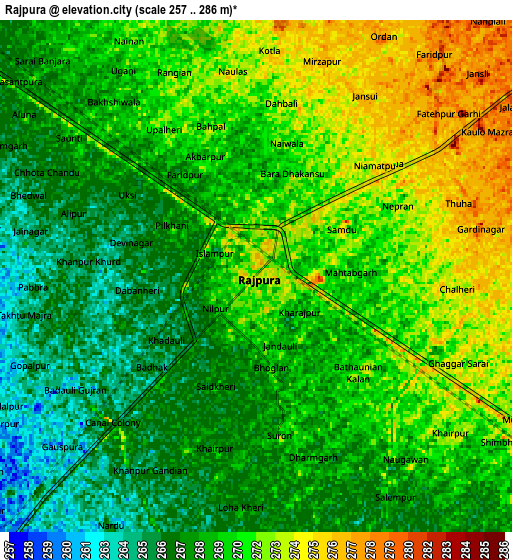
Below is the Elevation map of Rājpura, which displays elevation range with different colors. Scale of the first map is from 261 to 282 m (856 to 925 ft) with average elevation of 269.3 meters (=884 ft) [note 1]
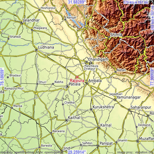
These maps also provides idea of topography and contour of this city, they are displayed at different zoom levels. More info about maps, scale and edge coordinates you can find below images.
| \ | Map #1 | Map #2 | Topo.Map |
| Scale [m] | 261..282 m | 257..286 m | × |
| Scale [ft] | 856..925 ft | 843..938 ft | × |
| Average | 269.3 m = 884 ft | 269.5 m = 884 ft | × |
| Width | 8.42 km = 5.2 mi | 16.84 km = 10.5 mi | 269.5 km = 167.5 mi |
| Height | 8.42 km = 5.2 mi | 16.84 km = 10.5 mi | 269.5 km = 167.5 mi |
| ↑Max Latitude | 30.516426° | 30.554276° | 31.68289° |
| Latitude at center | 30.47856° | 30.47856° | 30.47856° |
| ↓Min Latitude | 30.44068° | 30.402785° | 29.25914° |
| ← Min Longitude | 76.548895° | 76.504949° | 75.18659° |
| Longitude center | 76.59284° | 76.59284° | 76.59284° |
| →Max Longitude | 76.636785° | 76.680731° | 77.99909° |
Nearby cities:
Cities around Rājpura sort by population:
• Chandigarh elevation 351 m
34.2 km,  33°
33°
• Patiāla 258 m
24.9 km,  230°
230°
• Panchkula 335 m
34.4 km,  45°
45°
• Ambāla 276 m
23.6 km,  123°
123°
• Mohali 312 m
25.6 km, 28°
• Sirhind 270 m
27.1 km,  312°
312°
• Kharar 313 m
30.2 km,  9°
9°
• Basi 306 m
27 km,  63°
63°
• Basi 275 m
29.7 km,  321°
321°
• Sanaur 265 m
23.5 km,  213°
213°
• Banūr 287 m
14.8 km, 55°
• Ghanaur 265 m
16.5 km,  173°
173°
Multilingual:
 En español:
Rājpura elevación 273 m.
 En France:
Rājpura élévation 273 m.


Sources and notes:
- [note 1] Map square and city borders are not equal. Map elevation data is calculated only from area inside that square.
- [src 1] Elevation data from geonames database provided with same terms of usage.
- [src 2] The elevation map of Rājpura is generated using elevation data from NASA's 3 arcsec (90m) resolution SRTM data.
- [src 3] Base (background) map © OpenStreetMap contributors tiles are generated by Geofabrik and OpenTopoMap.
Copyright & License:
This Rājpura Elevation Map is licensed under CC BY-SA. You may reuse any part from this page, if you give a proper credit by linking to this URL:
 More info on terms of use page.