Panchkula elevation
Panchkula (Haryana), India elevation is 335 meters and Panchkula elevation in feet is 1099 ft above sea level [src 1]. Panchkula is a seat of a second-order administrative division (feature code) with elevation that is 42 meters (138 ft) bigger than average city elevation in India.
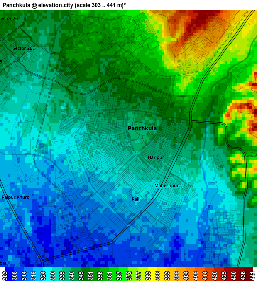
Below is the Elevation map of Panchkula, which displays elevation range with different colors. Scale of the first map is from 303 to 441 m (994 to 1447 ft) with average elevation of 340.4 meters (=1117 ft) [note 1]
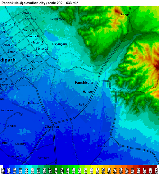
These maps also provides idea of topography and contour of this city, they are displayed at different zoom levels. More info about maps, scale and edge coordinates you can find below images.
| \ | Map #1 | Map #2 | Topo.Map |
| Scale [m] | 303..441 m | 292..633 m | × |
| Scale [ft] | 994..1447 ft | 958..2077 ft | × |
| Average | 340.4 m = 1117 ft | 358.2 m = 1175 ft | × |
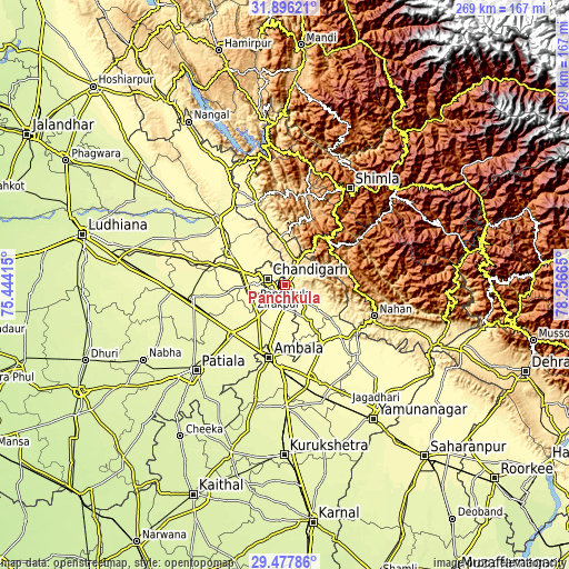
| Width | 8.4 km = 5.2 mi | 16.81 km = 10.4 mi | 268.9 km = 167.1 mi |
| Height | 8.4 km = 5.2 mi | 16.81 km = 10.4 mi | 268.9 km = 167.1 mi |
| ↑Max Latitude | 30.732391° | 30.770158° | 31.89621° |
| Latitude at center | 30.69461° | 30.69461° | 30.69461° |
| ↓Min Latitude | 30.656814° | 30.619003° | 29.47786° |
| ← Min Longitude | 76.806455° | 76.762509° | 75.44415° |
| Longitude center | 76.8504° | 76.8504° | 76.8504° |
| →Max Longitude | 76.894345° | 76.938291° | 78.25665° |
Nearby cities:
Cities around Panchkula sort by population:
• Chandigarh elevation 351 m
7.5 km,  308°
308°
• Mohali 312 m
12.4 km,  262°
262°
• Kharar 313 m
20.3 km,  286°
286°
• Kālka 703 m
18.3 km,  28°
28°
• Pinjaur 558 m
13.3 km, 29°
• Baddi 426 m
29.8 km,  349°
349°
• Basi 306 m
11.9 km,  182°
182°
• Banūr 287 m
20 km,  218°
218°
• Parwanoo 789 m
19.1 km, 33°
• Sabāthu 1235 m
34 km,  23°
23°
• Kasauli 1858 m
25.2 km, 25°
• Dagshai 1824 m
28.6 km,  42°
42°
Multilingual:
 En español:
Panchkula elevación 335 m.
 En France:
Panchkula élévation 335 m.
 Auf Deutsch:
Panchkula höhe über dem Meeresspiegel ist 335 m.

Sources and notes:
- [note 1] Map square and city borders are not equal. Map elevation data is calculated only from area inside that square.
- [src 1] Elevation data from geonames database provided with same terms of usage.
- [src 2] The elevation map of Panchkula is generated using elevation data from NASA's 3 arcsec (90m) resolution SRTM data.
- [src 3] Base (background) map © OpenStreetMap contributors tiles are generated by Geofabrik and OpenTopoMap.
Copyright & License:
This Panchkula Elevation Map is licensed under CC BY-SA. You may reuse any part from this page, if you give a proper credit by linking to this URL:
 More info on terms of use page.