Udalguri elevation
Udalguri (Assam), India elevation is 116 meters and Udalguri elevation in feet is 381 ft above sea level [src 1]. Udalguri is a populated place (feature code) with elevation that is 177 meters (581 ft) smaller than average city elevation in India.
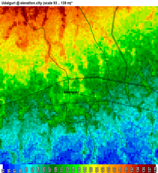
Below is the Elevation map of Udalguri, which displays elevation range with different colors. Scale of the first map is from 93 to 139 m (305 to 456 ft) with average elevation of 111.6 meters (=366 ft) [note 1]
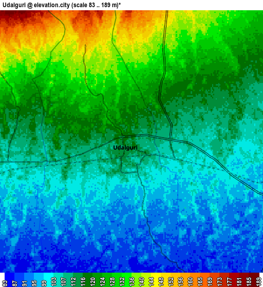
These maps also provides idea of topography and contour of this city, they are displayed at different zoom levels. More info about maps, scale and edge coordinates you can find below images.
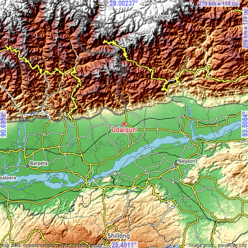
| \ | Map #1 | Map #2 | Topo.Map |
| Scale [m] | 93..139 m | 83..189 m | × |
| Scale [ft] | 305..456 ft | 272..620 ft | × |
| Average | 111.6 m = 366 ft | 113.7 m = 373 ft | × |
| Width | 8.73 km = 5.4 mi | 17.45 km = 10.8 mi | 279.2 km = 173.5 mi |
| Height | 8.73 km = 5.4 mi | 17.45 km = 10.8 mi | 279.2 km = 173.5 mi |
| ↑Max Latitude | 26.792904° | 26.832125° | 28.00237° |
| Latitude at center | 26.75367° | 26.75367° | 26.75367° |
| ↓Min Latitude | 26.714422° | 26.675161° | 25.4911° |
| ← Min Longitude | 92.058205° | 92.014259° | 90.6959° |
| Longitude center | 92.10215° | 92.10215° | 92.10215° |
| →Max Longitude | 92.146095° | 92.190041° | 93.5084° |
Nearby cities:
Cities around Udalguri sort by population:
• Guwahati elevation 59 m
72.6 km,  209°
209°
• Tezpur 74 m
70.6 km,  100°
100°
• Rangia 62 m
59.2 km,  235°
235°
• Mangaldai 62 m
35.4 km,  191°
191°
• Dhekiajuli 83 m
37.7 km, 98°
• Dhing 69 m
48.7 km,  130°
130°
• Morigaon 63 m
61.2 km,  156°
156°
• Rangāpāra 91 m
57 km,  80°
80°
• Khārupatia 66 m
26.5 km,  170°
170°
• Bomdila 2507 m
65.2 km,  29°
29°
• Rahā 64 m
71.1 km,  144°
144°
• Mushalpur 61 m
69.9 km,  253°
253°
Multilingual:
 En español:
Udalguri elevación 116 m.
 En France:
Udalguri élévation 116 m.
 Auf Deutsch:
Udalguri höhe über dem Meeresspiegel ist 116 m.

Sources and notes:
- [note 1] Map square and city borders are not equal. Map elevation data is calculated only from area inside that square.
- [src 1] Elevation data from geonames database provided with same terms of usage.
- [src 2] The elevation map of Udalguri is generated using elevation data from NASA's 3 arcsec (90m) resolution SRTM data.
- [src 3] Base (background) map © OpenStreetMap contributors tiles are generated by Geofabrik and OpenTopoMap.
Copyright & License:
This Udalguri Elevation Map is licensed under CC BY-SA. You may reuse any part from this page, if you give a proper credit by linking to this URL:
 More info on terms of use page.