Morigaon elevation
Morigaon (Assam), India elevation is 63 meters and Morigaon elevation in feet is 207 ft above sea level [src 1]. Morigaon is a seat of a second-order administrative division (feature code) with elevation that is 230 meters (755 ft) smaller than average city elevation in India.
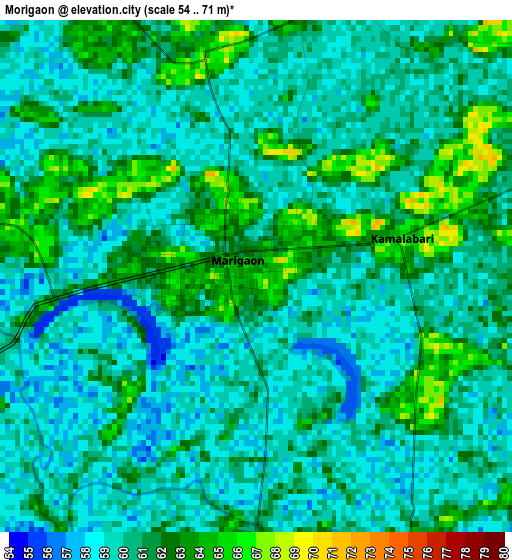
Below is the Elevation map of Morigaon, which displays elevation range with different colors. Scale of the first map is from 54 to 71 m (177 to 233 ft) with average elevation of 60.3 meters (=198 ft) [note 1]
These maps also provides idea of topography and contour of this city, they are displayed at different zoom levels. More info about maps, scale and edge coordinates you can find below images.
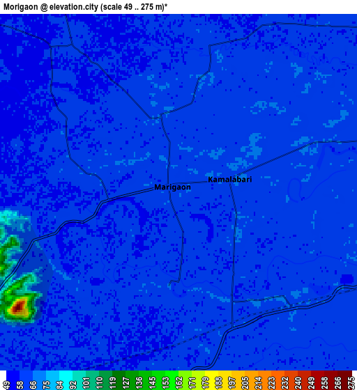
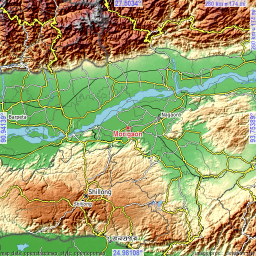
| \ | Map #1 | Map #2 | Topo.Map |
| Scale [m] | 54..71 m | 49..275 m | × |
| Scale [ft] | 177..233 ft | 161..902 ft | × |
| Average | 60.3 m = 198 ft | 61 m = 200 ft | × |
| Width | 8.76 km = 5.4 mi | 17.53 km = 10.9 mi | 280.5 km = 174.3 mi |
| Height | 8.76 km = 5.4 mi | 17.53 km = 10.9 mi | 280.5 km = 174.3 mi |
| ↑Max Latitude | 26.288487° | 26.327881° | 27.5034° |
| Latitude at center | 26.24908° | 26.24908° | 26.24908° |
| ↓Min Latitude | 26.20966° | 26.170226° | 24.98108° |
| ← Min Longitude | 92.303695° | 92.259749° | 90.94139° |
| Longitude center | 92.34764° | 92.34764° | 92.34764° |
| →Max Longitude | 92.391585° | 92.435531° | 93.75389° |
Nearby cities:
Cities around Morigaon sort by population:
• Guwahati elevation 59 m
60.5 km,  263°
263°
• Tezpur 74 m
62.1 km,  46°
46°
• Hojāi 78 m
57.7 km,  118°
118°
• Mangaldai 62 m
38.2 km,  304°
304°
• Dhekiajuli 83 m
52.2 km,  14°
14°
• Dhing 69 m
27.4 km,  27°
27°
• Khārupatia 66 m
36 km,  326°
326°
• Udalguri 116 m
61.2 km,  336°
336°
• Nongpoh 547 m
60.8 km,  230°
230°
• Dispur 60 m
56 km, 256°
• Rahā 64 m
16.9 km,  95°
95°
• Hamren 348 m
44.2 km,  142°
142°
Multilingual:
 En español:
Morigaon elevación 63 m.
 En France:
Morigaon élévation 63 m.


Sources and notes:
- [note 1] Map square and city borders are not equal. Map elevation data is calculated only from area inside that square.
- [src 1] Elevation data from geonames database provided with same terms of usage.
- [src 2] The elevation map of Morigaon is generated using elevation data from NASA's 3 arcsec (90m) resolution SRTM data.
- [src 3] Base (background) map © OpenStreetMap contributors tiles are generated by Geofabrik and OpenTopoMap.
Copyright & License:
This Morigaon Elevation Map is licensed under CC BY-SA. You may reuse any part from this page, if you give a proper credit by linking to this URL:
 More info on terms of use page.