Hojāi elevation
Hojāi (Assam, Hojai), India elevation is 78 meters and Hojāi elevation in feet is 256 ft above sea level [src 1]. Hojāi is a seat of a second-order administrative division (feature code) with elevation that is 215 meters (705 ft) smaller than average city elevation in India.
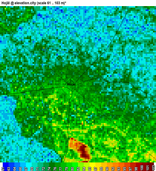
Below is the Elevation map of Hojāi, which displays elevation range with different colors. Scale of the first map is from 61 to 103 m (200 to 338 ft) with average elevation of 73.8 meters (=242 ft) [note 1]
These maps also provides idea of topography and contour of this city, they are displayed at different zoom levels. More info about maps, scale and edge coordinates you can find below images.
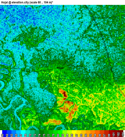
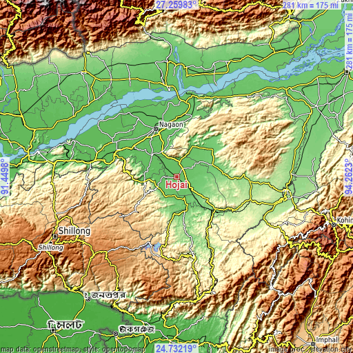
| \ | Map #1 | Map #2 | Topo.Map |
| Scale [m] | 61..103 m | 60..104 m | × |
| Scale [ft] | 200..338 ft | 197..341 ft | × |
| Average | 73.8 m = 242 ft | 73.5 m = 241 ft | × |
| Width | 8.78 km = 5.5 mi | 17.57 km = 10.9 mi | 281 km = 174.6 mi |
| Height | 8.78 km = 5.5 mi | 17.57 km = 10.9 mi | 281.1 km = 174.7 mi |
| ↑Max Latitude | 26.0423° | 26.081777° | 27.25983° |
| Latitude at center | 26.00281° | 26.00281° | 26.00281° |
| ↓Min Latitude | 25.963307° | 25.92379° | 24.73219° |
| ← Min Longitude | 92.812105° | 92.768159° | 91.4498° |
| Longitude center | 92.85605° | 92.85605° | 92.85605° |
| →Max Longitude | 92.899995° | 92.943941° | 94.2623° |
Nearby cities:
Cities around Hojāi sort by population:
• Dimāpur elevation 154 m
87.1 km,  96°
96°
• Tezpur 74 m
70.3 km,  355°
355°
• Diphu 200 m
60.2 km,  107°
107°
• Lumding Railway Colony 141 m
42.2 km,  131°
131°
• Dhekiajuli 83 m
86.6 km,  334°
334°
• Dhing 69 m
64.3 km,  323°
323°
• Morigaon 63 m
57.7 km,  298°
298°
• Maibong 295 m
83 km,  160°
160°
• Rahā 64 m
42.5 km,  307°
307°
• Khliehriat 1141 m
86.9 km,  214°
214°
• Biswanath Chariali 86 m
85.4 km,  19°
19°
• Hamren 348 m
25.1 km,  252°
252°
Multilingual:
 En español:
Hojāi elevación 78 m.
 En France:
Hojāi élévation 78 m.


Sources and notes:
- [note 1] Map square and city borders are not equal. Map elevation data is calculated only from area inside that square.
- [src 1] Elevation data from geonames database provided with same terms of usage.
- [src 2] The elevation map of Hojāi is generated using elevation data from NASA's 3 arcsec (90m) resolution SRTM data.
- [src 3] Base (background) map © OpenStreetMap contributors tiles are generated by Geofabrik and OpenTopoMap.
Copyright & License:
This Hojāi Elevation Map is licensed under CC BY-SA. You may reuse any part from this page, if you give a proper credit by linking to this URL:
 More info on terms of use page.