Malkapur elevation
Malkapur (Maharashtra, Satara Division), India elevation is 579 meters and Malkapur elevation in feet is 1900 ft above sea level [src 1]. Malkapur is a populated place (feature code) with elevation that is 286 meters (938 ft) bigger than average city elevation in India.
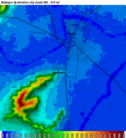
Below is the Elevation map of Malkapur, which displays elevation range with different colors. Scale of the first map is from 546 to 914 m (1791 to 2999 ft) with average elevation of 589.7 meters (=1935 ft) [note 1]
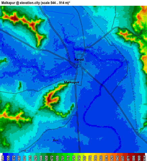
These maps also provides idea of topography and contour of this city, they are displayed at different zoom levels. More info about maps, scale and edge coordinates you can find below images.
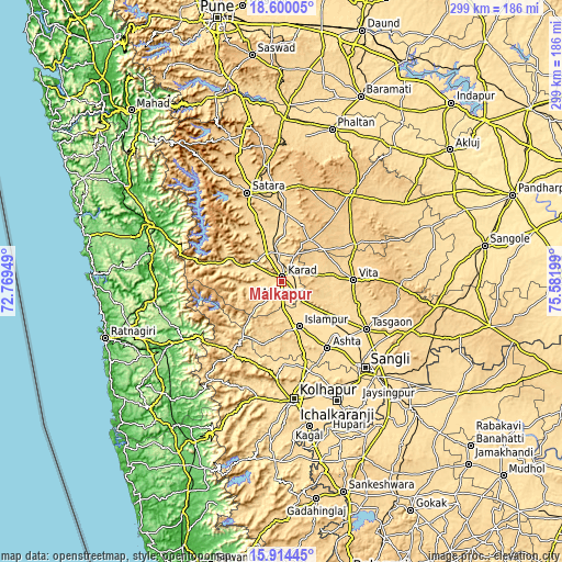
| \ | Map #1 | Map #2 | Topo.Map |
| Scale [m] | 546..914 m | 544..914 m | × |
| Scale [ft] | 1791..2999 ft | 1785..2999 ft | × |
| Average | 589.7 m = 1935 ft | 602 m = 1975 ft | × |
| Width | 9.33 km = 5.8 mi | 18.66 km = 11.6 mi | 298.6 km = 185.5 mi |
| Height | 9.33 km = 5.8 mi | 18.66 km = 11.6 mi | 298.6 km = 185.5 mi |
| ↑Max Latitude | 17.304101° | 17.346053° | 18.60005° |
| Latitude at center | 17.26214° | 17.26214° | 17.26214° |
| ↓Min Latitude | 17.220169° | 17.178189° | 15.91445° |
| ← Min Longitude | 74.131795° | 74.087849° | 72.76949° |
| Longitude center | 74.17574° | 74.17574° | 74.17574° |
| →Max Longitude | 74.219685° | 74.263631° | 75.58199° |
Nearby cities:
Cities around Malkapur sort by population:
• Satara elevation 709 m
50.9 km,  337°
337°
• Karād 579 m
3.1 km,  12°
12°
• Vite 689 m
38.5 km,  88°
88°
• Ashta 575 m
42.7 km,  144°
144°
• Tāsgaon 586 m
51.7 km,  118°
118°
• Koynanagar 642 m
46 km,  289°
289°
• Kodoli 566 m
42.9 km,  177°
177°
• Rahimatpur 649 m
36.8 km,  3°
3°
• Bhudgaon 569 m
59.9 km,  131°
131°
• Malkāpur 576 m
45.9 km,  213°
213°
• Pātan 589 m
31.7 km, 293°
• Panhāla 947 m
50.5 km,  187°
187°
Multilingual:
 En español:
Malkapur elevación 579 m.
 En France:
Malkapur élévation 579 m.
 Auf Deutsch:
Malkapur höhe über dem Meeresspiegel ist 579 m.

Sources and notes:
- [note 1] Map square and city borders are not equal. Map elevation data is calculated only from area inside that square.
- [src 1] Elevation data from geonames database provided with same terms of usage.
- [src 2] The elevation map of Malkapur is generated using elevation data from NASA's 3 arcsec (90m) resolution SRTM data.
- [src 3] Base (background) map © OpenStreetMap contributors tiles are generated by Geofabrik and OpenTopoMap.
Copyright & License:
This Malkapur Elevation Map is licensed under CC BY-SA. You may reuse any part from this page, if you give a proper credit by linking to this URL:
 More info on terms of use page.