Munduk elevation
Munduk (Bali), Indonesia elevation is 1163 meters and Munduk elevation in feet is 3816 ft above sea level [src 1]. Munduk is a populated place (feature code) with elevation that is 972 meters (3189 ft) bigger than average city elevation in Indonesia.
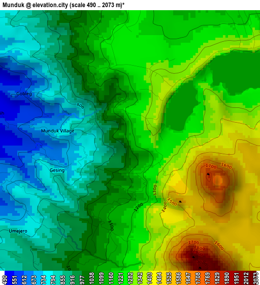
Below is the Elevation map of Munduk, which displays elevation range with different colors. Scale of the first map is from 490 to 2073 m (1608 to 6801 ft) with average elevation of 1124.5 meters (=3689 ft) [note 1]
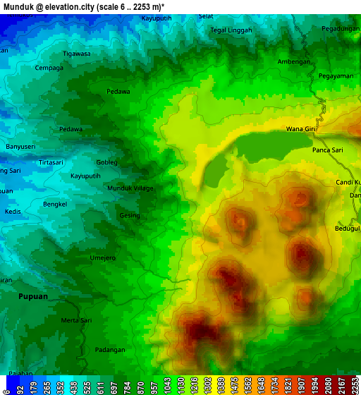
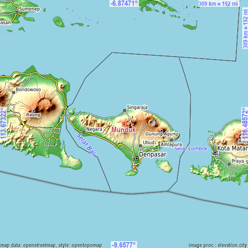
These maps also provides idea of topography and contour of this city, they are displayed at different zoom levels. More info about maps, scale and edge coordinates you can find below images.
| \ | Map #1 | Map #2 | Topo.Map |
| Scale [m] | 490..2073 m | 6..2253 m | × |
| Scale [ft] | 1608..6801 ft | 20..7392 ft | × |
| Average | 1124.5 m = 3689 ft | 959.8 m = 3149 ft | × |
| Width | 9.67 km = 6 mi | 19.34 km = 12 mi | 309.4 km = 192.3 mi |
| Height | 9.67 km = 6 mi | 19.34 km = 12 mi | 309.5 km = 192.3 mi |
| ↑Max Latitude | -8.225169° | -8.181673° | -6.87471° |
| Latitude at center | -8.26866° | -8.26866° | -8.26866° |
| ↓Min Latitude | -8.312146° | -8.355627° | -9.6577° |
| ← Min Longitude | 115.035525° | 114.991579° | 113.67322° |
| Longitude center | 115.07947° | 115.07947° | 115.07947° |
| →Max Longitude | 115.123415° | 115.167361° | 116.48572° |
Nearby cities:
Cities around Munduk sort by population:
• Singaraja elevation 11 m
17.4 km,  3°
3°
• Banjar 15 m
15.1 km,  305°
305°
• Tabanan 126 m
30.7 km,  170°
170°
• Seririt 17 m
17.6 km,  298°
298°
• Lovina 5 m
14 km,  341°
341°
• Tegalalang 439 m
28.8 km,  130°
130°
• Banjar Mandung 137 m
27.7 km,  177°
177°
• Basa 275 m
24.9 km,  156°
156°
• Pohgending Kawan 362 m
19.8 km, 159°
• Sukasada 110 m
14.6 km,  10°
10°
• Baturiti 894 m
13.3 km,  118°
118°
• Busungbiu 270 m
12.4 km,  276°
276°
Multilingual:
 En español:
Munduk elevación 1163 m.
 En France:
Munduk élévation 1163 m.


Sources and notes:
- [note 1] Map square and city borders are not equal. Map elevation data is calculated only from area inside that square.
- [src 1] Elevation data from geonames database provided with same terms of usage.
- [src 2] The elevation map of Munduk is generated using elevation data from NASA's 3 arcsec (90m) resolution SRTM data.
- [src 3] Base (background) map © OpenStreetMap contributors tiles are generated by Geofabrik and OpenTopoMap.
Copyright & License:
This Munduk Elevation Map is licensed under CC BY-SA. You may reuse any part from this page, if you give a proper credit by linking to this URL:
 More info on terms of use page.